


Meteorologist Myles Henderson’s First Warning Forecast
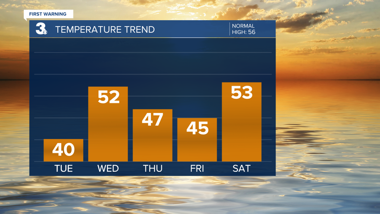
A refreeze risk this morning with freezing temperatures. A chilly stretch of days with highs in the 40s and 50s.
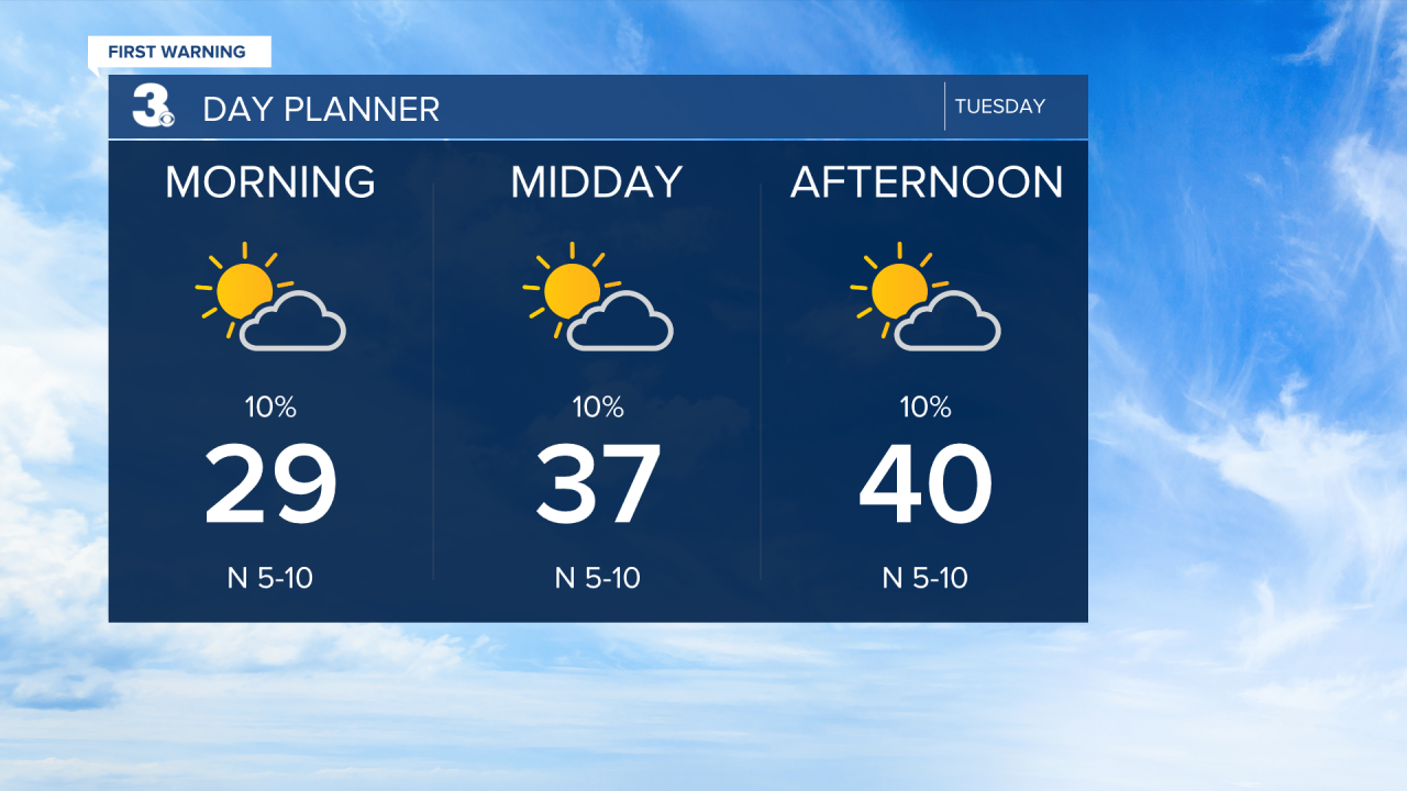
Temperatures will start in the 20s and 30s this morning, so there is a risk of refreeze. We will see a nice mix of sun and clouds today, but it will still be chilly with highs near 40.
A slight warm up for Wednesday. Highs will climb to the low 50s, still a few degrees below normal for this time of year. Expect partly to mostly cloudy skies with strong SW winds.
The below-normal air sticks around for the end of the week with high temperatures remaining in the 40s and 50s. Even colder air is set to move in early next week, behind a cold front on Sunday.
Today: Mix of Sun & Clouds. Highs near 40. Winds: N/W 5-10
Tonight: Partly to Mostly Cloudy. Lows near 30. Winds: W/SW 5-10
Tomorrow: Mix of Clouds, Windy. Highs in the low 50s. Winds: SW 10-20 G30
Weather updates on social media:
Facebook: MylesHendersonWTKR
Instagram: @MylesHendersonWTKR
