




Meteorologist Myles Henderson’s First Warning Forecast
More heat and humidity to end the week. Several days with a heat index in the triple digits.
Hot & humid today with highs in the low 90s and an afternoon heat index near 100. We will see mostly sunny to partly cloudy skies with a “pop-up” shower or storm possible.
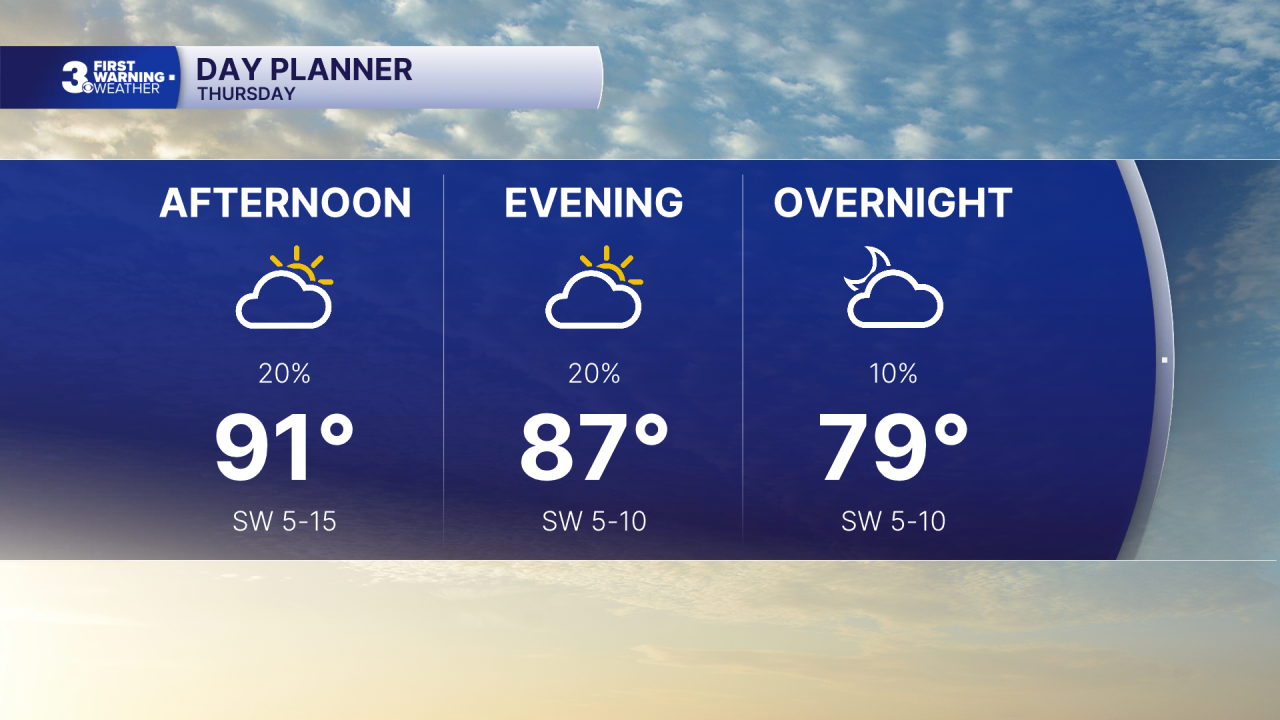
More of the same tomorrow with highs in the low 90s and a heat index to 100+. Expect a nice mix of sun and clouds with a slim chance for a shower/storm.
The hot and humid stretch continues through the weekend. Expect highs in the low to mid 90s with heat indices reaching 100 to 105. An isolated shower/storm is possible (20 to 30% chance).
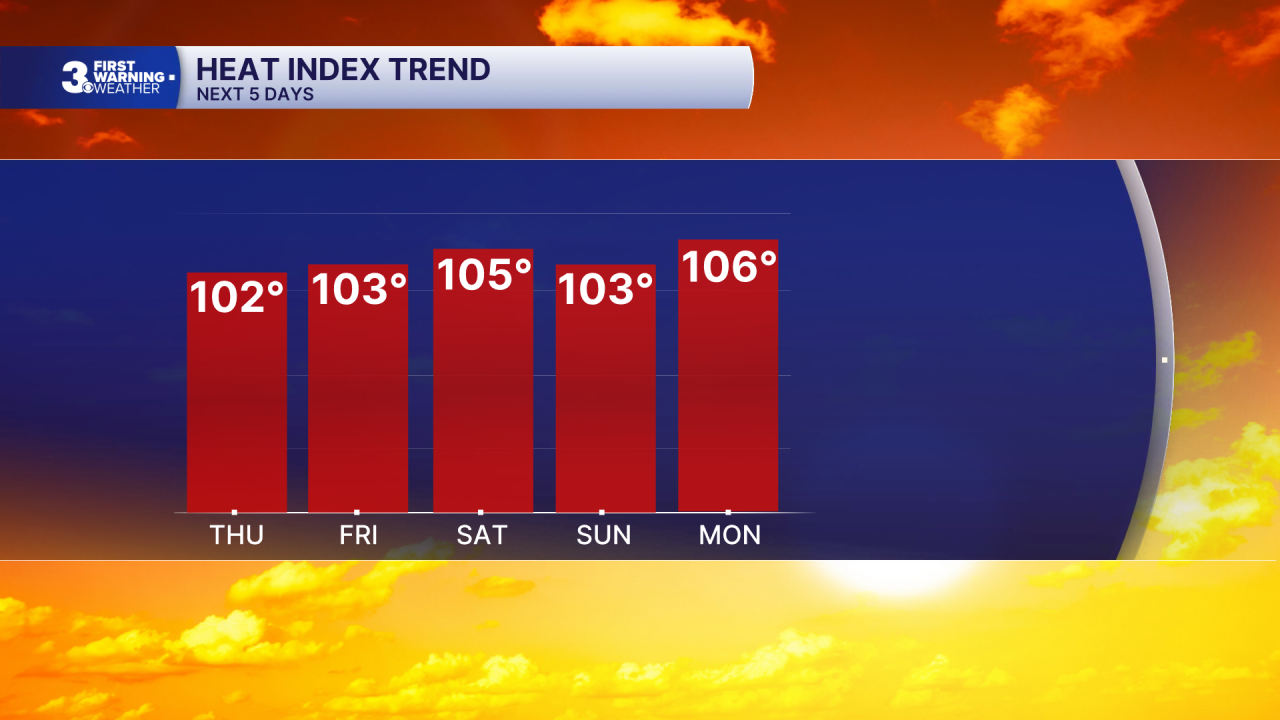
The heat and humidity stay locked in for next week. Highs will remain in the low to mid 90s and with the mugginess it will feel more like 100 to 105 each afternoon.
Today: Sun & Clouds. Highs in the low 90s. Winds: SW 5-15
Tonight: A Few Clouds. Lows in the mid 70s. Winds: SW 5-10
Tomorrow: Sun & Clouds. Highs in the low 90s. Winds: SW 5-15
Weather & Health
Pollen: Medium (Grasses)
UV Index: 10 (Extreme)
Air Quality: Good (Code Green)
Mosquitoes: Extreme
Tropical Update
No tropical activity at this time
Weather updates on social media:
Facebook: MylesHendersonWTKR
Instagram: @MylesHendersonWTKR
