




Meteorologist Myles Henderson’s First Warning Forecast
Several days in the 60s to end the week. Tracking a developing coastal storm to bring rain and wind this weekend.
Another chilly start with temperatures in the 20s and 30s this morning. Watch out for a few areas of patchy fog. Highs will reach the mid 60s today. We will start with sunshine but clouds will build in this afternoon to evening.
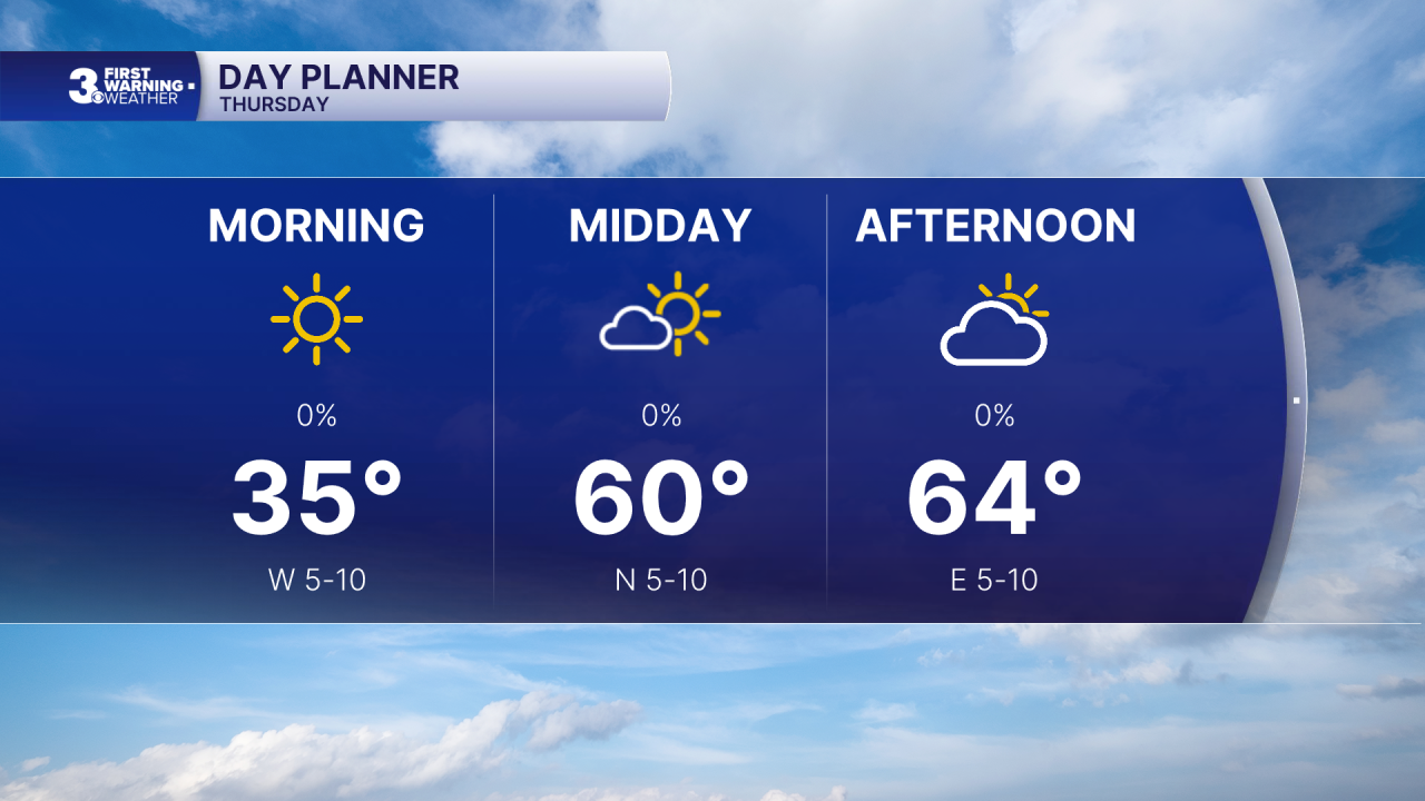
Highs will return to the mid 60s on Friday a mix of mostly sunny to partly cloudy skies.
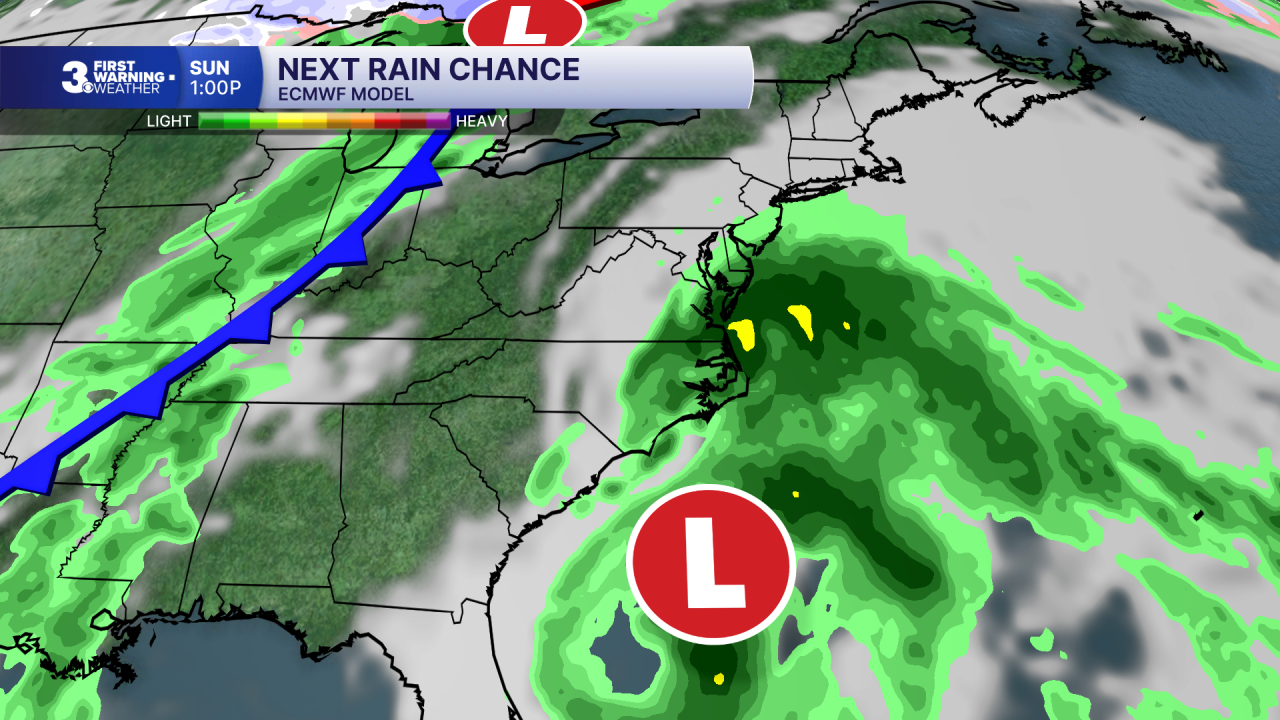
Highs will linger in the mid to upper 60s this weekend with partly to mostly cloudy skies. Our next chance for rain is Sunday as an area of low pressure develops along the Southeast coast. Expect widespread rain on Sunday with strong winds and a risk for coastal flooding, including ocean overwash for the Outer Banks.
Today: Building Clouds. Highs in the mid 60s. Winds: W/N/E 5-10
Tonight: Mostly Cloudy. Lows near 40. Winds: E/S 5-10
Tomorrow: Sun & Clouds. Highs in the mid 60s. Winds: W/N 5-10
Weather & Health
Pollen: Low (Ragweed)
UV Index: 3 (Low-Medium)
Air Quality: Good (Code Green)
Mosquitoes: Low
Tropical Update
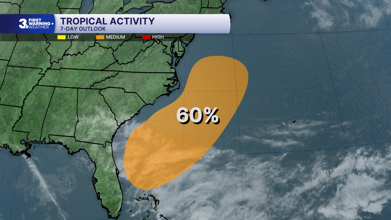
A non-tropical low pressure system is expected to form near the northern Bahamas by late Friday. This system could become a subtropical or tropical storm while it moves north or northeast near or just offshore of the southeastern U.S. coast through the weekend. Regardless of development, strong winds, dangerous surf, and coastal flooding are likely along portions of the southeast and mid-Atlantic coasts into early next week.
* Formation chance through 48 hours: Low (0%)
* Formation chance through 7 days: Medium (60%)
Weather updates on social media:
Facebook: MylesHendersonWTKR
Instagram: @MylesHendersonWTKR
