




Meteorologist Myles Henderson’s First Warning Forecast
Warming back into the 60s this week. A nice end to the work week. Tracking rain to end the weekend.
Another chilly start with temperatures in the 20s and 30s this morning. Watch out for a few areas of patchy fog. Highs will reach the low 60s today, near normal for this time of year.
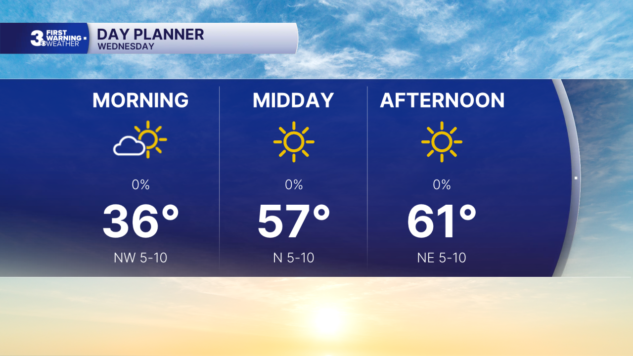
Highs will warm to the mid 60s to end the work week with a mix of mostly sunny to partly cloudy skies.
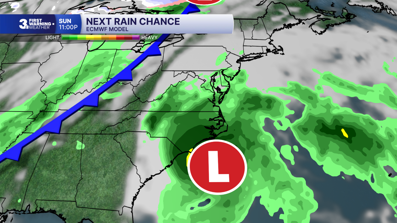
Highs will linger in the mid to upper 60s this weekend with partly to mostly cloudy skies. Our next chance for rain is setting up for Sunday to Monday with a cold front moving in from the west and an area of low pressure developing along the Southeast coast.
Today: Mostly Sunny. Highs in the low 60s. Winds: N 5-10
Tonight: Mainly Clear. Lows in the upper 30s. Winds: NE 5-10
Tomorrow: Building Clouds. Highs in the mid 60s. Winds: N 5-10
Weather & Health
Pollen: Low (Ragweed)
UV Index: 3 (Low-Medium)
Air Quality: Good (Code Green)
Mosquitoes: Low
Tropical Update
No tropical activity at this time
Weather updates on social media:
Facebook: MylesHendersonWTKR
Instagram: @MylesHendersonWTKR
