


Meteorologist Myles Henderson’s First Warning Forecast
A soggy week with several chances for showers and storms. Warming back to the 80s this week with building humidity.
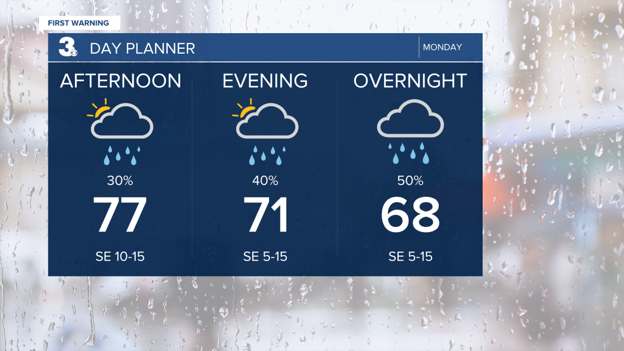
Mostly cloudy skies today with scattered showers. Highs in the mid to upper 70s, near normal for this time of year. Winds will start to pick up this afternoon.
An area of low pressure will slowly track across the Southeast to Mid-Atlantic, bringing significant rainfall to the region. Expect widespread showers & storms on Tuesday. It will be windy with a SE wind at 10 to 20 and gusts 25 to 30 mph.

Showers and storms continue for Wednesday. We could see 1” to 3” of rainfall through the first half of the week.
Highs will climb into the 80s for the second half of the week with building humidity. It will feel more like summertime by the end if the week.

Showers and storms return for Saturday as a cold front moves through.
Today: Mostly Cloudy, Scattered Showers. Highs in the upper 70s. Winds: SE 5-15
Tonight: Mostly Cloudy, Scattered Showers. Lows in the mid 60s. Winds: SE 5-15
Tomorrow: Showers & Storms, Windy. Highs in the mid 70s. Winds: SE 10-20
Weather & Health
Pollen: Low (Grasses, Trees)
UV Index: 2 (Low)
Air Quality: Good (Code Green)
Mosquitoes: High
Weather updates on social media:
Facebook: MylesHendersonWTKR
Instagram: @MylesHendersonWTKR
