


Meteorologist Myles Henderson’s First Warning Forecast
Back-to-back rain chances move in later this week. We will see some wild temperature swings later this week between passing fronts. Keeping an eye on another rain chance Sunday that could see some snow mix in overnight Sunday to Monday morning.
Highs will return to the upper 60s to near 70 this afternoon. Expect partly to mostly cloudy skies today with a few spotty showers possible. Winds will ramp up through the day, south at 10 to 20 mph this afternoon.
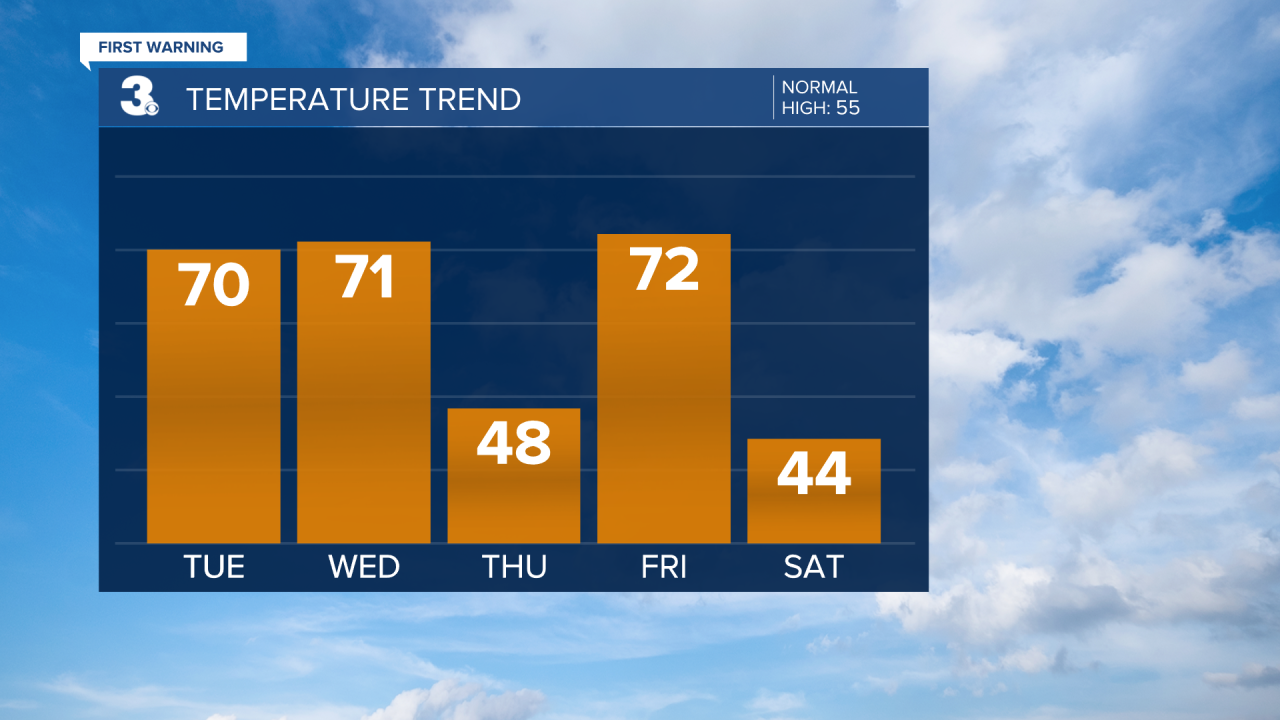
Our first wave of rain will move through Wednesday morning with a cold front. It will still be warm on Wednesday, but temperatures will fall to the 40s behind the front for Thursday. The second wave of rain will move through Thursday with a warm front lingering over the Mid-Atlantic. We will warm back to near 70 on Friday before a third wave of rain moves in with another cold front.

Cold air will return this weekend with highs in the mid to upper 40s and lows in the 30s. Expect partly cloudy skies on Saturday with another rain chance possible on Sunday. Rain could change over to snow late Sunday night to early Monday morning.
Today: Mix of Clouds, Spotty Showers. Highs near 70. Winds: S 10-15
Tonight: Mostly Cloudy. Lows in the upper 50s. Winds: SW 10-15
Tomorrow: Mostly Cloudy, Morning Showers. Highs near 70. Winds: SW 10-15
Weather updates on social media:
Facebook: MylesHendersonWTKR
Twitter: @MHendersonWTKR
Instagram: @MylesHendersonWTKR
