


Meteorologist Myles Henderson’s First Warning Forecast
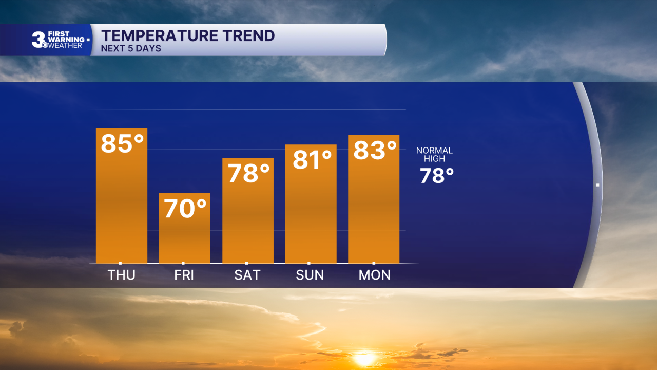
A cold front brings in rain and a cool down to end the week. Several rain chances and highs near 80 through Memorial Day weekend.
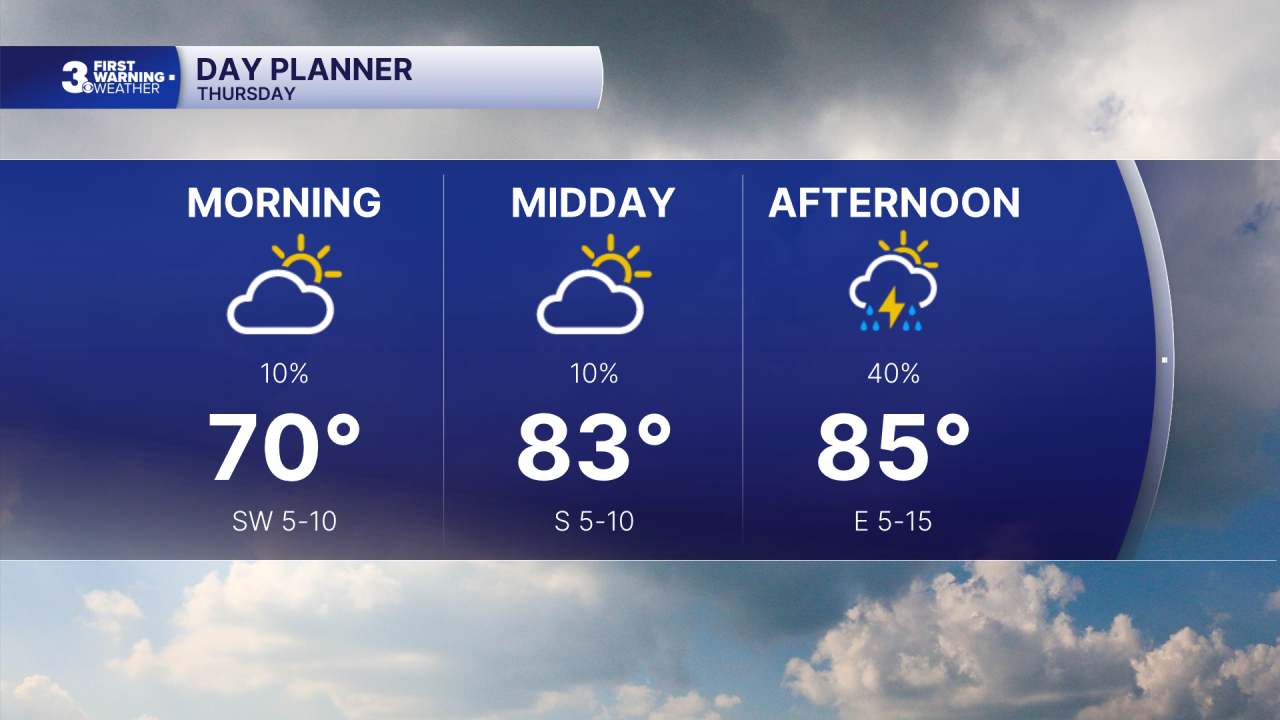
Still warm today, but not as hot as the first half of the week. Temperatures will climb to the mid 80s early in the afternoon but will quickly fall as a cold front moves through. Look for partly cloudy to mostly cloudy skies with scattered showers and storms developing this afternoon.
Friday will be the coolest day this week with highs struggling to reach the 70s. Expect mostly cloudy skies with scattered showers.
We will be stuck in an unsettled weather pattern through the holiday weekend. Expect partly to mostly cloudy skies with scattered showers and isolated storms each day. Temperatures will climb from the upper 70s to the low 80s, closer to normal for this time of year.
Today: Afternoon Storms. Highs in the mid 80s. Winds: SW/NE 5-15
Tonight: Showers/Storms. Lows in the low 60s. Winds: NE 5-15
Tomorrow: Mostly Cloudy, Showers. Highs near 70. Winds: NE 5-15
Weather & Health
Pollen: Medium-High (Trees & Grasses)
UV Index: 9 (Very High)
Air Quality: Good (Code Green)
Mosquitoes: High
Weather updates on social media:
Facebook: MylesHendersonWTKR
Instagram: @MylesHendersonWTKR
