


Meteorologist Myles Henderson’s First Warning Forecast
Stuck in an unsettled weather pattern to end the week. Cooling to the 70s, but still humid.
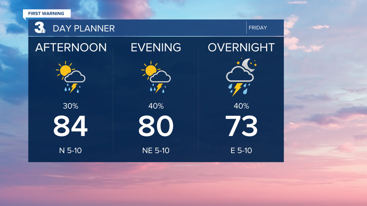
The cold front that moved in last night will transition to stationary front and linger over the Mid-Atlantic for the next several days, keeping us in a pattern of clouds and rain. Expect partly cloudy skies today with scattered showers and storms. Highs will drop to the mid 80s today, but it will still be humid.
Expect mostly cloudy skies this weekend with scattered showers and isolated storms possible both days. Highs will drop to the mid and upper 70s, but it will still be muggy.
The forecast for the first half of next week gets tricky… A developing tropical system (Imelda) could track toward the South Carolina coast, spreading rain across the Southeast to Mid-Atlantic. How this developing tropical system interacts with the stationary front and with Humberto to the east, adds uncertainty to the situation. Keep a close eye on the forecast for Monday through Wednesday of next week.

Today: Scattered Showers/Storms. Highs in the mid 80s. Winds: SW/NE 5-10
Tonight: Scattered Showers/Storms. Lows near 70. Winds: E 5-10
Tomorrow: Scattered Showers/Storms. Highs in the upper 70s. Winds: E 5-10
Weather & Health
Pollen: Low (Ragweed)
UV Index: 7 (High)
Air Quality: Good (Code Green)
Mosquitoes: Extreme
Tropical Update
Gabrielle is now post-tropical and continues tracking generally east across the eastern Atlantic. Gabrielle will move across the Azores today and near the coast of Portugal by early Sunday.
Humberto strengthens to a hurricane over the Central Atlantic. Humberto is centered about 450 miles NE of the northern Leeward Islands. A slow WNW to NW motion is expected during the next couple of days. Maximum sustained winds have increased to near 90 mph with higher gusts. Significant strengthening is forecast, and Humberto is forecast to become a major hurricane later today or on Saturday

Tracking a tropical wave located near Hispaniola and the Turks and Caicos Islands. An area of low pressure is expected to form along the wave today when it moves near the southeast Bahamas. This low is expected to become a tropical depression when it is in the vicinity of the central and northwest Bahamas later today or over the weekend, and then track NW or north over the southwestern Atlantic.
* Formation chance through 48 hours: High (80%)
* Formation chance through 7 days: High (90%)

Weather updates on social media:
Facebook: MylesHendersonWTKR
Instagram: @MylesHendersonWTKR
