


Meteorologist Myles Henderson’s First Warning Forecast
A Tornado Warning was in effect for Isle of Wight, Southampton, Surry and Sussex until 9:15 AM today. The warning has since expired.
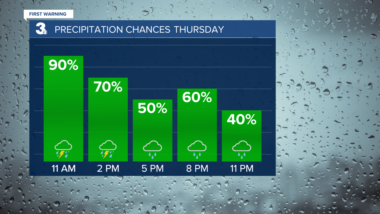
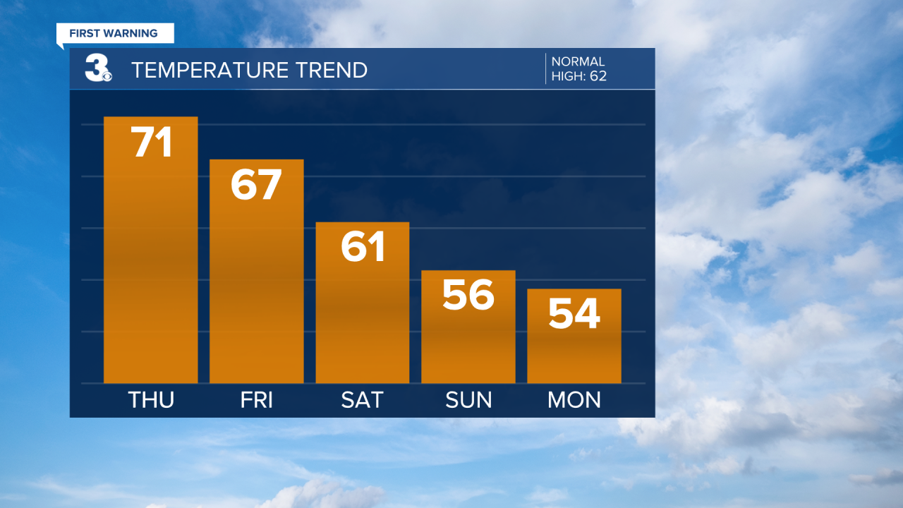
Rain and storms continue today with a threat for severe weather. Still warm to end the work week but much cooler for the weekend.
Expect mostly cloudy skies today with several rounds of showers and storms moving through. Strong to severe thunderstorms are possible, including damaging wind gusts, localized flooding, and isolated tornadoes. Storm chances will taper off this afternoon, but rain will linger this evening and tonight. It will still be warm (and muggy) with temperatures lingering in the upper 60s to low 70s all day.
We will get a chance to dry out on Friday. Any leftover showers should move off the coast early Friday morning and we will see the sunshine return by midday. Temperatures will drop to the mid and upper 60s tomorrow.
Even cooler air is set to move in this weekend with highs in the low 60s on Saturday and mid 50s on Sunday. A few showers are possible Saturday, but we will see partly cloudy skies most of the weekend. Winds will ramp up, west at 10 to 20 on Saturday and NW at 10 to 20 with gusts to 30 mph on Sunday.
Today: Mostly Cloudy, Rain & Storms, Breezy. Highs in the low 70s. Winds: S 10-15
Tonight: Rain Moving Out. Lows in the mid 50s. Winds: SW 10-15
Tomorrow: Clearing Skies. Highs in the upper 60s. Winds: SW 5-15
Weather & Health
Pollen: Low (Juniper, Birch, Sycamore)
UV Index: 2 (Low)
Air Quality: Good (Code Green)
Mosquitoes: Low
Weather updates on social media:
Facebook: MylesHendersonWTKR
Twitter: @MHendersonWTKR
Instagram: @MylesHendersonWTKR
