




Meteorologist Myles Henderson’s First Warning Forecast
Several chances for showers and storms to start the week. A break from the heat for the second half of the week.
Not as hot today, but still humid. Highs will only reach the mid 80s, but it will feel more like the low 90s. Expect partly to mostly cloudy skies with scattered showers and storms. Strong to severe storms are possible with damaging wind gusts and localized flooding.
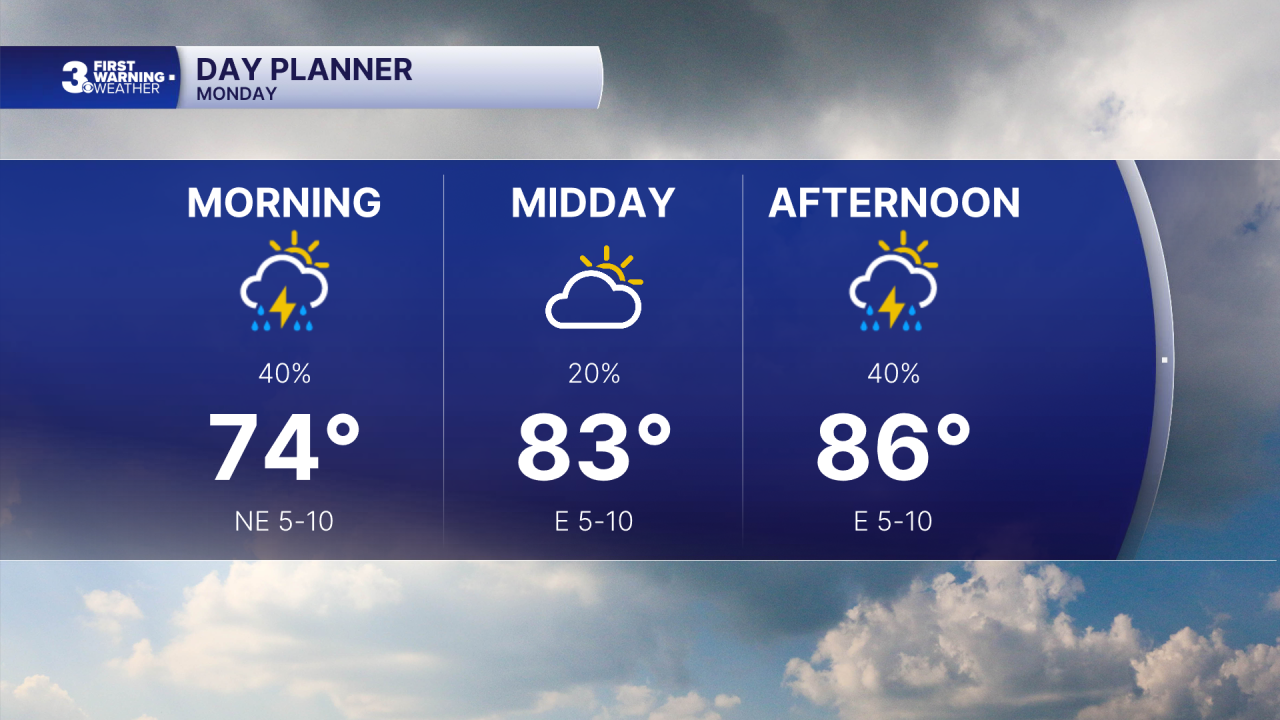
Warming back to the 90s tomorrow, with the humidity it will feel like the triple digits. Another chance for showers and storms tomorrow, including a risk for severe storms.
More of the same for Wednesday with highs near 90 and a heat index in the triple digits. Severe storms are possible on Wednesday as well.
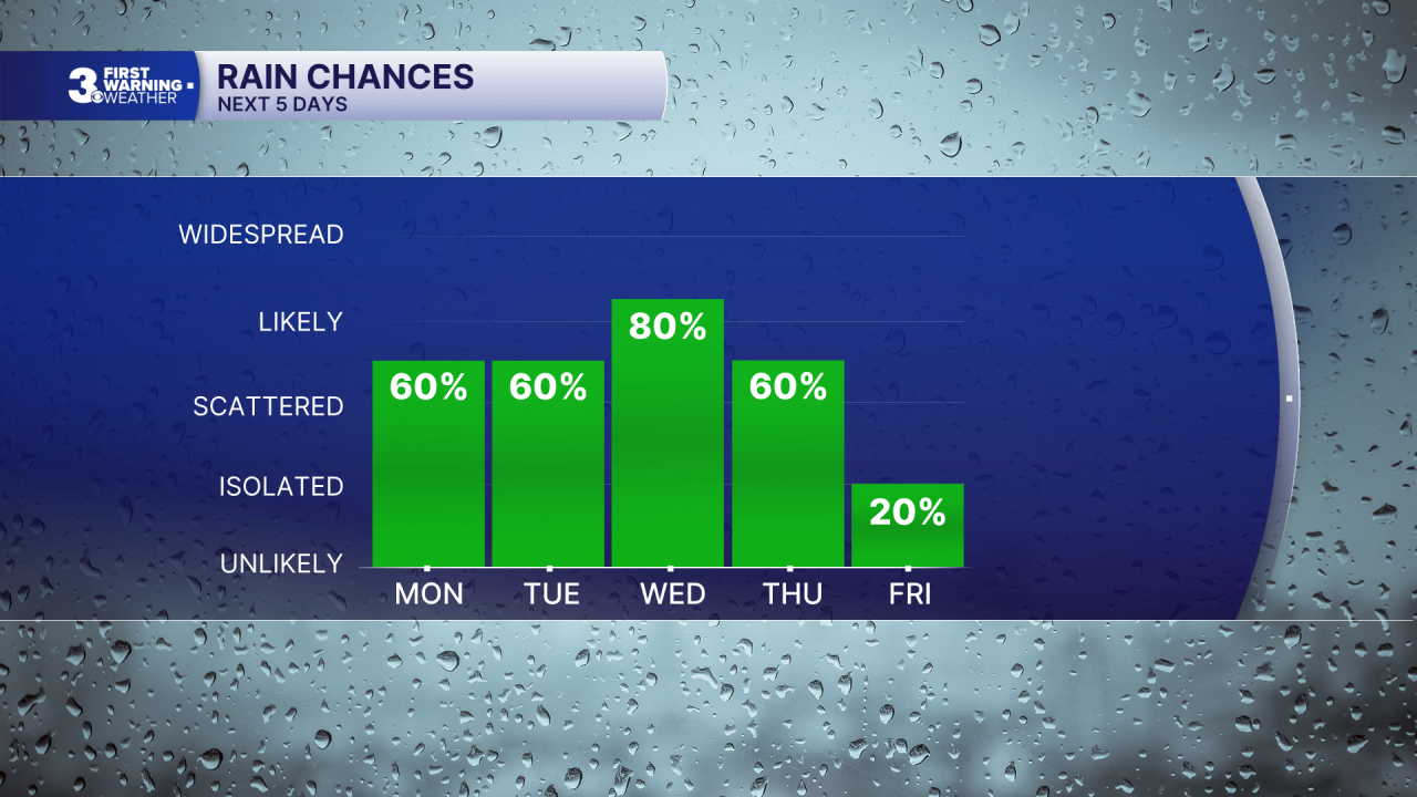
Changes move in for the second half of the week behind a cold front. Highs will drop to the 80s and the humidity will come down. We will still have some leftover showers/storms on Thursday, but rain chances should drop to end the week.
Today: Scattered Storms. Highs in the mid 80s. Winds: E 5-10
Tonight: Partly Cloudy. Lows in the mid 70s. Winds: E/S 5-10
Tomorrow: Scattered Storms. Highs in the low 90s. Winds: SW 10-15
Weather & Health
Pollen: Medium (Grasses)
UV Index: 8 (High)
Air Quality: Moderate (Code Yellow)
Mosquitoes: Extreme
Tropical Update
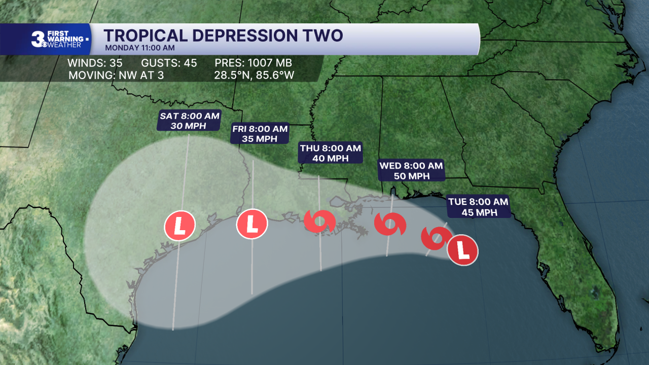
Tropical Depression Two continues drifting NW off the Gulf Coast of Florida. On the forecast track, the depression will move near or along the northern Gulf coast during the next several days.
Maximum sustained winds are near 35 mph with higher gusts. TD 2 is getting better organized and is expected to become a tropical storm later today. Additional gradual strengthening is expected through Tuesday.
Weather updates on social media:
Facebook: MylesHendersonWTKR
Instagram: @MylesHendersonWTKR
