


Meteorologist Myles Henderson’s First Warning Forecast
Several chances for showers and storms to end the week. Warming back to the 70s and 80s.
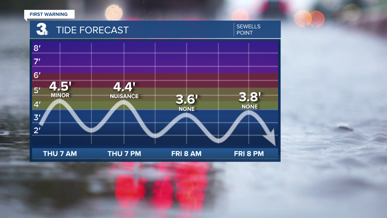
Get ready for a messy day. Expect cloudy skies with on and off showers, drizzle, and pockets of fog. It will still be windy today with NE wind at 10 to 20 and gusts to 25 mph. We will see another round of tidal flooding, but water levels will be lower than the past few days. Highs will only reach the low to mid 60s today, 15 degrees below normal for this time of year.
We will take a big step warmer Friday, reaching the mid 70s. Expect mostly cloudy skies with scattered showers and storms throughout the day. The biggest storm chance will be in the afternoon to early evening.
We will climb to the upper 70s on Saturday and the low 80s on Sunday, but rain chances continue. Expect mostly cloudy skies with scattered showers and storms on Saturday (60%). We will see more sunshine mix in for Sunday with a lower chance for showers/storms (30%).
Today: Mostly Cloudy, Showers. Highs in the mid 60s. Winds: NE 10-20 G25
Tonight: Mostly Cloudy, Showers. Lows in the upper 50s. Winds: NE 5-15
Tomorrow: Mostly Cloudy, Showers/Storms. Highs in the mid 70s. Winds: E 5-15
Weather & Health
Pollen: Medium (Oak, Birch, Poplar)
UV Index: 5 (Moderate)
Air Quality: Good (Code Green)
Mosquitoes: Moderate
Weather updates on social media:
Facebook: MylesHendersonWTKR
Twitter: @MHendersonWTKR
Instagram: @MylesHendersonWTKR
