


Meteorologist Myles Henderson’s First Warning Forecast
Warming back to the 70s with another round of rain and storms today. Cooling to the 60s this weekend with more sunshine. Back to the 70s early next week.
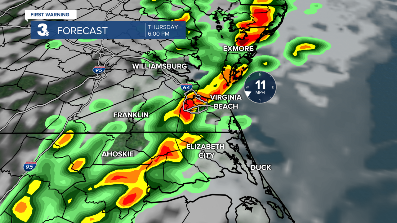
We will see more clouds than sun today with scattered showers this morning to midday. Rain and storm chances go up this afternoon to evening. The biggest chance will be 3 PM to 8 PM. Strong to severe thunderstorms are possible with the potential for damaging wind gusts, hail, and isolated tornadoes. It will still be warm today with highs in the mid to upper 70s.
Cooler air moves in for Friday and this weekend. Expect partly cloudy skies with a few lingering showers (20% chance) Friday. Highs will drop to the mid 60s, near normal for this time of year.
We will see a nice mix of mostly sunny to partly cloudy skies this weekend with slim rain chances. Highs will only reach the low 60s both days. We will climb back to the 70s next week.

Today: Mostly Cloudy, Showers, Storms. Highs in the mid 70s. Winds: SE/SW 5-15
Tonight: Partly Cloudy. Lows in the low 50s. Winds: W/NW 5-10
Tomorrow: Partly Cloudy, Spotty Showers. Highs in the mid 60s. Winds: NW/SW 5-10
Weather & Health
Pollen: Medium-High (Maple, Juniper, Birch)
UV Index: 3 (Moderate)
Air Quality: Good (Code Green)
Mosquitoes: Low
Weather updates on social media:
Facebook: MylesHendersonWTKR
Twitter: @MHendersonWTKR
Instagram: @MylesHendersonWTKR
