


Meteorologist Myles Henderson’s First Warning Forecast
One more day with highs in the 80s. A threat for severe storms later today as a cold front moves through. Much cooler for the second half of the week.
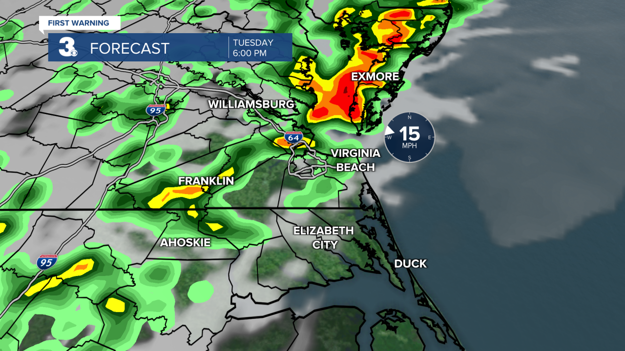
Warm again today with highs in the mid to upper 80s, 10 to 15 degrees above normal for this time of year. We will start with sunshine this morning, but clouds will build in through the afternoon. Showers and storms will move in later this afternoon to evening from west to east. The biggest chance for storms will be 5 PM to 9 PM. Strong to severe storms are possible with gusty winds, heavy downpours, and pockets of hail.
Any leftover showers will move out early Wednesday morning and we will be back to sunshine by midday. It will be much cooler behind the cold front with highs in the mid to upper 60s. Winds will also kick up tomorrow, NW at 10 to 20 mph.
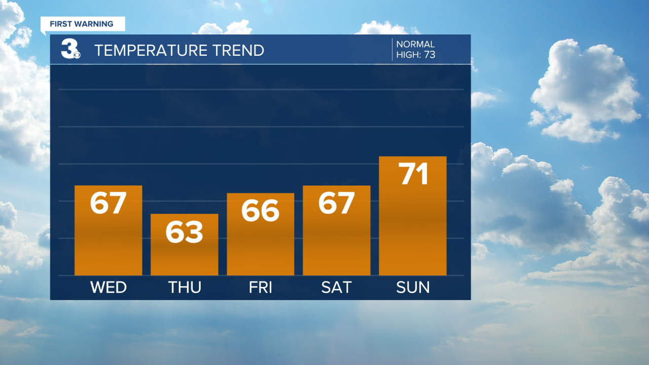
We will see lots of sunshine on Thursday, but it will be the coolest day of the week with highs in the low to mid 60s. Sunshine will continue for Friday as we begin a very slow warmup. Expect highs in the mid 60s Friday, upper 60s Saturday, and low 70s Sunday.
Today: AM Sun, PM Storms. Highs in the mid 80s. Winds: SW/NW 5-15
Tonight: Mostly Cloudy, Storms. Lows in the mid 50s. Winds: NW 5-15
Tomorrow: AM Clearing, Cooler, Breezy. Highs in the upper 60s. Winds: NW 10-20
Weather & Health
Pollen: High (Oak, Sweetgum, Sycamore)
UV Index: 8 (Very High)
Air Quality: Moderate (Code Yellow)
Mosquitoes: Moderate
Weather updates on social media:
Facebook: MylesHendersonWTKR
Twitter: @MHendersonWTKR
Instagram: @MylesHendersonWTKR
