


Meteorologist Myles Henderson’s First Warning Forecast
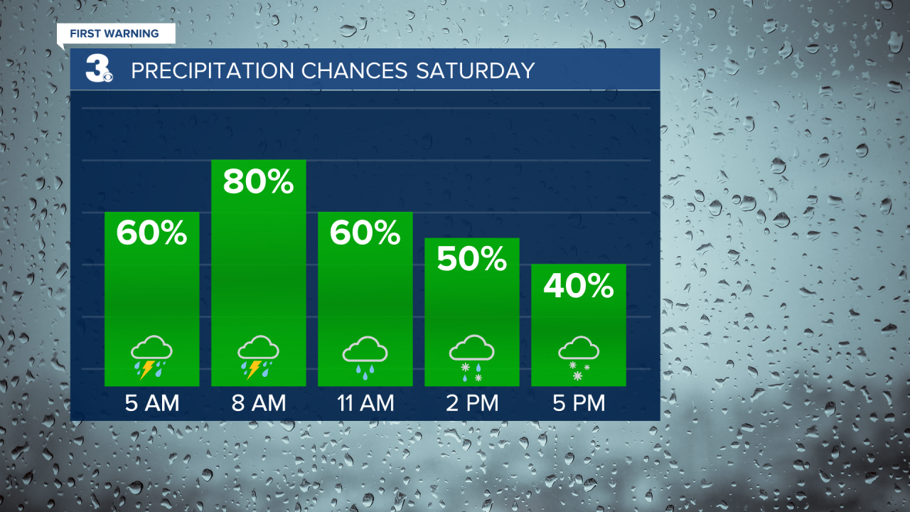
Nice today but get ready for some wild weather this weekend. We have a threat for severe thunderstorms Saturday morning, a chance for snow Saturday afternoon, winds gusting to over 40 mph, and a 30+ degree temperature drop.
Today will be a nice weather day for us. We will see a mix of mostly sunny to partly cloudy skies today with highs in the upper 50s, near normal for this time of year.
A cold front will move through the region on Saturday, bringing us some dramatic weather changes. Severe thunderstorms are possible Saturday morning as the front moves in. Temperatures will fall from the 60s Saturday morning to the 30s Saturday afternoon. With the colder air, we could see a switch from rain to snow Saturday afternoon. Little to no accumulation is expected. Winds will also ramp up on Saturday, with gusts to 40+ mph possible.
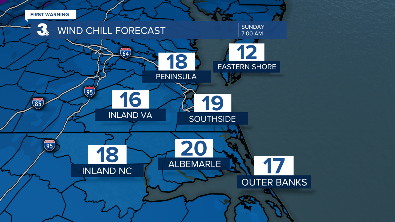
The chilly air will stick around for Sunday. Temperatures will start in the 20s Sunday morning with a wind chill in the teens. Highs will only reach the upper 40s, about 10 degrees below normal. We will see lots of sunshine, but it will still be breezy with winds at 10 to 20 mph, especially in the morning.
Today: Partly Cloudy. Highs in the upper 50s. Winds: N/SE 5-10
Tonight: Mostly Cloudy, Showers. Lows near 50. Winds: S 5-10
Tomorrow: AM Storms, PM Snow, Windy. Falling from the 60s to 30s. Winds: S/NW 15-25 G35+
Weather & Health
Pollen: Medium-High (Juniper, Maple, Ash)
UV Index: 5 (Moderate)
Air Quality: Good (Code Green)
Mosquitoes: Low
Weather updates on social media:
Facebook: MylesHendersonWTKR
Twitter: @MHendersonWTKR
Instagram: @MylesHendersonWTKR
