

Derrah Getter's First Warning Forecast
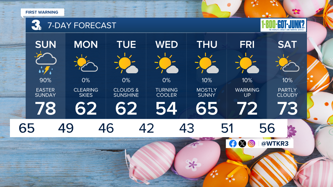
This evening, skies will be partly cloudy. Lows tonight fall into the mid 60s.

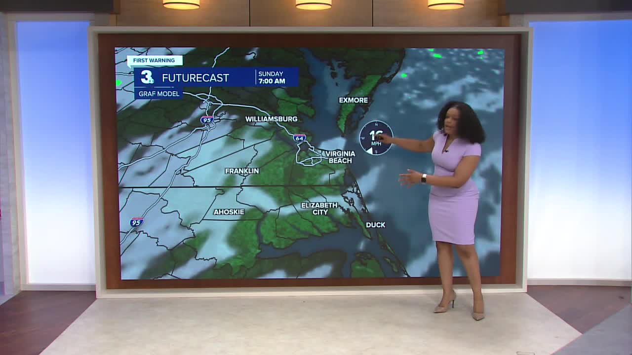
Sunday morning will be dry. Sunrise will be at 6:42 am. Clouds increase throughout the morning. Showers and thunderstorms arrive in the afternoon. Highs will reach the upper 70s. There is a level 1 out of 5 severe weather threat in place. Damaging wind gusts will be possible. The line of storms exits the region late Sunday night.

Cooler temperatures return for most of next week. Highs will be closer to average in the 50s and 60s. The brief cool down will slightly lower the tree pollen levels. Conditions will be mainly dry. Temperatures start warming up again late week.
Let's connect on social media!
Forecaster Derrah Getter:
For weather updates on Facebook: HERE
For weather updates on X: HERE
Follow me on Instagram: HERE
Check out the Interactive Radar on WTKR.com: Interactive Radar
