


Meteorologist Myles Henderson’s First Warning Forecast
A comfortable week with highs in the 60s and 70s. Tracking a round of showers and storms for Wednesday. Another rain chance Saturday.
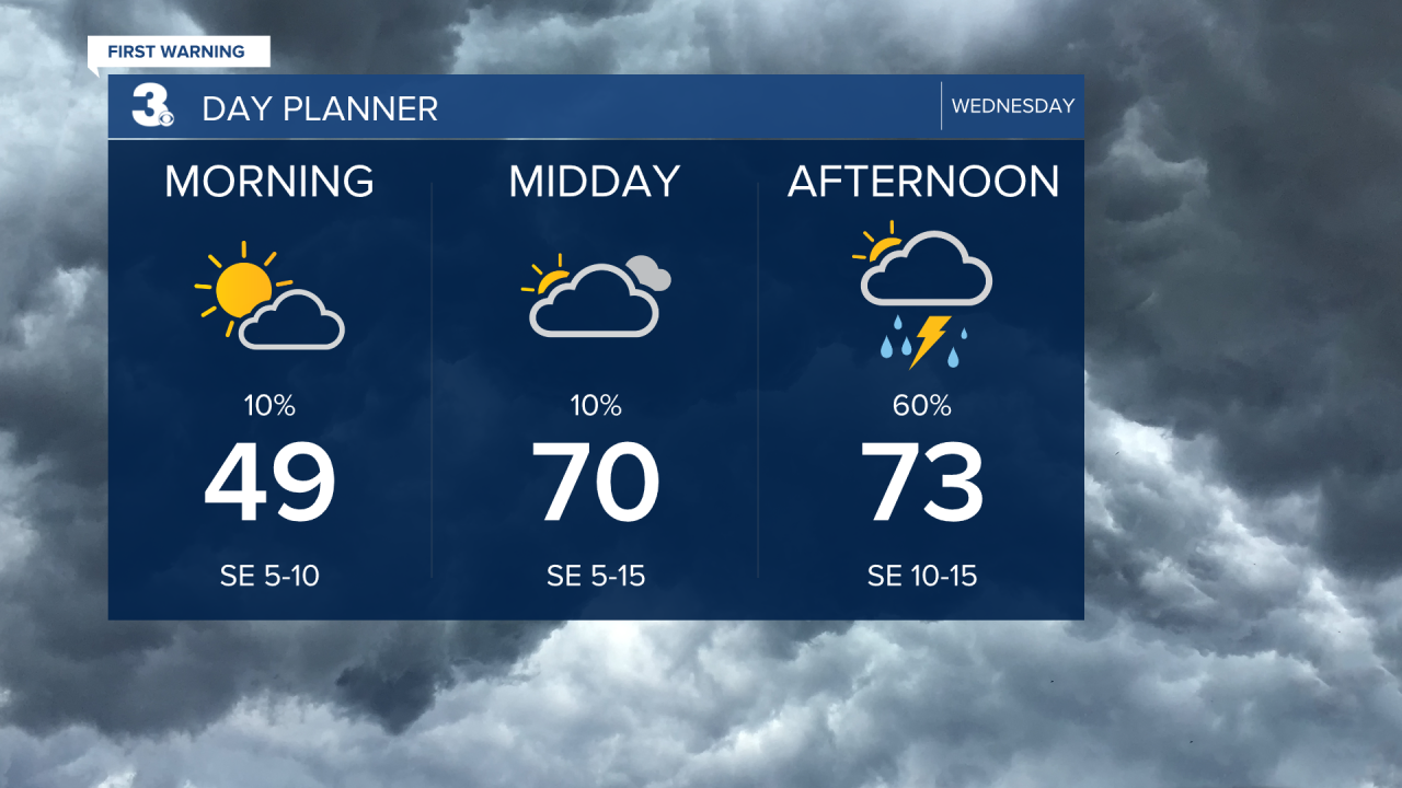
Highs will warm to the low and mid 70s today, closer to normal for this time of year. We will see mostly cloudy skies with scattered showers and storms, mainly in the afternoon and evening. Some storms could be strong to severe with gusty winds and heavy downpours.
Thursday and Friday look nice with a mix of mostly sunny to partly cloudy skies and highs in the upper 60s to low 70s.
Highs will drop to the 60s this weekend. Expect clouds and showers on Saturday with more sunshine on Sunday.

Today: Scattered Showers/Storms. Highs in the mid 70s. Winds: SE 5-15
Tonight: Scattered Showers/Storms. Lows in the upper 50s. Winds: S/W 5-10
Tomorrow: Partly Cloudy. Highs near 70. Winds: NW 5-15
Weather & Health
Pollen: Medium (Oak, Sweetgum, Sycamore)
UV Index: 4 (Medium)
Air Quality: Good (Code Green)
Mosquitoes: Low

Weather updates on social media:
Facebook: MylesHendersonWTKR
Instagram: @MylesHendersonWTKR
