First Warning Forecast:
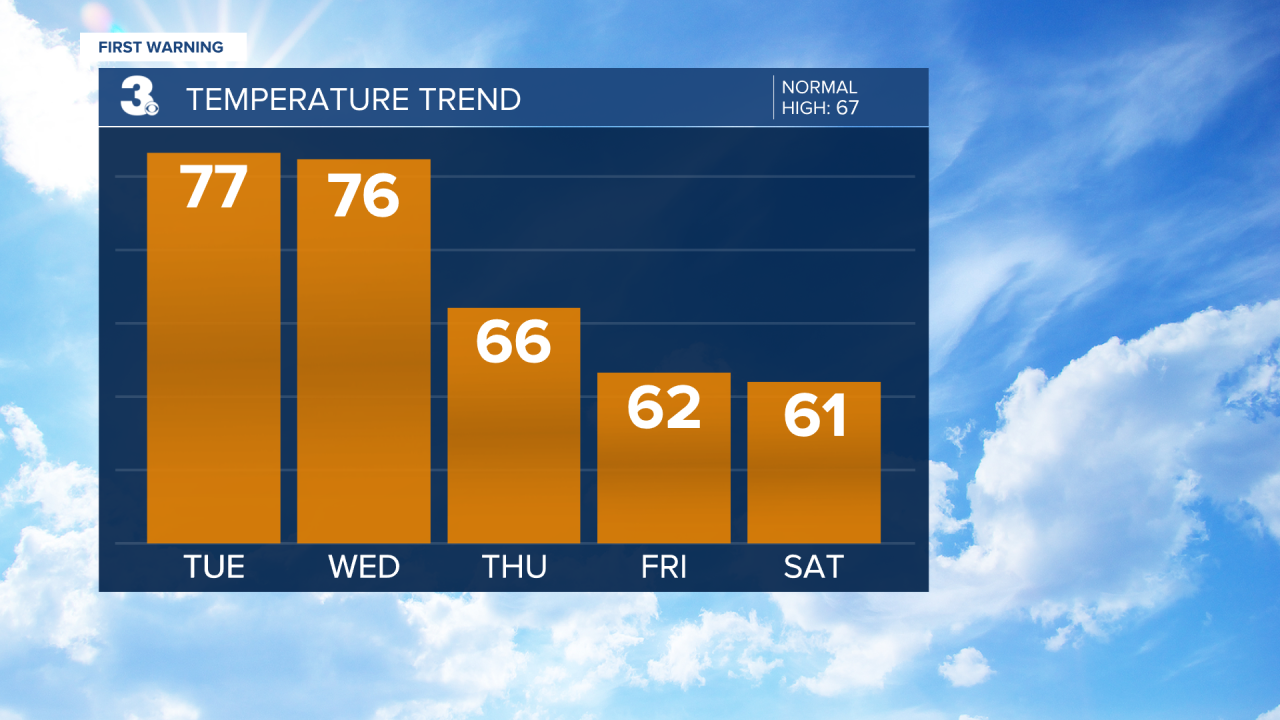
Temperatures trend above normal this week, but the warmer weather will also bring the chance for spring showers and storms.
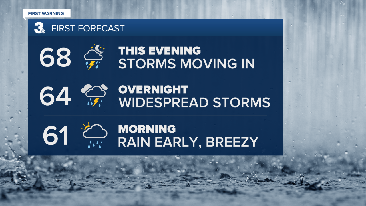
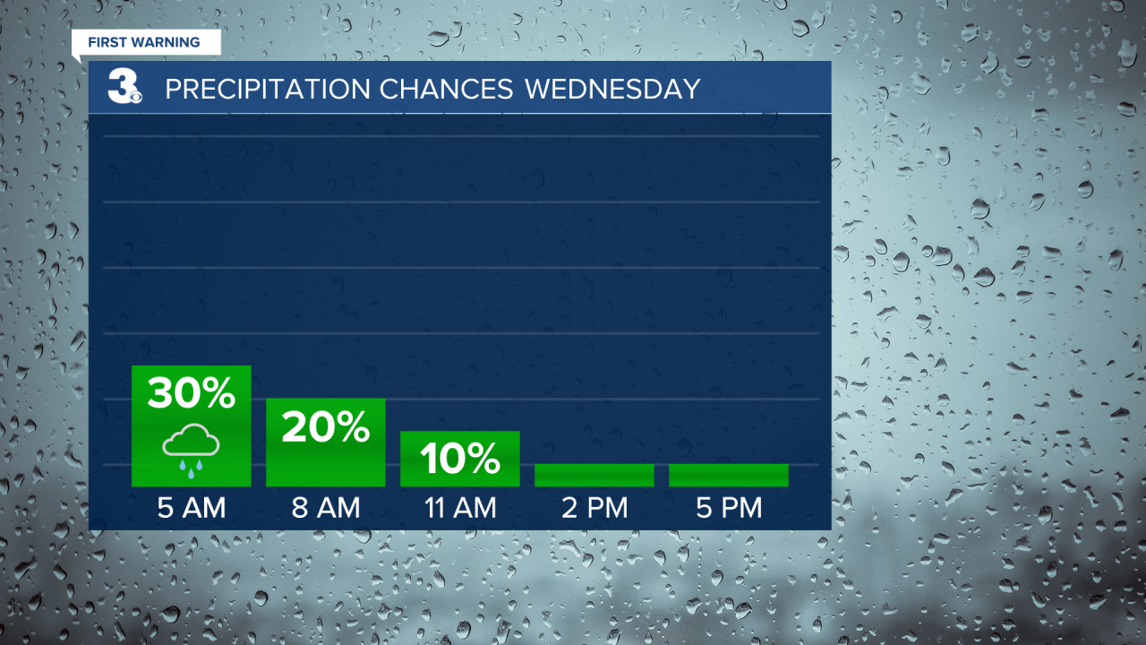
Showers will continue overnight and into Wednesday morning. Drier conditions will move in by the afternoon. It will be another warm day with highs in the mid 70s.
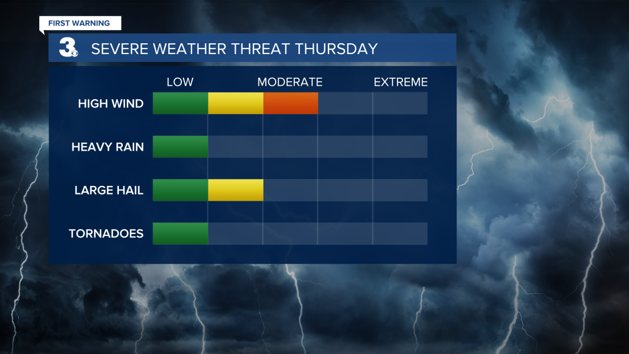
A cold front will cross the area on Thursday. This will bring showers and storms to the area. Most of the area is under a level 2 for severe storms, which means scattered severe storms will be possible. Damaging wind gusts, heavy rain and large hail cannot be ruled out. Temperatures will once again be mild with highs in the low 70s.

Cooler behind the cold front on Friday. A few spotty showers will be possible with highs in the mid 60s.
The weekend is looking cool and mainly dry with highs in the low 60s.