




Meteorologist Myles Henderson’s First Warning Forecast
A cool and windy weekend. Showers on Saturday, some clearing for Sunday. A lingering coastal storm brings strong wind and flooding risks.
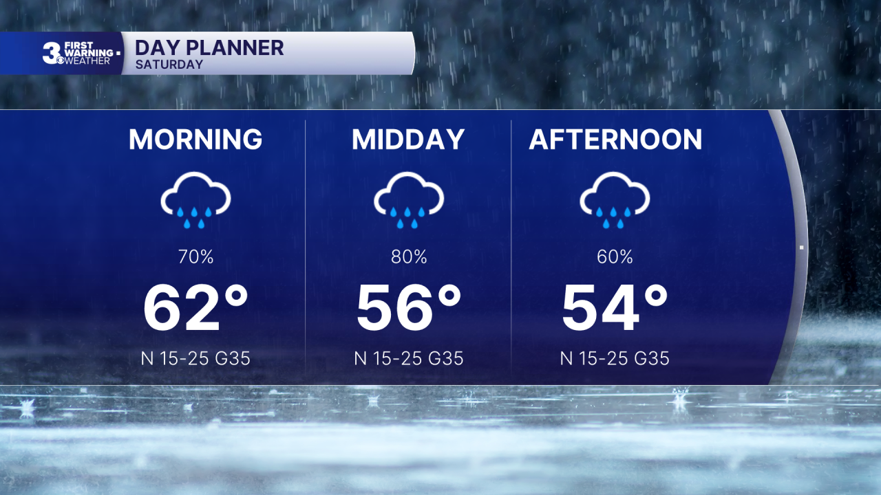
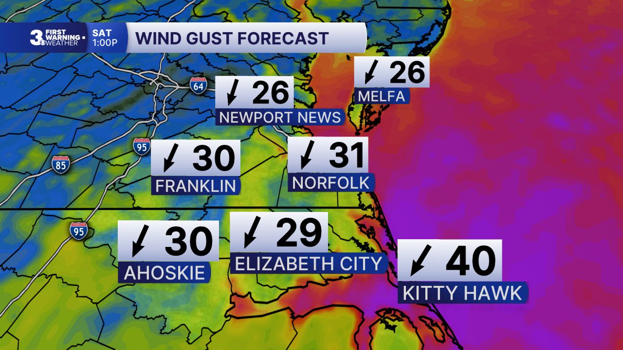
Much cooler today with temperatures falling into the 50s, about 30 degrees cooler than yesterday afternoon. Expect cloudy skies with showers throughout the day. It will be windy with gusts to 30 mph inland and 40+ mph near the coast.
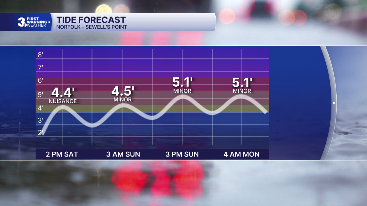
Highs will return to the low 60s on Sunday with partly cloudy skies and lower rain chances. It will still be windy with a NE wind at 15 to 25 and gusts 30 to 40 mph. The persistent N/NE winds will trigger tidal flooding and potential ocean overwash.
A coastal storm will linger off the Carolina coast for much of next week. The strong N/NE winds will continue for several days, and multiple rounds of tidal flooding are expected. Showers are possible depending on how close the low gets to the coastline. Highs will remain in the mid 60s all week.
Today: Cloudy, Showers, Windy. Temperatures falling into the 50s. Winds: N 15-25 G35
Tonight: Mostly Cloudy, Showers, Windy. Lows near 50. Winds: N 15-25 G35
Tomorrow: Cloudy, Windy. Highs in the low 60s. Winds: NE 15-25 G35
Weather & Health
Pollen: Low (Ragweed)
UV Index: 1 (Low)
Air Quality: Good (Code Green)
Mosquitoes: Very High
Tropical Update
No tropical activity at this time
Weather updates on social media:
Facebook: MylesHendersonWTKR
Instagram: @MylesHendersonWTKR
