


Meteorologist Myles Henderson’s First Warning Forecast
A 50/50 weekend with rain on Saturday and sunshine on Sunday. Cool this weekend but warming back to the 80s next week.
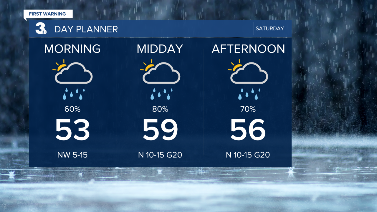
Cool, breezy, and gloomy today. Expect mostly cloudy skies with showers as an area of low-pressure slides along the NC coast. Rain chances (& totals) will be higher to the SE and lower to the NW. Temperatures will struggle to reach 60 today and it will be breezy with a north wind at 10 to 15 mph and higher gusts.
Skies will clear early Sunday morning, and we will see sunshine for most of the day. It will still be cool and breezy with highs in the mid 60s, about 10 degrees below normal for this time of year.
Warmer air returns next week with highs climbing to the 70s and 80s. Highs will jump to the mid and upper 70s on Monday and into the low 80s on Tuesday. Looking ahead to another round of showers/storms on Thursday with a cold front.

Today: Mostly Cloudy, Showers, Breezy Highs in the upper 50s. Winds: N 10-15 G20
Tonight: Clearing Skies. Lows in the upper 40s. Winds: NW 5-10
Tomorrow: Mostly Sunny, Breezy. Highs in the mid 60s. Winds: NW 10-15
Weather & Health
Pollen: Low (Oak, Birch, Sweetgum)
UV Index: 2 (Low)
Air Quality: Good (Code Green)
Mosquitoes: Moderate

Weather updates on social media:
Facebook: MylesHendersonWTKR
Instagram: @MylesHendersonWTKR
