


Meteorologist Myles Henderson’s First Warning Forecast
Tracking showers & storms moving in today. Colder air returns to end the week.
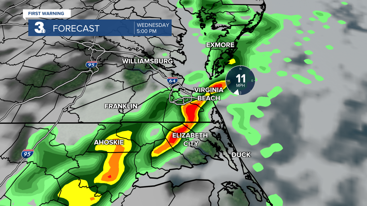
Showers and storms will build in today as a cold front moves in from the west. A few showers are possible this morning, rain chances start to pick up around midday, but the biggest chance for rain and storms will be this afternoon to evening (3 pm to 7 pm). Strong to severe storms are possible with gusty winds and isolated tornadoes. It will be windy today with a SW wind at 10 to 15 and gusts to 25 mph. Highs will reach the mid 70s today, almost 25 degrees above normal for this time of year.
Expect clearing skies on Thursday, mostly cloudy in the morning, partly cloudy through midday, and mostly sunny by the afternoon. Highs will drop to the mid 60s tomorrow.
Even cooler air will move in to end the week. Expect highs in the mid 50s on Friday with mostly sunny skies. Highs will linger in the upper 40s to low 50s this weekend with more sunshine on Saturday and more clouds on Sunday.

Today: Showers, Storms, Breezy. Highs in the mid 70s. Winds: SW 10-15 G25
Tonight: Mostly Cloudy. Lows in the upper 50s. Winds: SW 10-15 G25
Tomorrow: Clearing Skies. Highs in the mid 60s. Winds: W 5-10
Weather updates on social media:
Facebook: MylesHendersonWTKR
Twitter: @MHendersonWTKR
Instagram: @MylesHendersonWTKR
