




Meteorologist Myles Henderson’s First Warning Forecast
A coastal storm continues to bring strong wind and tidal flooding to end the work week.
*** Coastal Flood Warning until 4 PM Friday for most of Hampton Roads. Significant flooding near times of high tide.
*** Wind Advisory until 8 PM Thursday for coastal Virginia and North Carolina. Wind gusts to 40+ mph along the coastline.
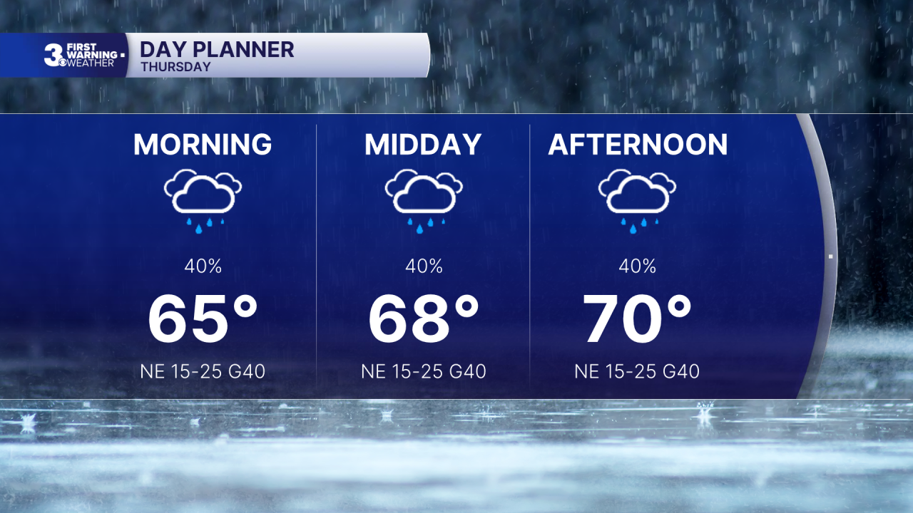
Another messy day today with cloudy skies, showers/drizzle, and strong wind. NE winds will continue at 15 to 25 mph with gusts to 40+ along the coast and 30+ inland. The persistent NE wind will trigger more tidal flooding today. Expect flooding and travel issues for several hours before and after high tide this morning and again this evening.
We will see a mix of clouds on Friday with scattered showers/drizzle. It will still be windy with a north wind at 10 to 20 and gusts to 30 mph. We will again see flooding near times of high tide.
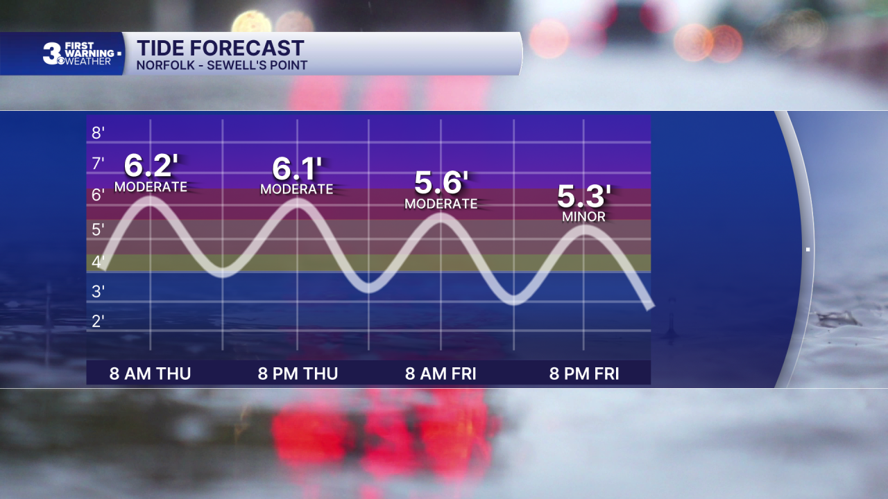
Conditions will slowly improve as we head through the weekend. Expect a nice mix of sun and clouds with lower rain chances. It will still be breezy this weekend but not as strong or gusty as the work week. High tide water levels will continue to slowly drop, but lingering flooding spots could remain.
Today: Cloudy, Showers, Windy. Highs near 70. Winds: NE 15-25 G40
Tonight: Cloudy, Showers, Windy. Lows near 60. Winds: NE 10-20 G30
Tomorrow: Partly Cloudy, Showers, Windy. Highs near 70. Winds: N 10-20 G30
Weather & Health
Pollen: Low (Ragweed)
UV Index: 2 (Low)
Air Quality: Moderate (Code Yellow)
Mosquitoes: Very High
Tropical Update
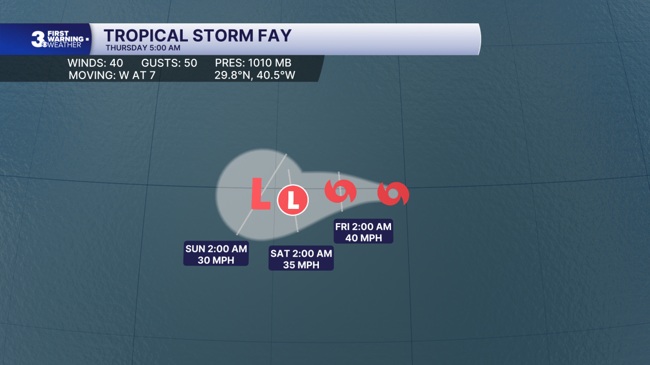
Tropical Storm Fay has redeveloped over the open Atlantic. A generally westward motion is expected over the next few days. Maximum sustained winds have increased to near 40 mph with higher gusts. Little change in strength is forecast during the next day or two, with gradual weakening expected thereafter.
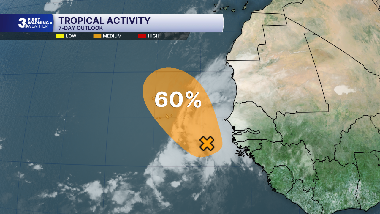
Watching an area of low pressure located a few hundred miles SSE of the Cabo Verde Islands. This system could become a short-lived tropical depression later today or on Friday while it moves NW to north. However, strong upper-level winds should end the opportunity for development by the weekend.
* Formation chance through 48 hours: Medium (60%)
* Formation chance through 7 days: Medium (60%)
Weather updates on social media:
Facebook: MylesHendersonWTKR
Instagram: @MylesHendersonWTKR
