

Derrah Getter's First Warning Forecast
This evening, mostly cloudy conditions persist. Showers fade overnight but some lingering rain will be possible very early Thursday morning.

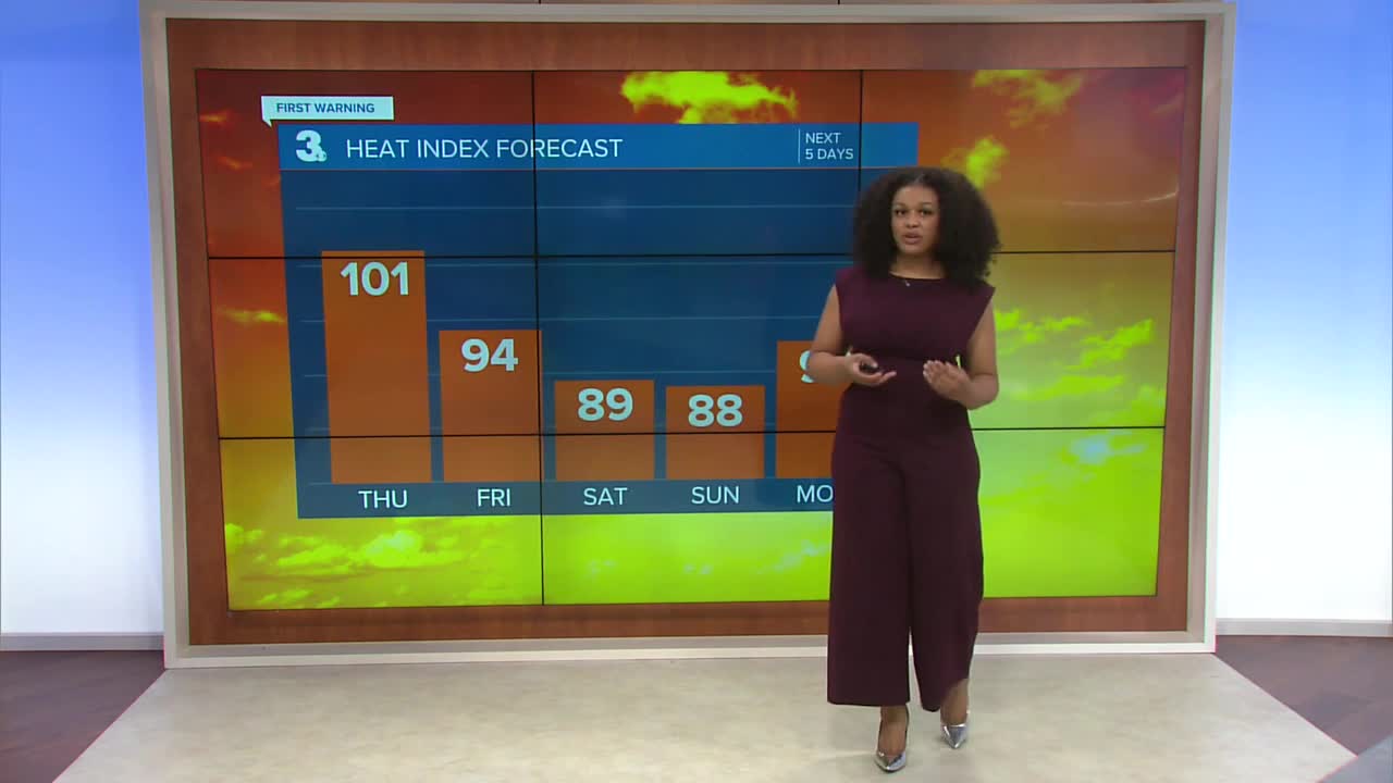
Thursday will likely be our hottest day of the week with high temperatures near 90s and heat index values near 100 degrees. There will be the chance for another round of scattered thunderstorms in the afternoon.

Rain chances get lower over the weekend. The bright conditions return Saturday afternoon and throughout the day on Sunday. Temperatures hover in the mid to upper 80s.

Tracking Tropical Storm Erin:
Erin has strengthened slightly and is starting to become better organized. It is expected to continue moving west into warmer waters where strengthening will be more conducive. By Sunday, Erin could reach major hurricane strength (category 3 or higher). A front could potentially push the storm out to sea and away from the U.S. early next week.

There's a second area to watch near the Yucatan Peninsula. Some strengthening is possible later this week. It's forecast to move over land where it would ultimately fizzle out.
Let's connect on social media!
Forecaster Derrah Getter:
For weather updates on Facebook: HERE
For weather updates on X: HERE
Follow me on Instagram: HERE
Check out the Interactive Radar on WTKR.com: Interactive Radar
