


Meteorologist Myles Henderson’s First Warning Forecast
A break from the heat and humidity this weekend. Tracking rain, storms, and a flooding threat. Back to the heat and humidity again next week.
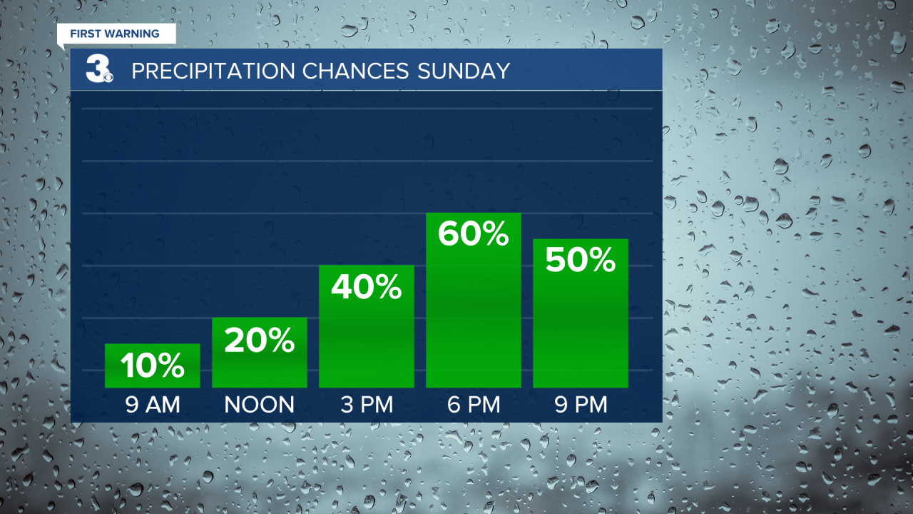
Highs will return to the mid 80s today, just a few degrees below normal for this time of year. Expect partly cloudy to mostly cloudy skies today with scattered showers and storms, mainly this afternoon to evening. Some storms could be strong to severe with damaging wind gusts and localized flooding possible.
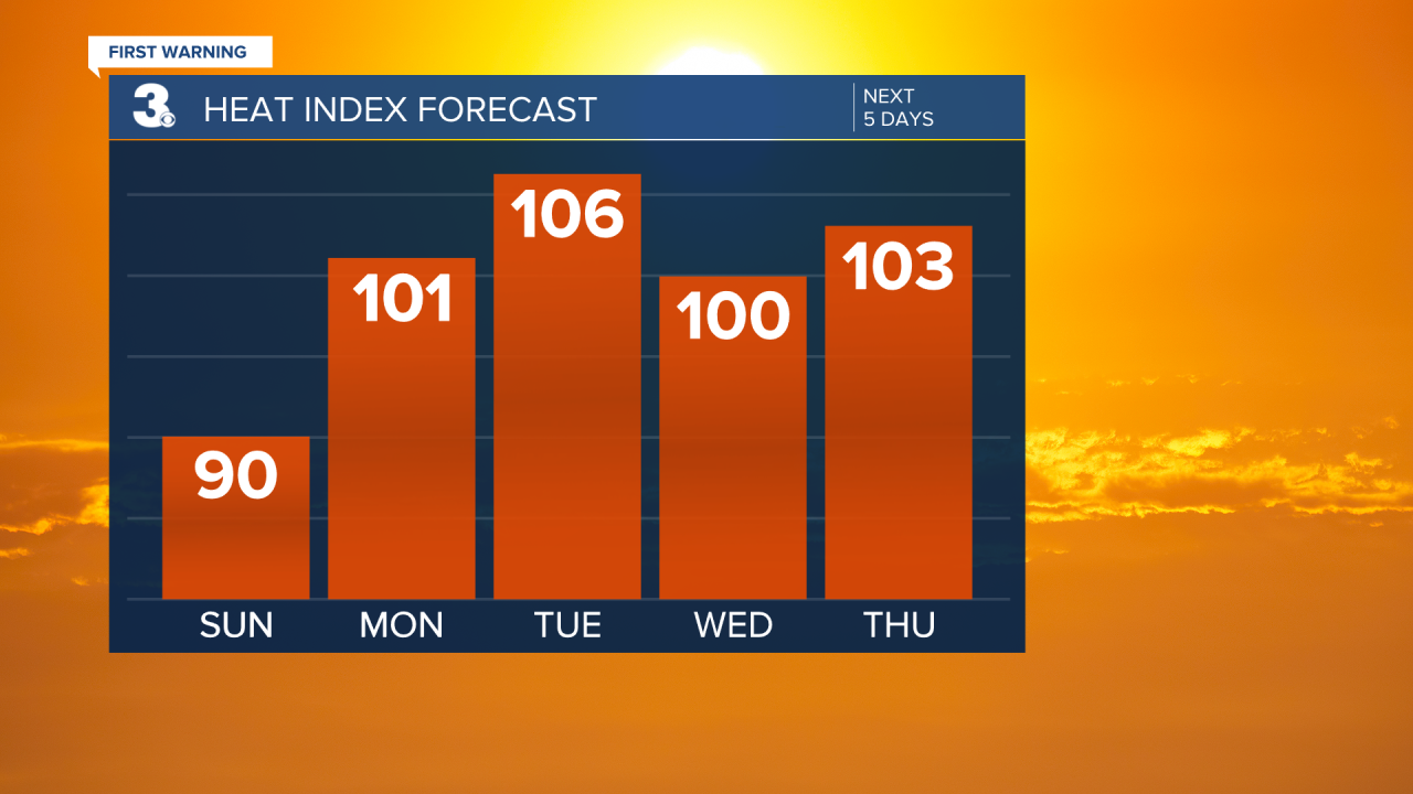
The heat and humidity return next week. Highs will warm to the low 90s on Monday with an afternoon heat index near 100. We will see mostly cloudy to partly cloudy skies with scattered showers and storms leftover.
Most of the work week will be typical summer days. Highs will reach the low to mid 90s with afternoon heat index values in the triple digits. We will see a mix of sun and clouds with a “pop-up” shower or storm possible each day.
Today: Partly to Mostly Cloudy, Scattered Storms. Highs in the mid 80s. Winds: SE 5-10
Tonight: Mostly Cloudy, Scattered Storms. Lows in the low 70s. Winds: S 5-10
Tomorrow: Mostly to Partly Cloudy, Scattered Storms. Highs in the low 90s. Winds: SW 5-10
Weather & Health
Pollen: Medium (Grasses)
UV Index: 9 (Very High)
Air Quality: Good (Code Green)
Mosquitoes: Extreme
Tropical Update
No tropical activity at this time
Weather updates on social media:
Facebook: MylesHendersonWTKR
Twitter: @MHendersonWTKR
Instagram: @MylesHendersonWTKR
