




Meteorologist Myles Henderson’s First Warning Forecast
Several cool and windy days this week. Flooding risks near times of high tide.
A coastal storm continues to linger off the Carolina coast. Strong N/NE winds remain, and multiple rounds of tidal flooding are expected. Rough surf and the potential for ocean overwash will continue.
Mostly sunny with highs in the mid 60s today. It will still be windy, north at 10 to 20 with gusts to 30 mph. We will see additional flooding risks near high tide times this morning and again this evening.
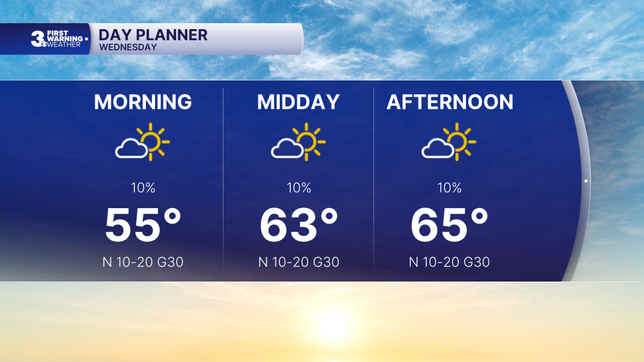
Winds will start to back down tomorrow, north at 10 to 15 mph. Expect mostly sunny skies with highs in the upper 60s.
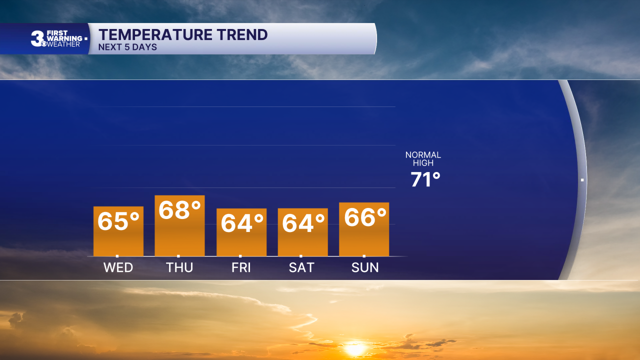
Highs will linger in the mid to upper 60s to end the week. It will still be breezy, but the strong gusts will start to back down as the coastal low tracks up the East Coast.
Today: Mostly Sunny, Windy. Highs in the mid 60s. Winds: N 10-20 G30
Tonight: A Few Clouds, Breezy. Lows in the low 50s. Winds: N 10-15
Tomorrow: Mostly Sunny, Breezy. Highs in the upper 60s. Winds: N 10-15
Weather & Health
Pollen: Low-Medium (Ragweed)
UV Index: 5 (Medium)
Air Quality: Good (Code Green)
Mosquitoes: Moderate
Tropical Update
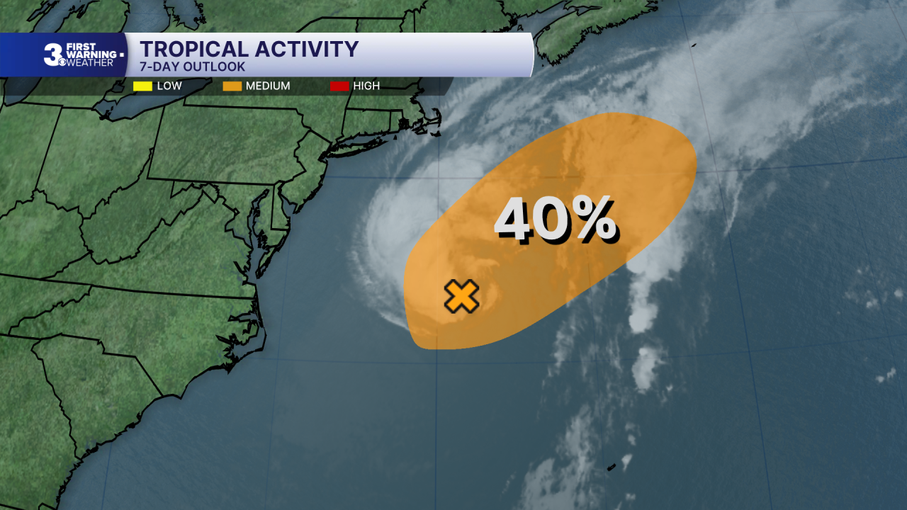
Watching a non-tropical low-pressure area located a few hundred miles off the mid-Atlantic United States. Satellite imagery indicates that the low is still frontal. Over the next day or two, the low could gradually lose its frontal features while it moves slowly NNE over the Gulf Stream, allowing the system to briefly develop subtropical characteristics. By the end of the week, the system is expected to accelerate NE away from the eastern United States, and environmental conditions are expected to become unfavorable for additional subtropical or tropical development.
* Formation chance through 48 hours: Medium (40%)
* Formation chance through 7 days: Medium (40%)
Weather updates on social media:
Facebook: MylesHendersonWTKR
Instagram: @MylesHendersonWTKR
