


Meteorologist Myles Henderson’s First Warning Forecast
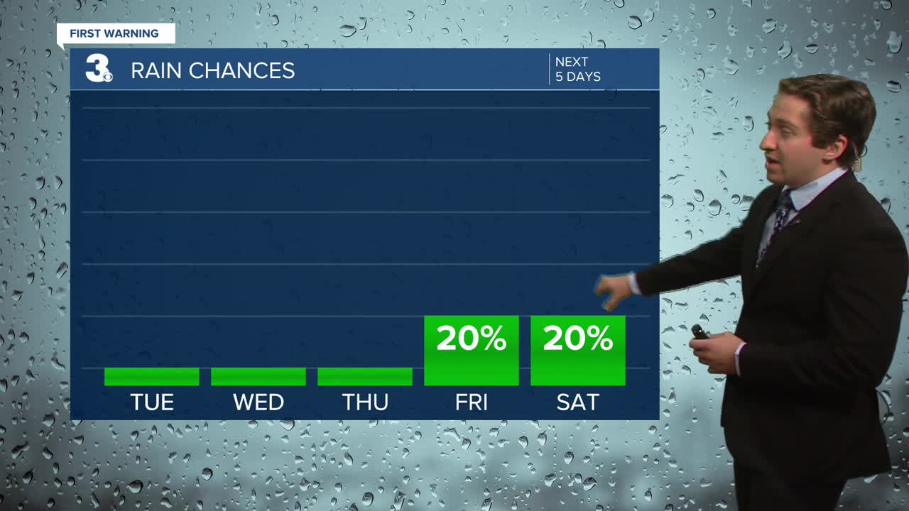
Sunshine and 60s through midweek. Warming to the 70s this weekend. Tracking a few rain chances to end the week.
Very nice today with mostly sunny skies and highs in the low 60s, about 5 degrees below normal for this time of year. It will still be a bit breezy but not as strong as yesterday.

Sunshine will continue tomorrow with highs warming to the upper 60s. We will drop back to the lower 60s on Thursday with sunshine.
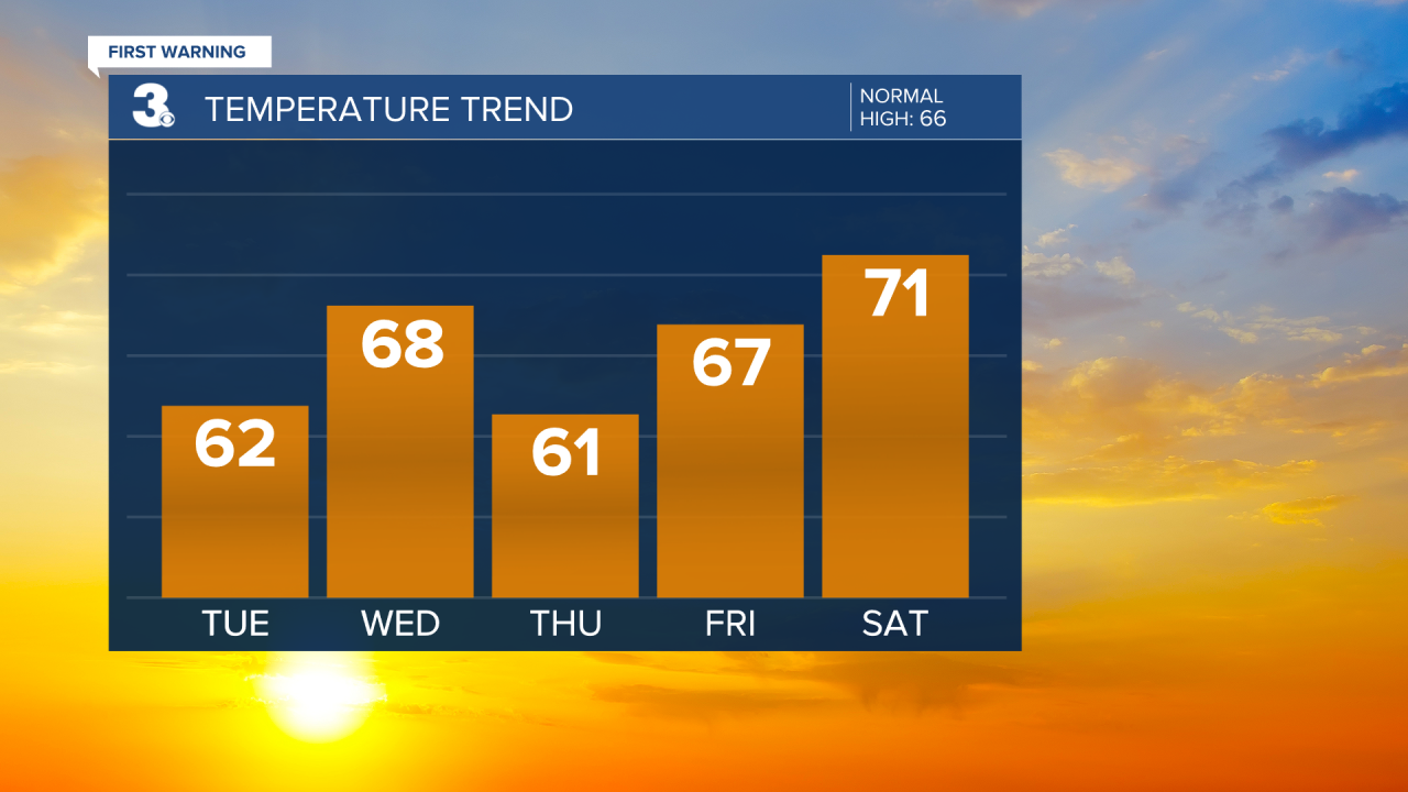
A cold front is set to move through late Friday to early Saturday. Most of the rain will fall apart before it gets here, but a spotty shower is possible. Highs will warm to the low 70s this weekend. Another cold front will move in on Sunday and could give us another chance for scattered showers.

Today: Mostly Sunny. Highs in the low 60s. Winds: NW 5-15
Tonight: Mainly Clear. Lows in the mid 40s. Winds: W 5-10
Tomorrow: Mostly Sunny, Breezy. Highs in the upper 60s. Winds: SW 10-20
Weather & Health
Pollen: Low (Ragweed)
UV Index: 4 (Moderate)
Air Quality: Good (Code Green)
Mosquitoes: Low
Tropical Update
No tropical activity at this time
Weather updates on social media:
Facebook: MylesHendersonWTKR
Instagram: @MylesHendersonWTKR
