


Meteorologist Myles Henderson’s First Warning Forecast
Another warming trend to start the work week. Tracking rain and a threat for severe storms for midweek. Trending cooler this weekend.
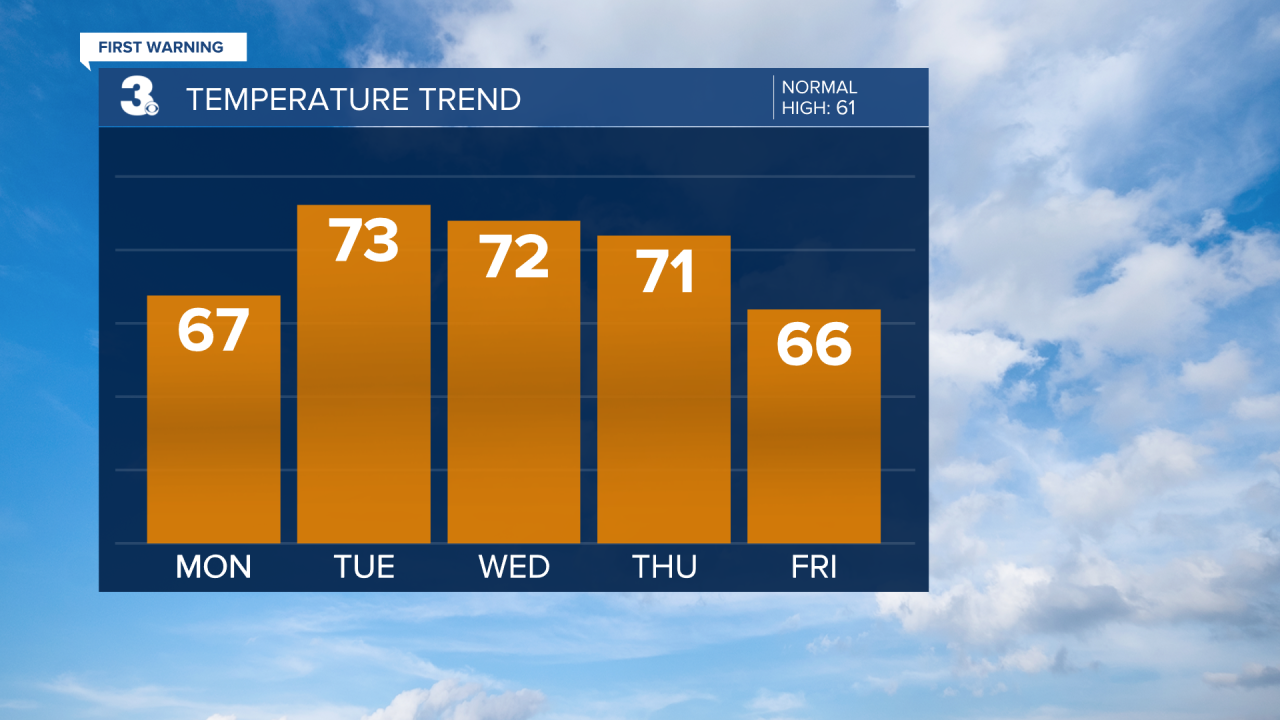
We will see lots of sunshine today with highs in the mid to upper 60s, about 5 degrees above normal for this time of year. Expect clear skies tonight with lows in the upper 40s. We will start with sunshine tomorrow, but clouds will build in by the afternoon. Highs will warm to the low and mid 70s tomorrow.
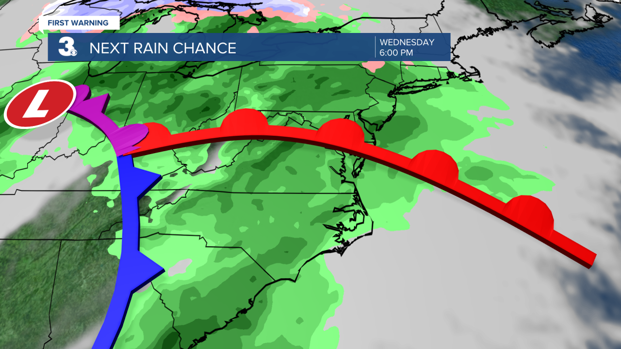
Our next rain maker (a cold front) is set to move in Wednesday. Expect mostly cloudy skies Wednesday with slim rain chances in the morning and building rain chances in the afternoon to evening. Strong to severe thunderstorms are possible, including damaging wind gusts and localized flooding. Rain and storms will continue Thursday. Rain chances will be higher in the morning and dropping by the afternoon. It will still be warm with highs in the low 70s both days.
We will get a chance to dry out on Friday with highs falling to the mid 60s. Temperatures will drop to the low 60s and upper 50s this weekend.
Today: Sunny. Highs in the upper 60s. Winds: NW/SW 5-10
Tonight: Mainly Clear. Lows in the upper 40s. Winds: SW 5-10
Tomorrow: AM Sun, PM Clouds. Highs in the mid 70s. Winds: SW 5-10
Weather & Health
Pollen: High (Juniper, Birch, Sycamore)
UV Index: 5 (Moderate)
Air Quality: Good (Code Green)
Mosquitoes: Low
Weather updates on social media:
Facebook: MylesHendersonWTKR
Twitter: @MHendersonWTKR
Instagram: @MylesHendersonWTKR
