

Derrah Getter's First Warning Forecast
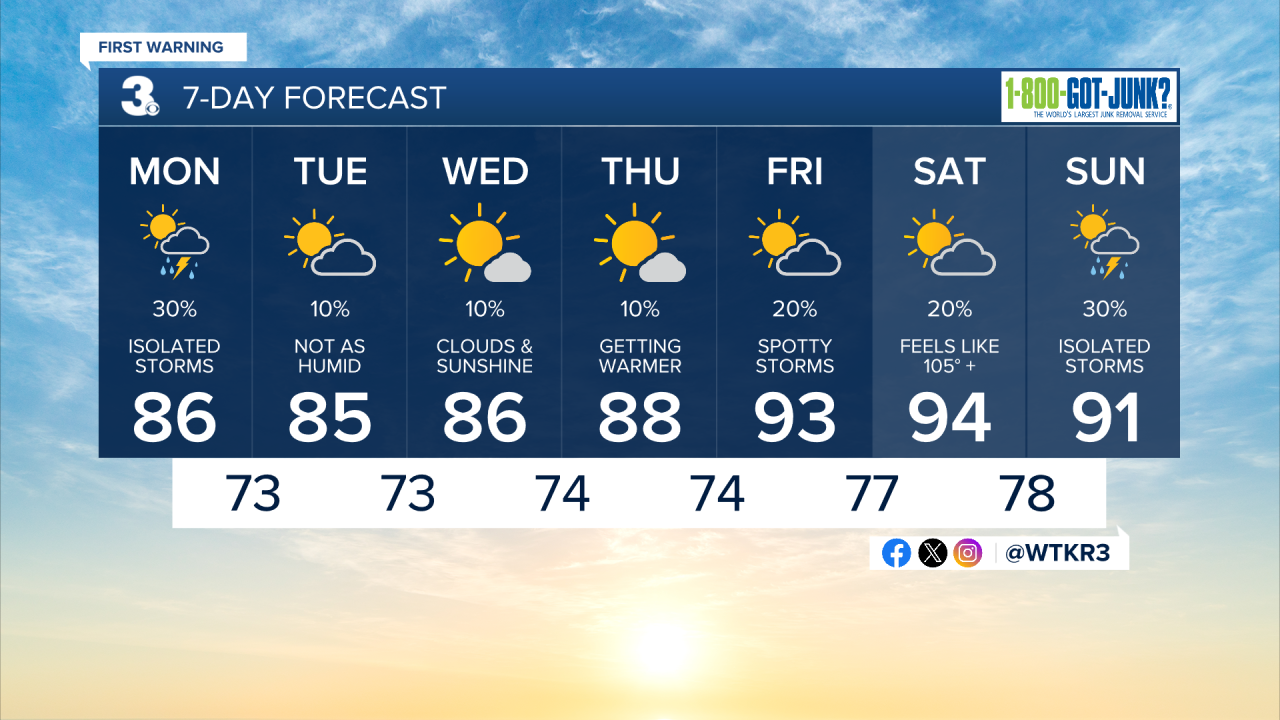
This morning will be warm and muggy with temperatures in the upper 70s out the door.
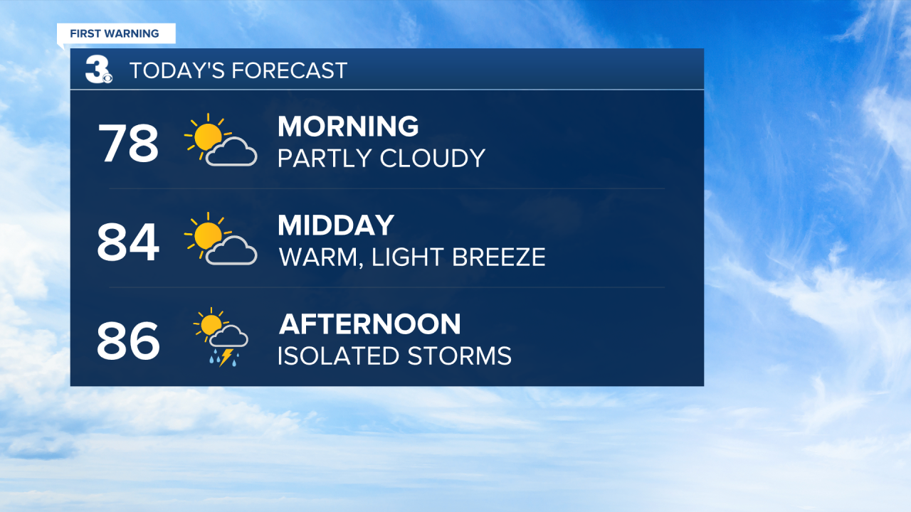
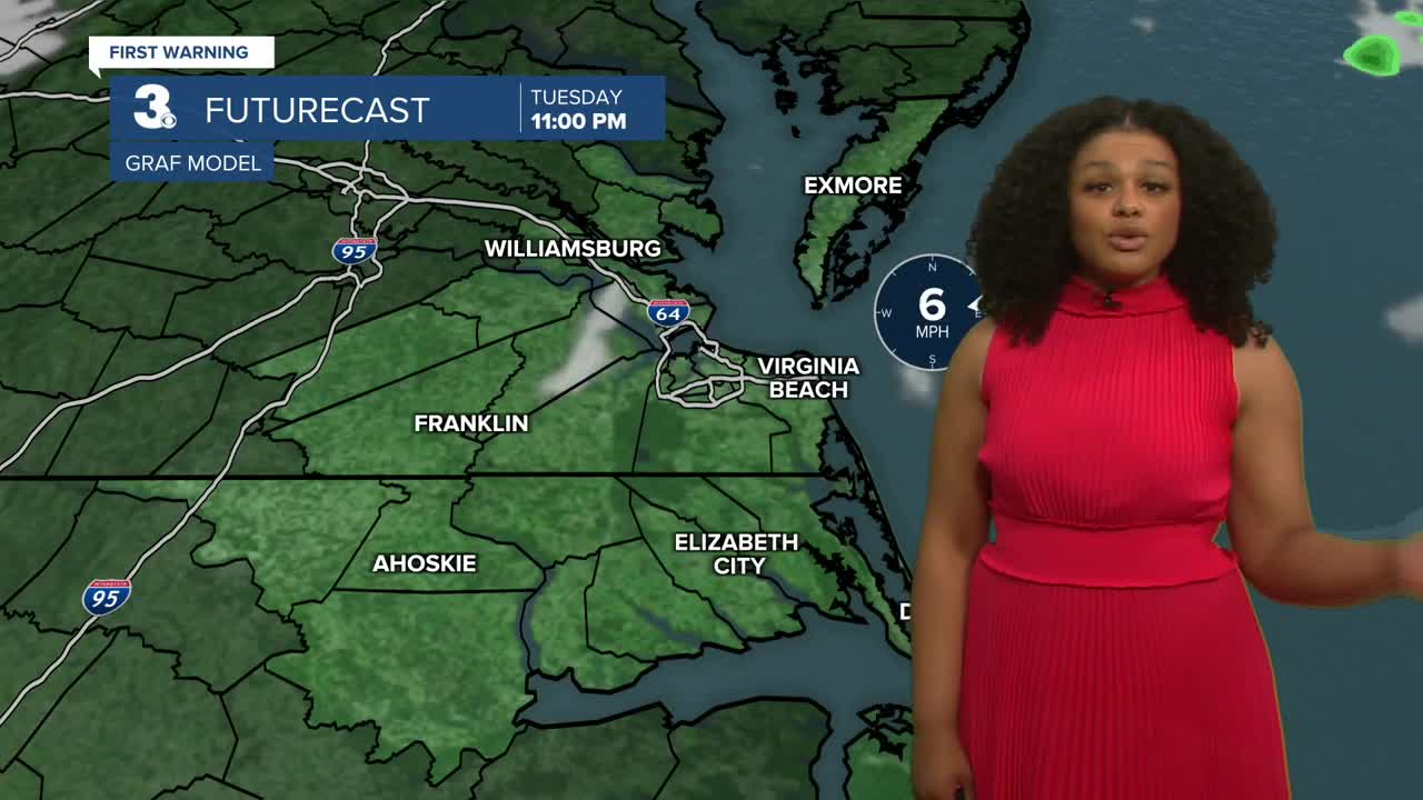
Isolated showers and storms develop this afternoon along a cold front. High temperatures reach the mid to upper 80s underneath partly sunny skies.
Much more comfortable conditions extend through the rest of the work week with highs in the mid to upper 80s and lower humidity. Rain chances will be lower as well.
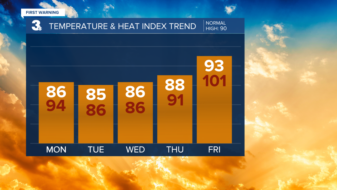
The heat builds back in just before the upcoming weekend with highs back in the 90s and isolated storm chances.
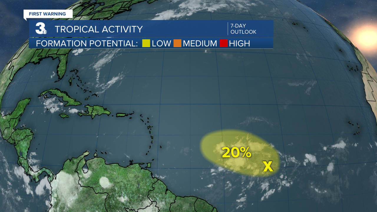
2025 Atlantic Hurricane Season Update
7/21, 8 am
A small area of low pressure about 900 miles ESE of the Lesser Antilles is producing disorganized showers and thunderstorms. There is a 20% chance of tropical cyclone formation in the next 7 days. Some slight strengthening is possible but by the middle of the week conditions are forecast to become unfavorable for further development.
Let's connect on social media!
Forecaster Derrah Getter:
For weather updates on Facebook: HERE
For weather updates on X: HERE
Follow me on Instagram: HERE
Check out the Interactive Radar on WTKR.com: Interactive Radar
