

Derrah Getter's First Warning Forecast
This evening will be very pleasant. High tide will bring minor tidal flooding concerns to our coastal neighborhoods around 9 pm. Lows dip into the mid 60s underneath mostly clear skies tonight.

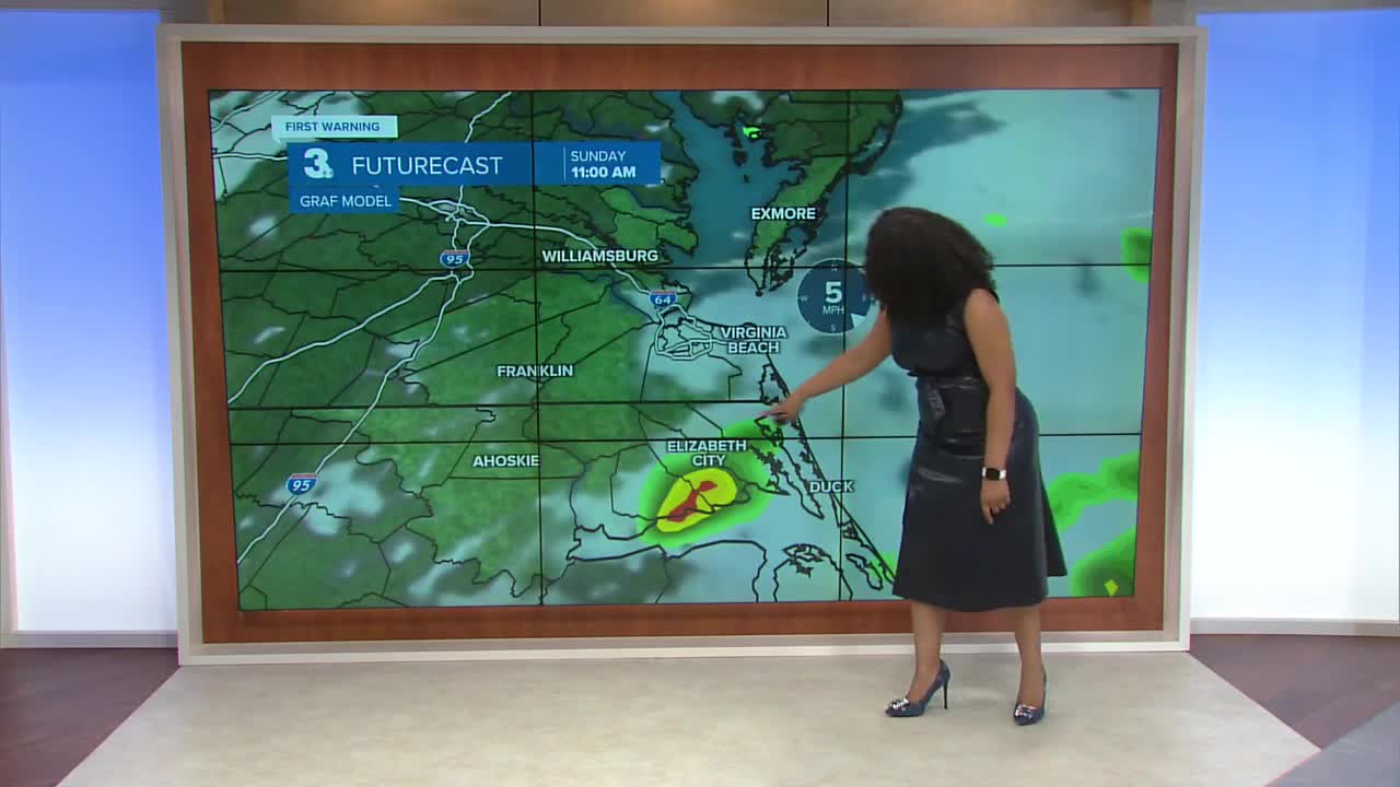
Saturday will start out bright but more clouds build in during the afternoon. High temperatures reach the low to mid 80s. Sunday, rain chances will be slightly higher with isolated showers and storms in the afternoon. Highs will remain in the low to mid 80s.

Temperatures briefly warm up to start next week but a strong cold front pulls in some milder air from Canada. Temperatures fall back into the upper 70s and low 80s during the second half of the week.

2025 Atlantic Hurricane Season Update
Hurricane Erin will continue moving away from the U.S. east coast and into the northern/central Atlantic. High rip current risks at all area beaches remain in effect through Saturday.
Showers and storms associated with a trough of low pressure about 250 miles northeast of the Leeward Islands continue to better organize. Environmental conditions are favorable for further development. A tropical storm is likely to form over the weekend. The next name on the list is Fernand.
Formation chance through 48 hours...HIGH...80%
Formation chance through 7 days...HIGH...90%
Showers and storms associated with a tropical wave located halfway between the west coast of Africa and the Winward Islands remains disorganized but conditions are favorable for development. A short-lived tropical depression could form within the next day.
Formation chance through 48 hours...LOW...30%
Formation chance through 7 days...MEDIUM...40%

Let's connect on social media!
Forecaster Derrah Getter:
For weather updates on Facebook: HERE
For weather updates on X: HERE
Follow me on Instagram: HERE
Check out the Interactive Radar on WTKR.com: Interactive Radar
