

Patrick's First Warning Forecast:
We have a tropical storm churning off our coast. But most of us probably won't notice the difference. Fay will bring a little rough surf along the coast, along with a few downpours.
As Fay churns by, we're expecting the heaviest downpours on the northern Eastern Shore. Some folks there may receive several inches of rain. And there's even a slight chance for flash flooding.

Most of us will wake up to dry weather on Friday morning as Fay exits the region. But there's a slight chance for a few showers wrapping around the storm in the afternoon
Friday will be a warm July day, with highs in the upper 80s and lower 90s.
We are back to the summer heat, humidity, and storms this weekend. Highs will climb to the low 90s both Saturday and Sunday. Afternoon heat index values will reach 100 to 105 on Saturday and 98-102 on Sunday.
Both days will see a mix of sun and clouds with scattered showers and storms popping up in the afternoon to evening. The best chance for rain is on Saturday
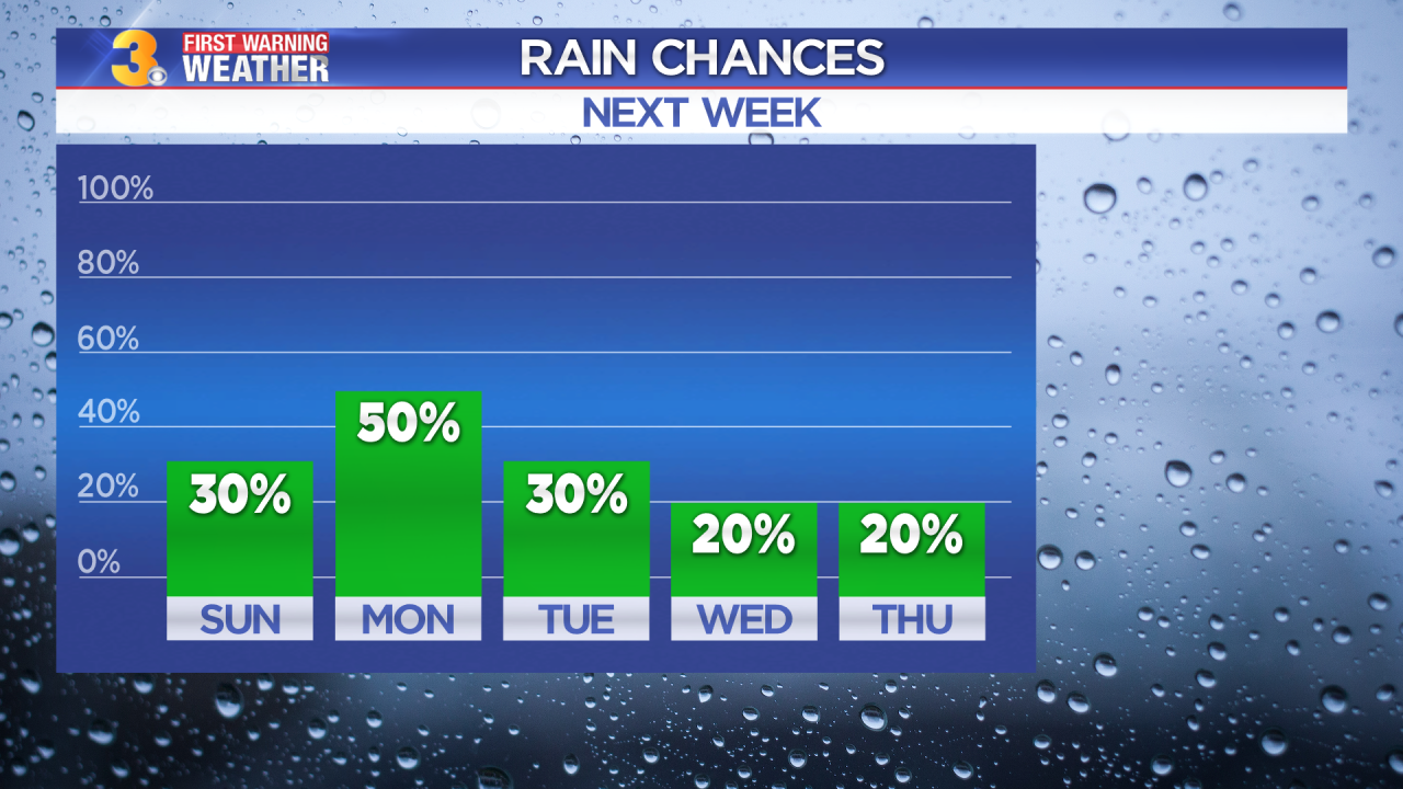
The hot and stormy pattern continues for the start of the work week. But high pressure will build in for a few days, bringing us lower rain chances by Wednesday and Thursday.
