


Meteorologist Myles Henderson’s First Warning Forecast
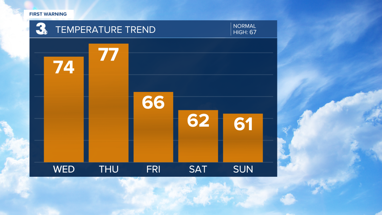
Warming back to the 70s with another round of rain and storms on the way. Cooling to the 60s this weekend with more sunshine.
Showers will move out this morning and clouds will clear out by midday. Expect partly cloudy skies with highs in the mid 70s this afternoon. Clouds will start to build in again tonight with lows in the 50s.
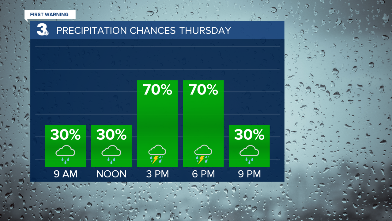
Another round of rain and storms is set to move in on Thursday with a cold front. The biggest chance will be Thursday afternoon to evening (2 PM to 7 PM). Strong to severe thunderstorms are possible with the potential for damaging wind gusts, hail, and isolated tornadoes. Highs will return to the mid 70s again tomorrow.
Cooler air will return for Friday and the weekend. Expect partly cloudy skies with a few lingering showers (20% chance) Friday. Highs will drop to the mid 60s, near normal for this time of year. We will see partly cloudy skies on Saturday and mostly sunny skies on Sunday with highs in the low 60s both days.
Today: AM Showers, Clearing Skies. Highs in the mid 70s. Winds: W 10-15
Tonight: Partly Cloudy. Lows in the upper 50s. Winds: NE/SE 5-10
Tomorrow: Mostly Cloudy, Showers/Storms. Highs in the mid 70s. Winds: S/W 10-15
Weather & Health
Pollen: Medium (Maple, Juniper, Birch)
UV Index: 5 (Moderate)
Air Quality: Good (Code Green)
Mosquitoes: Low
Weather updates on social media:
Facebook: MylesHendersonWTKR
Twitter: @MHendersonWTKR
Instagram: @MylesHendersonWTKR
