

Derrah Getter's First Warning Forecast

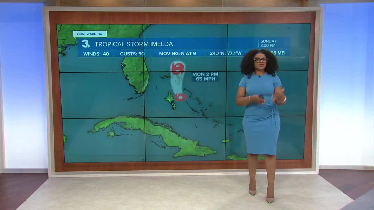
Newly formed Tropical Storm Imelda is currently located near the Bahamas. Winds are sustained at 40 mph. Slow strengthening is expected over the next couple days. The current forecast track shows the storm staying away from the Carolina coast, making a sharp turn away. Confidence is increasing that storm impacts will be limited. Southern most portions of the Outer Banks are still subject to dangerous rip currents and heavy rain but the wind threat is decreasing.

Humberto is currently a category 4 hurricane. It is expected to maintain its strength as a major hurricane through early next week. It’s forecast track takes it away from the U.S. coastline and confidence that this will play out as forecast is high.

This model run is a snapshot of Tuesday evening. This is just one model so take it with a grain of salt but if this scenario plays out, that would mean periods of heavy rainfall, coastal flooding, beach erosion as well as rough surf southern most parts of the Outer Banks.

Let's connect on social media!
Forecaster Derrah Getter:
For weather updates on Facebook: HERE
For weather updates on X: HERE
Follow me on Instagram: HERE
Check out the Interactive Radar on WTKR.com: Interactive Radar
