


Meteorologist Myles Henderson’s First Warning Forecast
The hot and humid stretch continues through midweek. A cold front brings rain and storms, plus some relief to end the week.
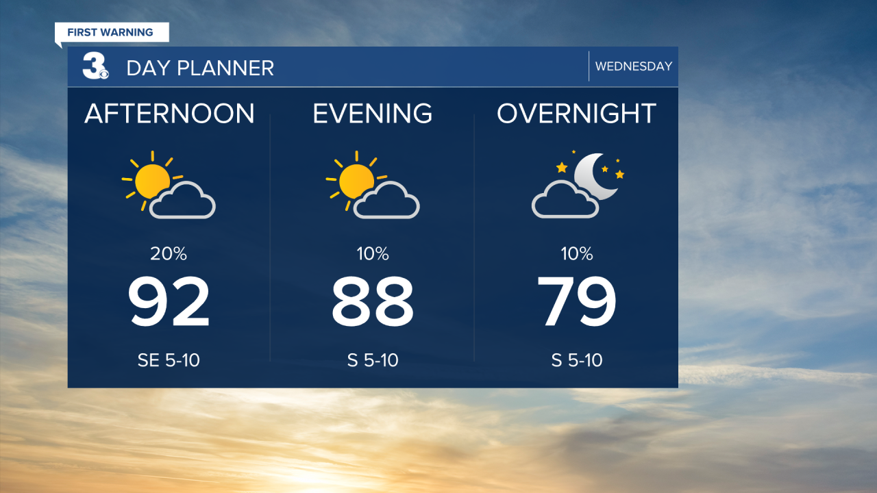
Highs will return to the low 90s this afternoon with an afternoon heat index near 100. Expect a mix of mostly sunny to partly cloudy skies today. A “pop-up” shower or storm is possible this afternoon.
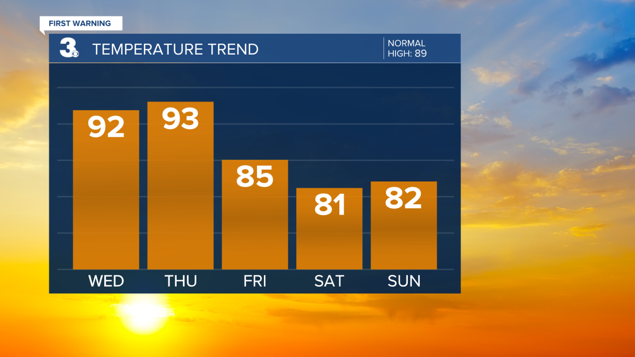
Hot and humid again tomorrow with highs in the low to mid 90s and a heat index of 100 to 105.
A cold front is set to move through the region late Thursday to Friday. Expect rain and storms starting Thursday afternoon to evening and continuing through Friday. Cooler and less humid air moves in behind the cold front.
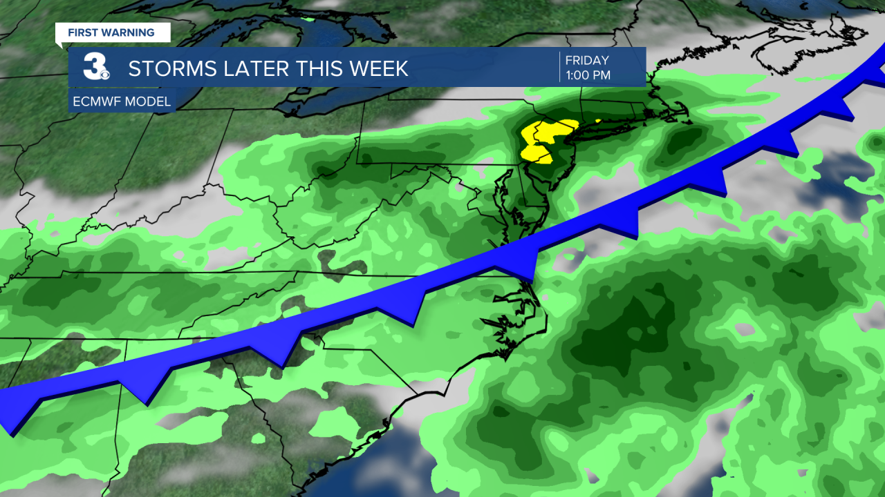
Highs will drop to the 80s beginning on Friday and lower humidity will move in for the weekend. Scattered showers and storms will linger for Saturday with more sunshine for Sunday. It will be windy this weekend, especially Saturday with wind gusts to 30 mph.
Today: Sun & Clouds. Highs in the low 90s. Winds: S 5-10
Tonight: Partly Cloudy. Lows in the mid 70s. Winds: S 5-10
Tomorrow: Afternoon Storms. Highs in the low 90s. Winds: S 5-10
Weather & Health
Pollen: Medium-High (Grasses)
UV Index: 10 (Very High)
Air Quality: Moderate (Code Yellow)
Mosquitoes: Extreme
Tropical Update
No tropical activity at this time
Weather updates on social media:
Facebook: MylesHendersonWTKR
Instagram: @MylesHendersonWTKR
