

Derrah Getter's First Warning Forecast
This evening, a cold front will bring scattered showers and cooler temperatures.
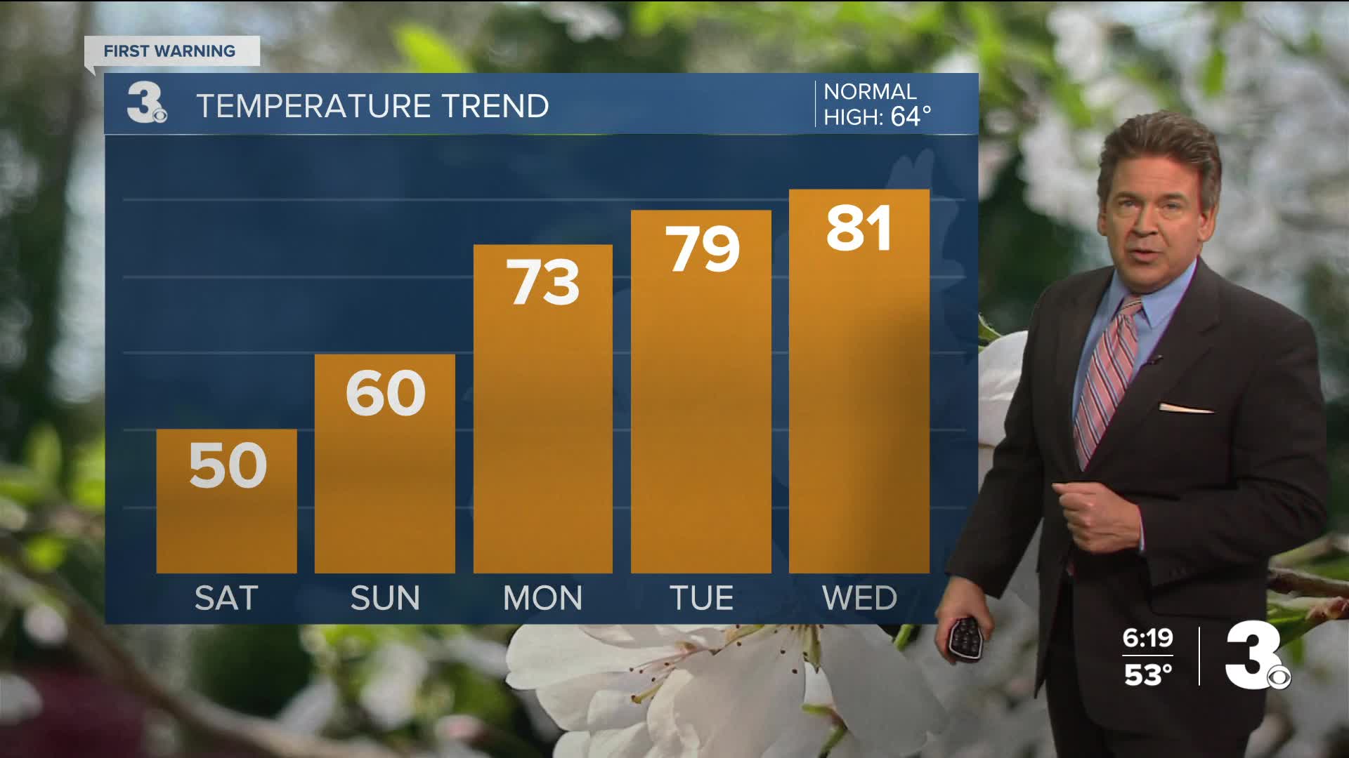
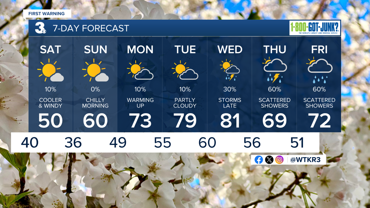
The rain moves in this evening and lingers overnight. Conditions will be dry and sunny by Saturday morning but much cooler. Highs will be near 50 degrees on a windy Saturday and near 60 degrees with lots of sunshine on Sunday. Outside of a 10% chance of early A.M. rain along the Outer Banks on Saturday morning, no rain is expected this weekend.
Showers tonight should drop around a half inch of rain by early Saturday morning.

Shower chances return for several days later next week. Temperatures quickly warm up again with highs back in the 80s by Wednesday.


Pollen levels gradually get higher next week. Highest levels will be around Tuesday and Wednesday. Tree pollen is highest right now with juniper, elm and poplar being the main allergens.
Let's connect on social media!
Forecaster Derrah Getter:
For weather updates on Facebook: HERE
For weather updates on X: HERE
Follow me on Instagram: HERE
Check out the Interactive Radar on WTKR.com: Interactive Radar
