


Meteorologist Myles Henderson’s First Warning Forecast
Warming back to the 70s to end the week. Tracking showers, storms, and strong winds for the weekend.
Another chilly start this morning but we will climb into the 70s this afternoon. Expect a mix of partly to mostly cloudy skies today with S/SW winds at 10 to 20 and gusts to near 30 mph. Scattered showers will build in this evening.

Expect showers and storms on Saturday as a cold front moves through. There is a “Level 1” severe threat for parts of southeast VA and all of eastern NC. The biggest rain/storm chance will be in the midday to afternoon time frame. It will be extremely windy Saturday with SW winds at 20 to 30 and gusts to 40+ mph. Highs will climb back into the 70s.

Sunshine returns for Sunday, but it will be much cooler with highs in the upper 50s. It will still be windy Sunday morning, but winds will start to relax through the day. We will warm back into the 70s again next week.

Today: Building Clouds, Windy. Highs in the low 70s. Winds: S 10-20G30
Tonight: Showers, Windy. Lows in the low 60s. Winds: SW 10-20G30
Tomorrow: Showers/Storms, Windy. Highs in the upper 70s. Winds: SW 20-30G40
Weather & Health
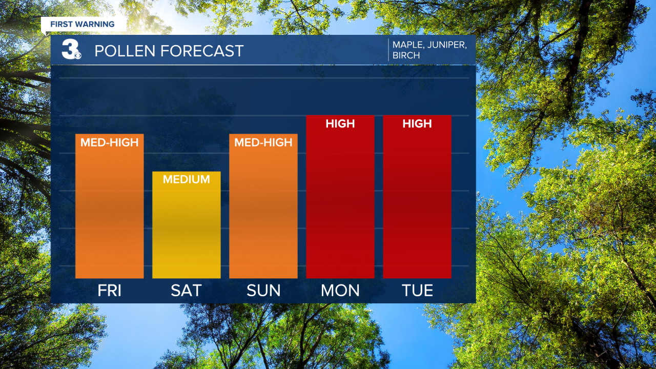
Pollen: Medium-High (Maple, Juniper, Birch)
UV Index: 6 (High)
Air Quality: Good (Code Green)
Mosquitoes: Low
Weather updates on social media:
Facebook: MylesHendersonWTKR
Twitter: @MHendersonWTKR
Instagram: @MylesHendersonWTKR
