


Meteorologist Myles Henderson’s First Warning Forecast
Tracking storms for the weekend. A warm and humid stretch with several days in the 80s.
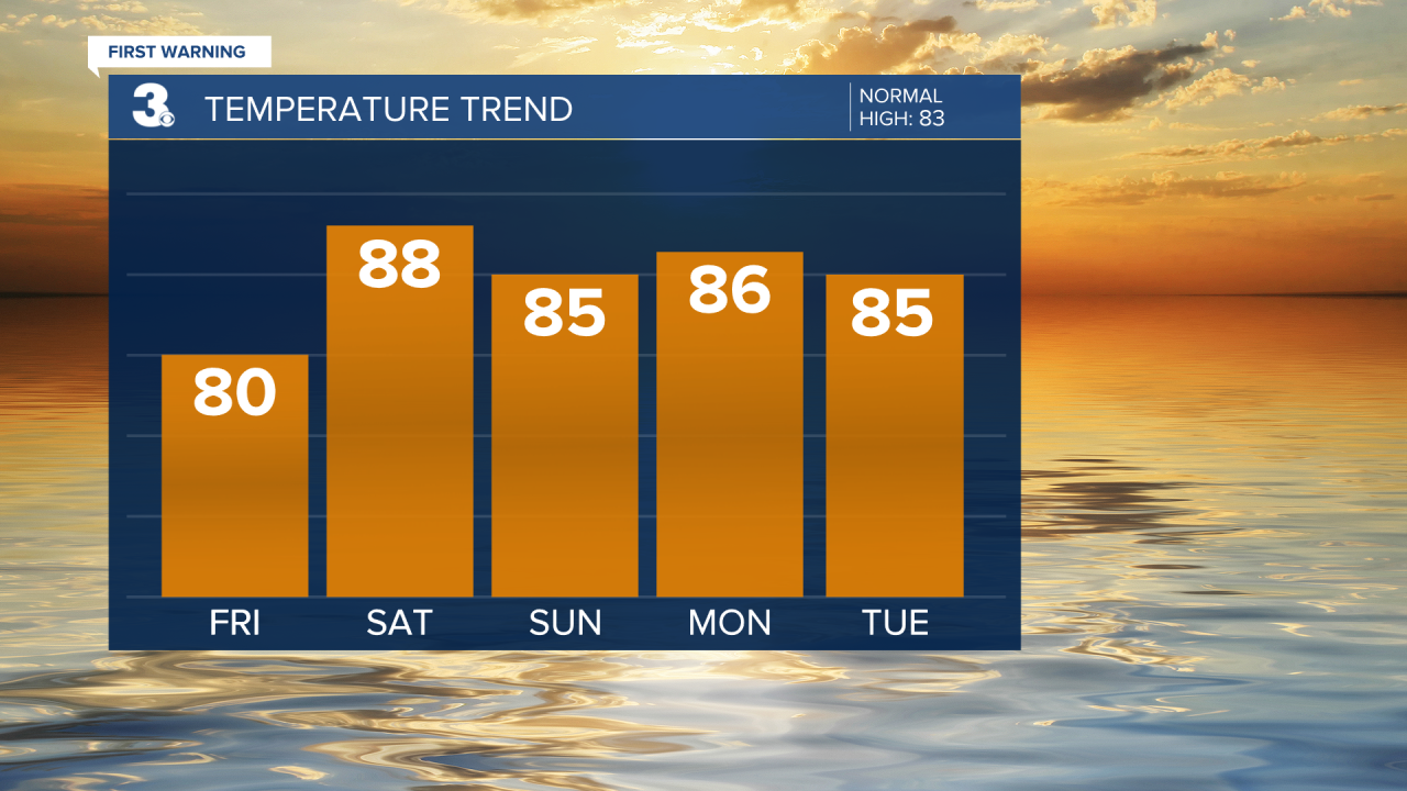
An area of low pressure will slide off the coastline today. Expect mostly cloudy skies with showers this morning to midday. Clouds will start to clear out this afternoon with highs near 80.

Showers and storms return for the weekend as a cold front moves through the region. Watch for storms to develop during the midday to afternoon window both days. Strong to severe storms are possible with a risk for damaging wind gusts. Highs will warm to the mid and upper 80s through the weekend and it will still be humid.

Highs in the 80s, humidity, and an unsettled weather pattern will stick around for the first half of next week.
Today: AM Showers, Clearing Skies. Highs near 80. Winds: E 5-10
Tonight: Partly to Mostly Cloudy. Lows in the upper 60s. Winds: S 5-10
Tomorrow: Scattered Storms. Highs in the upper 80s. Winds: SW 5-10
Weather & Health
Pollen: Low (Grasses)
UV Index: 2 (Low)
Air Quality: Good (Code Green)
Mosquitoes: Very High
Tropical Update
No tropical activity at this time
Weather updates on social media:
Facebook: MylesHendersonWTKR
Instagram: @MylesHendersonWTKR
