

Derrah Getter's First Warning Forecast
Enjoy the sunshine today because rain returns tonight.
This afternoon’s high temperatures reach near 90 underneath partly cloudy skies.
A slow-moving cold front will approach the area this evening bringing the chance of a few isolated strong to severe thunderstorms. Our biggest threat is damaging wind gusts.

The rain will linger into the upcoming weekend. Temperatures hover in the upper 70s and low 80s with more clouds around. Scattered showers and storms will be possible through early next week.
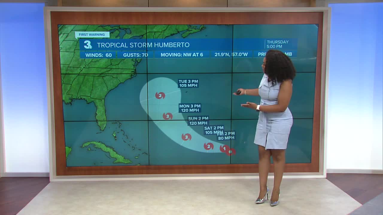
Next week, we’ll be monitoring the possible impacts from Humberto and another area of potential in the tropics.

2025 Atlantic Hurricane Season Update:
A tropical wave over the northeastern Caribbean Sea is producing a large area of disorganized showers and thunderstorms. The wave is expected to briefly speed up as it moves WNW at 15-20 mph then slowly turn late this week. A tropical depression is likely to form.
Formation chance through 48 hours...HIGH...70%
Formation chance through 7 days...HIGH...90%

Humberto is currently a tropical storm. It is expected to strengthen into a hurricane by Saturday and a major hurricane (category 3 or higher) by Monday.

Hurricane Gabrielle is currently a low-end category 1 hurricane. It is continuing to get weaker as it moves over the north central Atlantic.

Let's connect on social media!
Forecaster Derrah Getter:
For weather updates on Facebook: HERE
For weather updates on X: HERE
Follow me on Instagram: HERE
Check out the Interactive Radar on WTKR.com: Interactive Radar
