


Meteorologist Myles Henderson’s First Warning Forecast
A summer-like stretch with heat, humidity, and afternoon storms. Several rain chances through the end of the week.
Highs will reach the low to mid 90s today with an afternoon heat index to 100+. Expect partly cloudy skies to start the day with scattered showers and storms building this afternoon to evening. Strong to severe storms are possible with damaging winds and a risk for localized flooding.

Highs will linger in the upper 80s to low 90s to end the week. It will still be humid so the afternoon heat index will be in the upper 90s to low triple digits. We will see several chances for showers and storms as a stationary front lingers over the region.
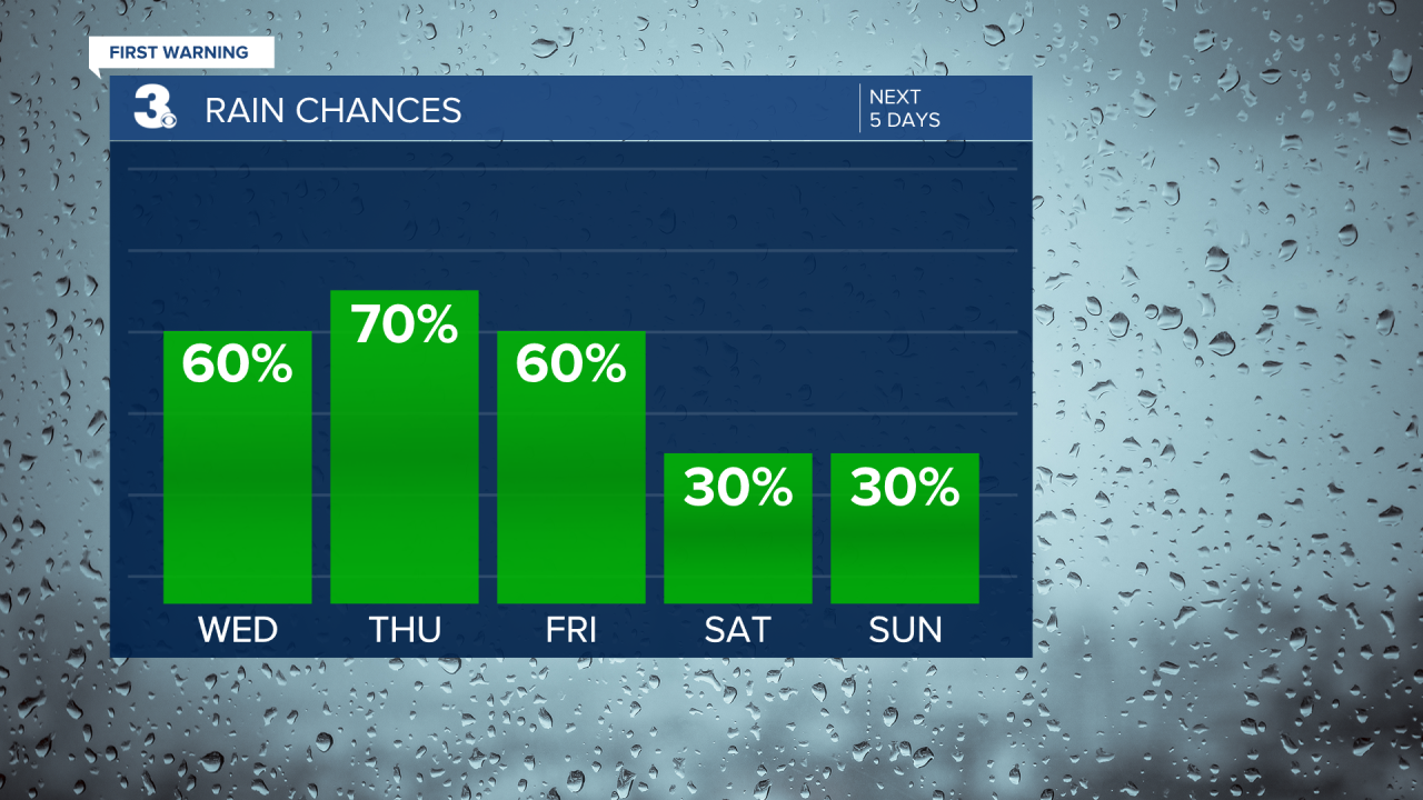
Not much change for the weekend. Highs will remain in the low 90s with an afternoon heat index in the low triple digits. Expect partly cloudy skies with scattered showers/storms possible.

Today: Scattered Storms. Highs in the mid 90s. Winds: SW 5-15
Tonight: Scattered Storms. Lows in the mid 70s. Winds: SW 5-10
Tomorrow: Scattered Storms. Highs near 90. Winds: SW 5-10
Weather & Health
Pollen: Low-Medium (Grasses)
UV Index: 10 (Very High)
Air Quality: Good (Code Green)
Mosquitoes: Extreme
Tropical Update
No tropical activity at this time
Weather updates on social media:
Facebook: MylesHendersonWTKR
Instagram: @MylesHendersonWTKR
