




Meteorologist Myles Henderson’s First Warning Forecast
A hot and humid week with a heat index back to the triple digits. Tracking a cold front to end the week that will increase rain chances but drop the temperatures.
***A Heat Advisory is in effect from 11 AM Wednesday to 8 PM Thursday for large parts of Virginia and North Carolina.
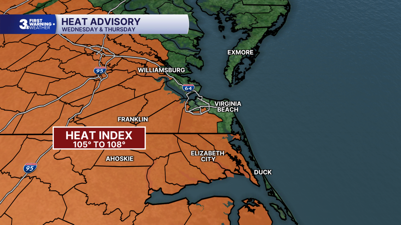
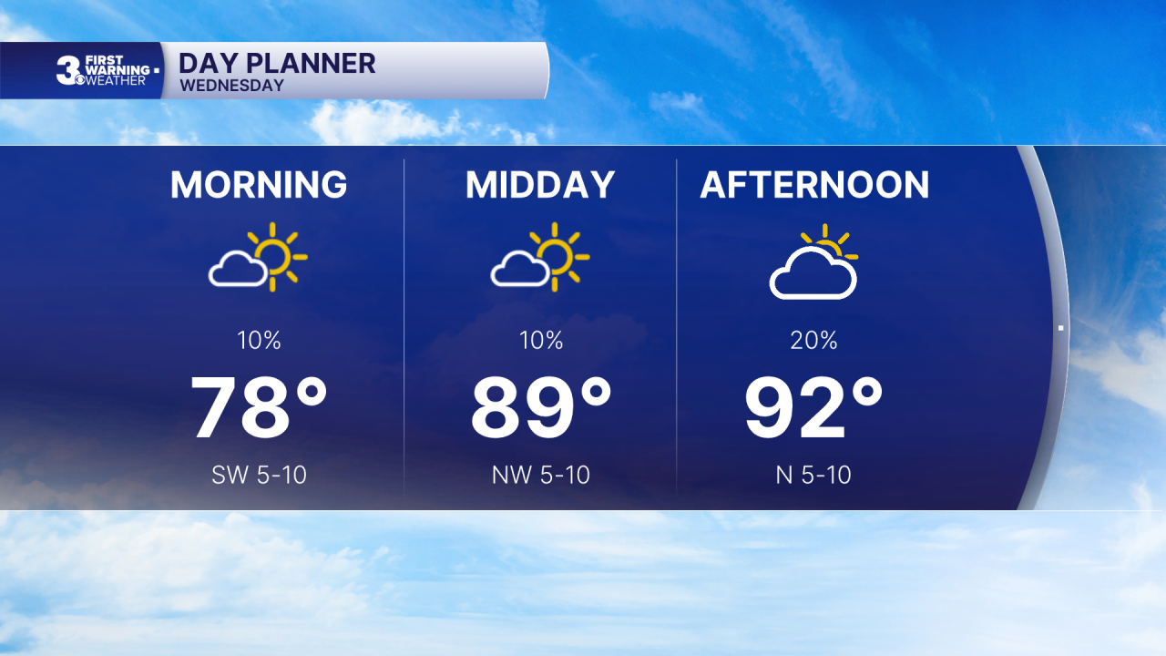
Hot and humid again today with highs in the low 90s and an afternoon heat index in the triple digits. Expect a mix of mostly sunny to partly cloudy skies with a “pop-up” shower/storm possible.
More heat and humidity to end the workweek with highs in the mid to upper 90s and an afternoon heat index of 105 to 110. Each day will bring a mix of sun and clouds with scattered showers and storms as a cold front moves in.
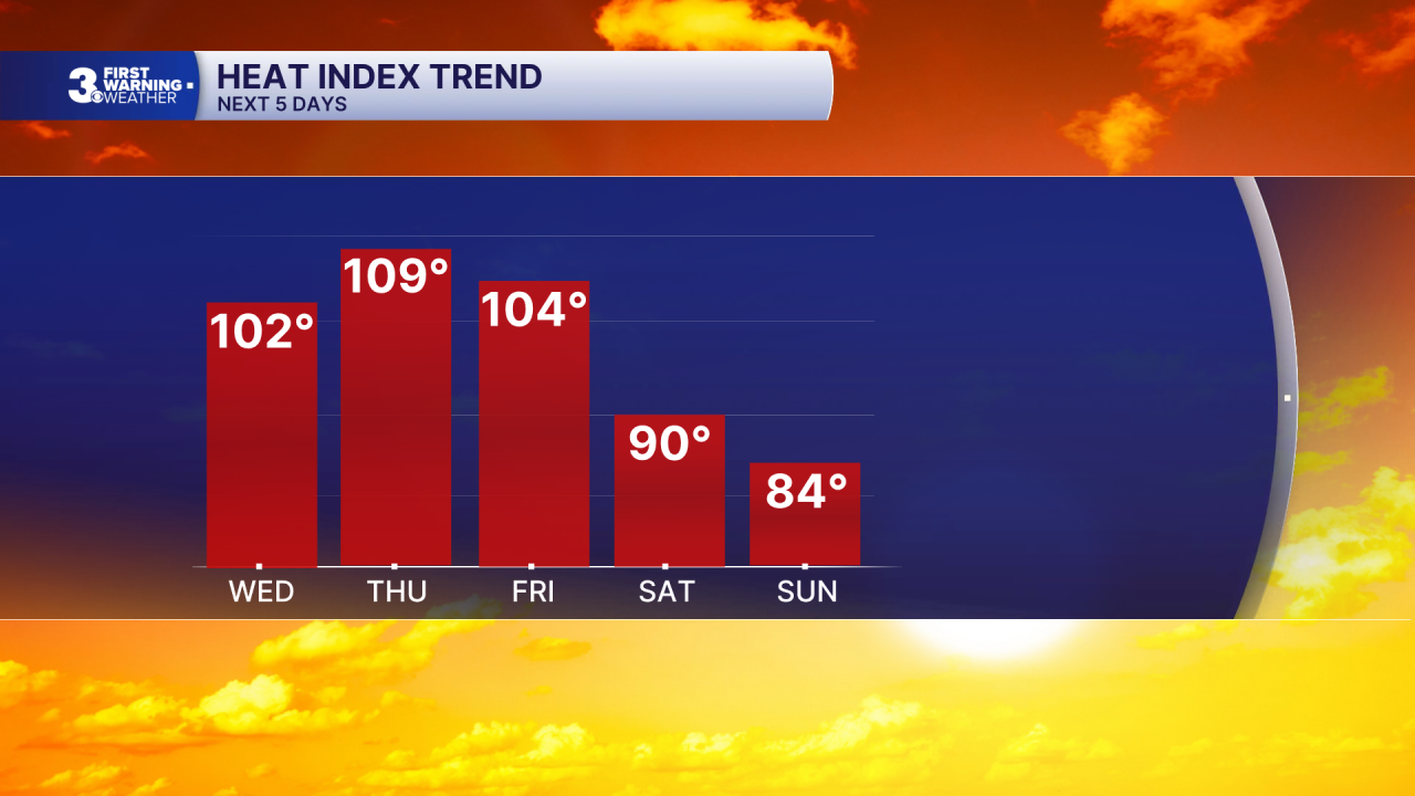
The cold front will break us out of the hot stretch. Highs will drop low and mid 80s this weekend with lower humidity. A few leftover showers are possible on Saturday with more sunshine for Sunday and Labor Day.
Today: Sun & Clouds. Highs in the low 90s. Winds: W/N/E 5-10
Tonight: Partly Cloudy. Lows in the upper 70s. Winds: E 5-10
Tomorrow: Sun & Clouds. Highs in the upper 90s. Winds: SW 5-10
Weather & Health
Pollen: High (Ragweed, Grasses)
UV Index: 8 (High)
Air Quality: Moderate (Code Yellow)
Mosquitoes: Extreme
Tropical Update
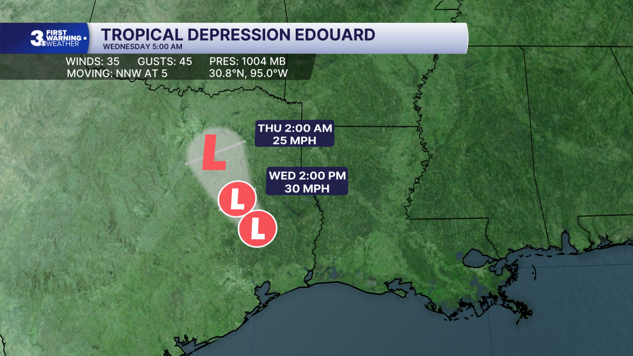
Edouard continues to weaken over southeastern Texas. Maximum sustained winds are near 35 mph with higher gusts. Continued weakening is expected over the next 24 hours, as Edouard is forecast to dissipate Wednesday night.
Weather updates on social media:
Facebook: MylesHendersonWTKR
Instagram: @MylesHendersonWTKR
