

Derrah Getter's First Warning Forecast
A slow-moving front brings rain this weekend. Soon-to-be Imelda will bring rain next week.

This evening, widely scattered showers and storms pop up. Lows will be near 70. The rain will linger into Saturday morning.
Skies will be mostly cloudy Saturday morning with a few spotty showers. Scattered storms fire up in the afternoon. Highs will be in the low 80s.
Sunday will show little signs of improvement. While it won’t be raining all day long, mostly cloudy skies and morning showers and storms remain. Highs will be in the upper 70s.
Next week scattered showers and storm chances stick around due to the development of what is currently Tropical Wave Invest 94-L but is expected to become our next named storm, Imelda.

2025 Atlantic Hurricane Season Update:
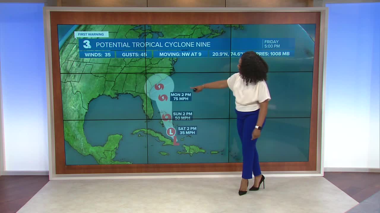
Potential Tropical Cyclone Nine is forecast to slowly strengthen. It currently sits over far eastern Cuba. By early next week the latest forecast track has it stall off the coast of South Carolina. Heavy rainfall will be possible for Hampton Roads through the middle of next week.

Humberto has rapidly intensified and is now a category 4 hurricane. It is expected to continue strengthening and maintain major hurricane status over the weekend. It’s forecast track takes it away from the U.S. coastline.

Let's connect on social media!
Forecaster Derrah Getter:
For weather updates on Facebook: HERE
For weather updates on X: HERE
Follow me on Instagram: HERE
Check out the Interactive Radar on WTKR.com: Interactive Radar
