


Meteorologist Myles Henderson’s First Warning Forecast
Highs near 80 to end the work week. Rain chances for Friday and this weekend. Much cooler to start next week.
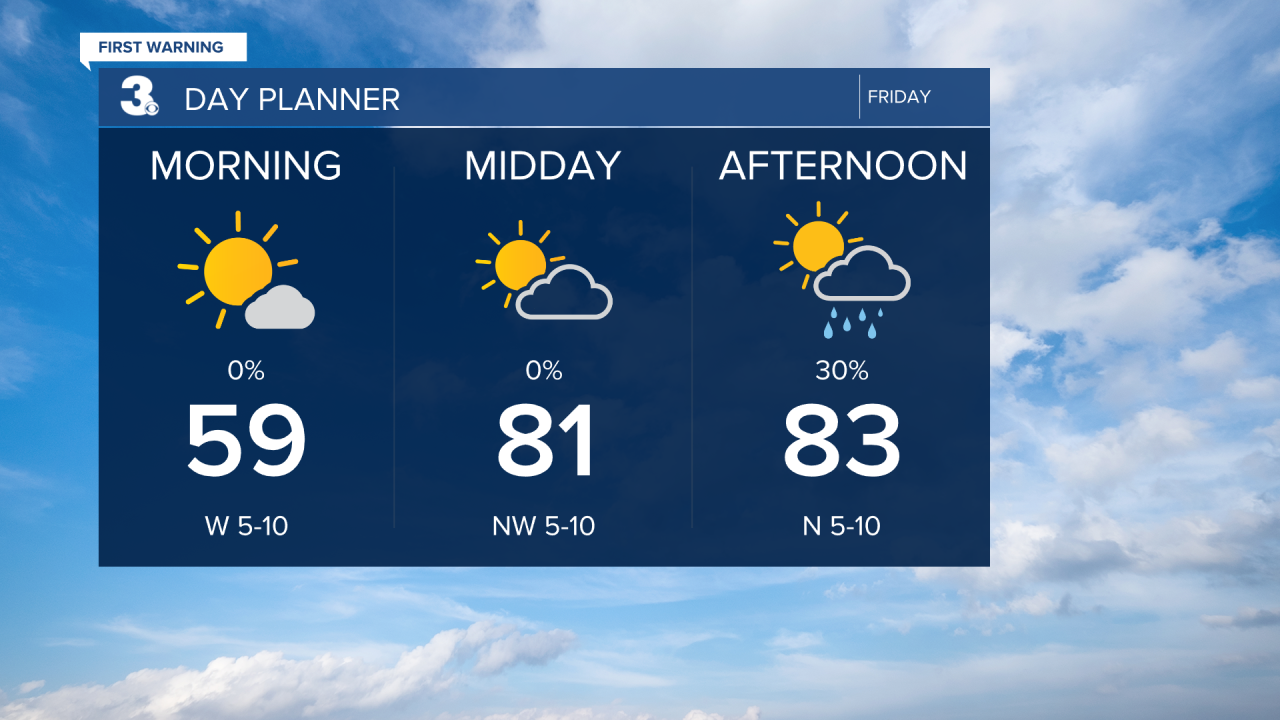
Highs will return to the low and mid 80s this afternoon. We will see mostly sunny skies this morning with clouds building in through midday. Look for scattered showers this afternoon to evening with an isolated thunderstorm possible.
We will start with sunshine Saturday morning, but clouds will build in through the day. Highs will reach the upper 70s to near 80. Rain chances will increase through the afternoon to evening with the highest rain chance Saturday night.

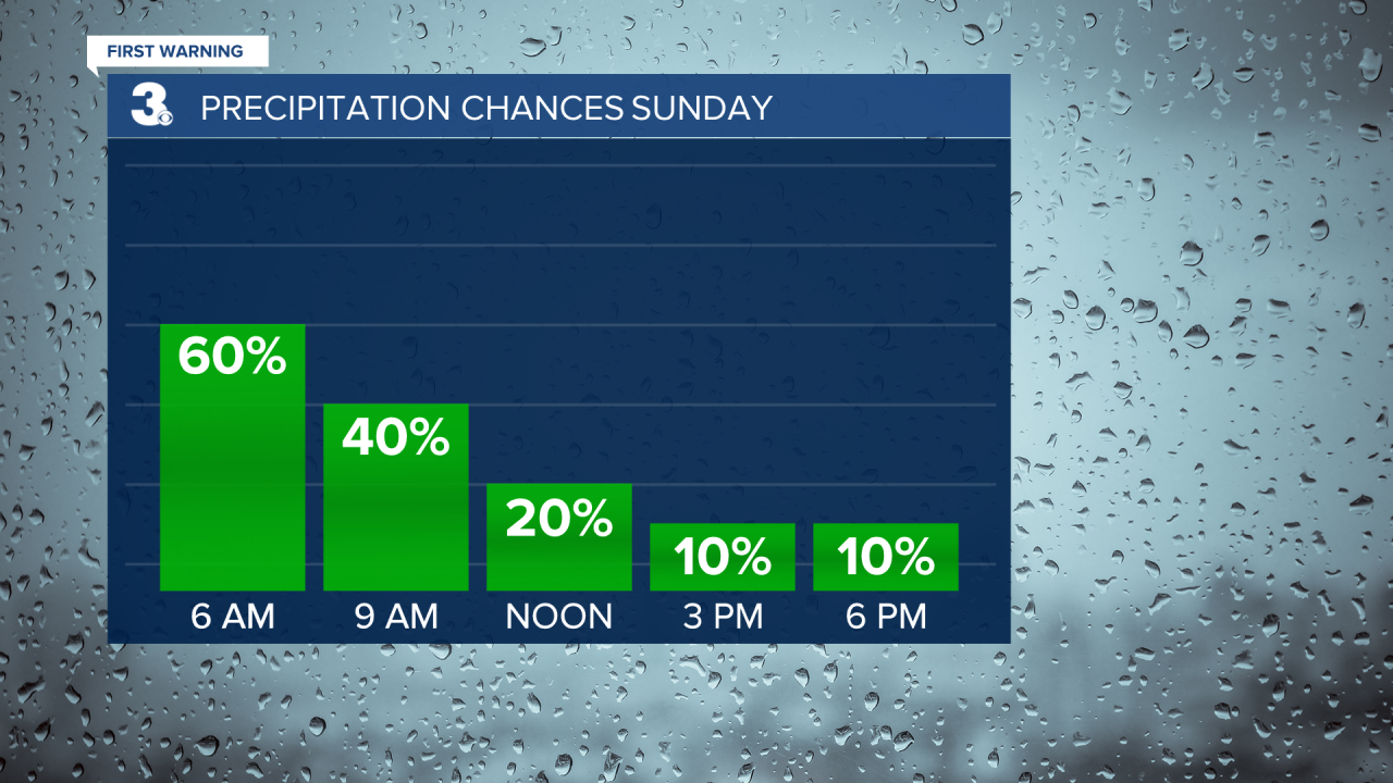
Showers will linger for Sunday morning but should taper off by midday. Cooler air moves in Sunday with highs in the low to mid 60s. The wind will also pick up, NE at 10 to 20 mph.
The cool and breezy conditions will continue for Monday. We will warm back into the 70s by midweek, near normal for this time of year.
Today: Building Clouds, Scattered Showers. Highs in the low 80s. Winds: W/N/E 5-10
Tonight: Partly Cloudy. Lows in the upper 50s. Winds: E 5-10
Tomorrow: Building Clouds, Scattered Showers. Highs in the upper 70s. Winds: SE 5-10
Weather & Health
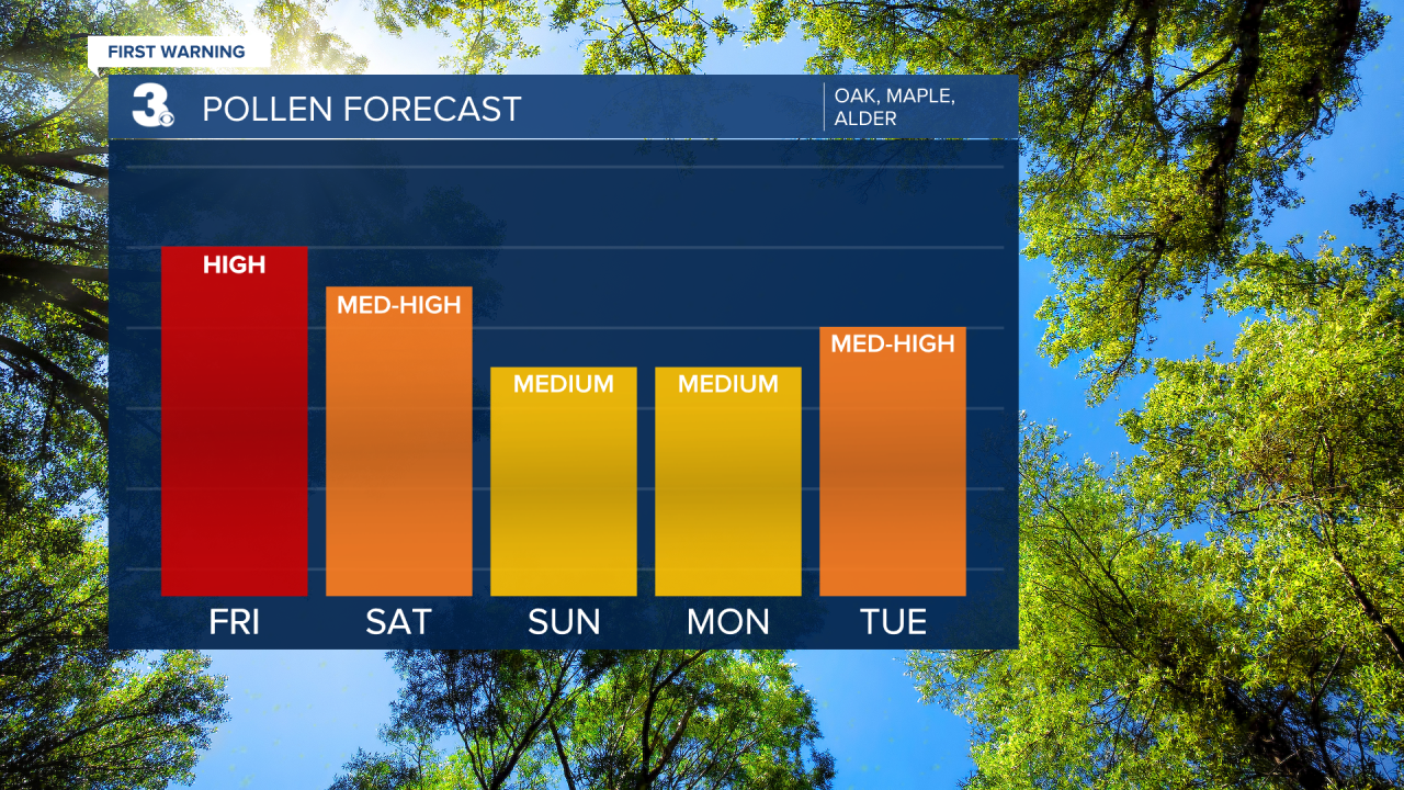
Pollen: High (Oak, Maple, Alder)
UV Index: 7 (High)
Air Quality: Moderate (Code Yellow)
Mosquitoes: Moderate
Weather updates on social media:
Facebook: MylesHendersonWTKR
Instagram: @MylesHendersonWTKR
