


Meteorologist Myles Henderson’s First Warning Forecast
The warm week continues with highs in the 80s. Rain returns for Easter Sunday. Cooler air returns early next week.
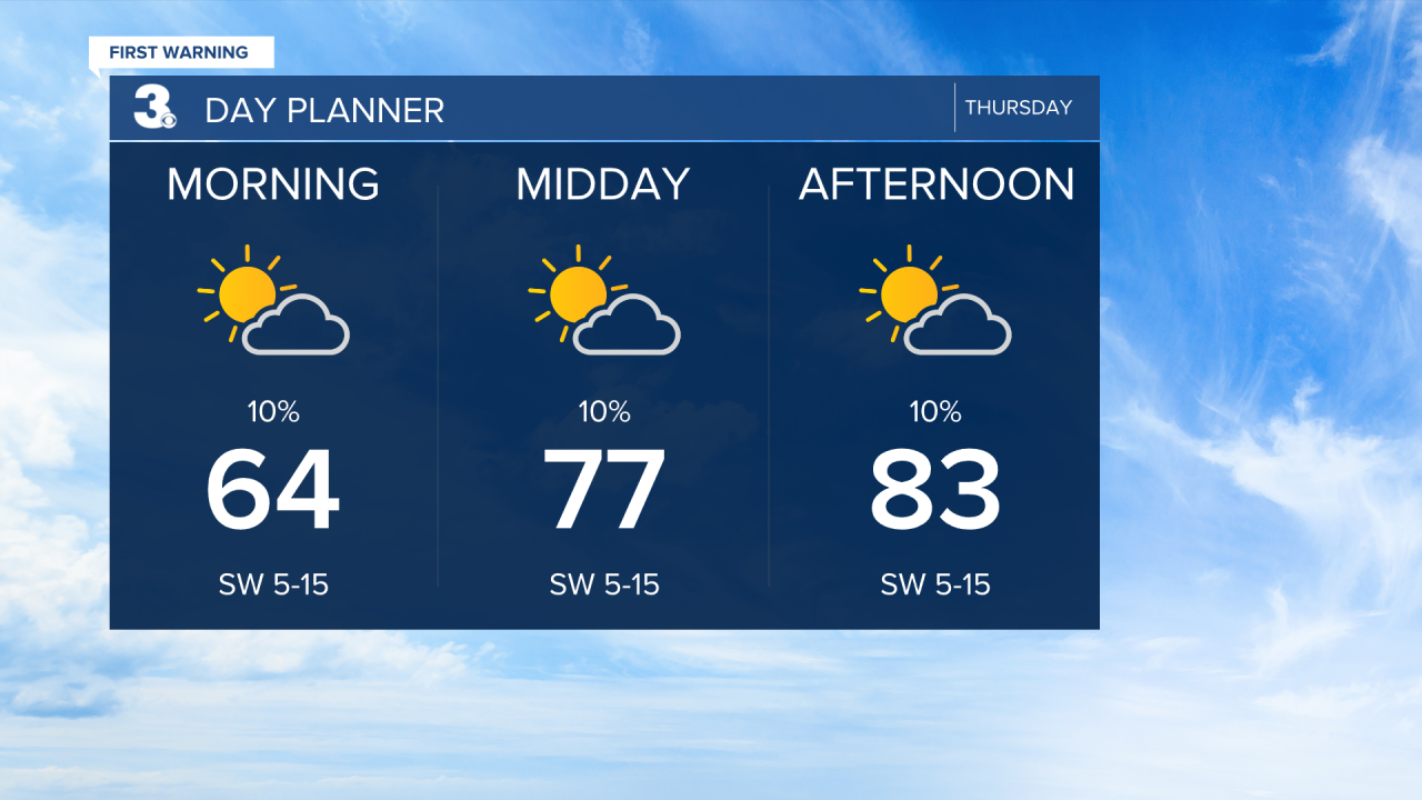
Warm again today with highs in the mid 80s, not as warm as yesterday but still well above normal for this time of year. Look for a mix of mostly sunny to partly cloudy skies. It will still be breezy but not as strong as yesterday.
Highs will linger in the low 80s to end the week. Expect partly cloudy skies with very slim rain chances Friday and Saturday.
A cold front is set to move in on Easter Sunday, bringing rain with it. Rain chances will be lower in the morning and higher in the afternoon to evening. An isolated thunderstorm is possible. Highs will reach the upper 70s and it will be windy with a SW wind at 10 to 20 mph.

The front will also bring in a cool down to start next week. Highs will drop to the mid 60s for Monday and Tuesday, near normal for this time of year.
Today: Partly Cloudy. Highs in the mid 80s. Winds: SW 5-15
Tonight: Partly Cloudy. Lows in the low 60s. Winds: SW 5-15
Tomorrow: Partly Cloudy. Highs in the low 80s. Winds: SW 5-15
Weather & Health
Pollen: High (Juniper, Elm, Poplar)
UV Index: 7 (High)
Air Quality: Moderate (Code Yellow)
Mosquitoes: Low
Weather updates on social media:
Facebook: MylesHendersonWTKR
Instagram: @MylesHendersonWTKR
