


Meteorologist Myles Henderson’s First Warning Forecast
Warm and gloomy again today. A cooler stretch to end the week. Tracking rain for Friday.
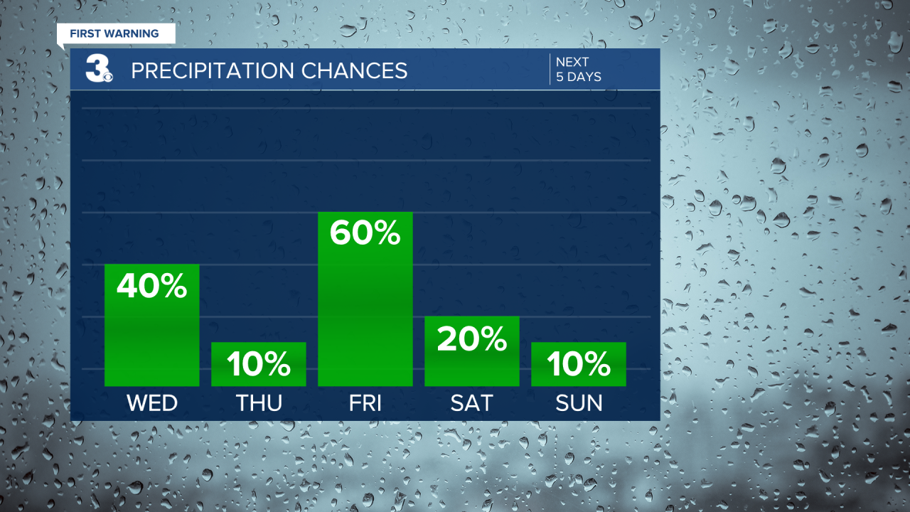
Expect cloudy skies today with scattered showers. Biggest rain chances will be this afternoon to early evening. Highs will reach the upper 60s, about 10 degrees above normal for this time of year.

Cooler air returns for the end of the week. Highs will drop to the upper 50s tomorrow with some clearing. Expect some sunshine tomorrow morning with clouds building through the afternoon to evening.

Rain returns on Friday, mainly in the afternoon to evening. Highs will only reach the low 50s.

The cooler air sticks around for the weekend with highs in the low to mid 50s. Rain chances will be low, but we will continue to see a mix of clouds. Expect more clouds on Saturday and more sunshine in the mix for Sunday.
Today: Mostly Cloudy, Showers. Highs in the upper 60s. Winds: SW 5-10
Tonight: Mostly Cloudy, Showers. Lows in the mid 50s. Winds: W 5-10
Tomorrow: Mix of Clouds, Breezy. Highs in the upper 50s. Winds: N 10-15
Weather & Health
Pollen: Low (Mixed)
UV Index: 1 (Low)
Air Quality: Good (Code Green)
Mosquitoes: Low
Tropical Update
A large non-tropical area of low pressure located over the central subtropical Atlantic about 800 miles northeast of the northern Leeward Islands continues to produce a large area of disorganized showers and thunderstorms. Environmental conditions appear marginally conducive for development and a subtropical or tropical storm could form within the next day or two. By Thursday night or early Friday, the low will move northeastward over cooler waters and interact with a mid-latitude trough, limiting the chance for additional subtropical or tropical development of the system.
* Formation chance through 48 hours: Medium (50%)
* Formation chance through 5 days: Medium (50%)

Weather updates on social media:
Facebook: MylesHendersonWTKR
Twitter: @MHendersonWTKR
Instagram: @MylesHendersonWTKR
