


Meteorologist Myles Henderson’s First Warning Forecast
A very warm week with highs in the 80s to near 90. Rain chances remain low.
Highs will reach the low to mid 80s today, about 15 degrees warmer than yesterday. Expect partly cloudy skies with very slim rain chances. It will be windy today with a SW wind at 10 to 20 and gusts to 30 mph.

Another step warmer tomorrow with highs in the upper 80s. We will see partly cloudy skies and it will still be breezy with a SW wind at 10 to 15 mph.
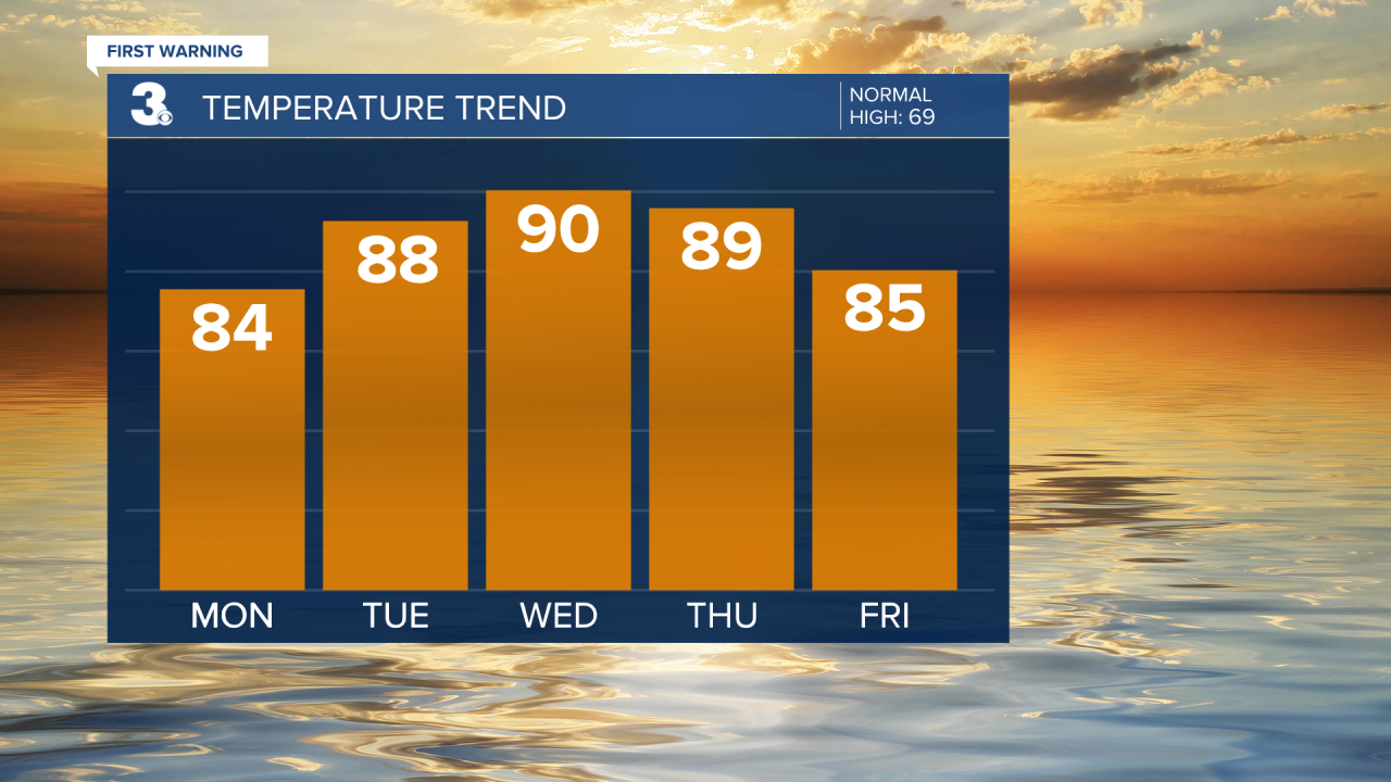
Even warmer on Wednesday with highs near 90 degrees, near our record highs for that date. Highs will linger in the mid to upper 80s to end the week.
Our next chance for showers is Sunday with a cold front.

Today: Partly Cloudy, Windy. Highs in the mid 80s. Winds: SW 10-20 G30
Tonight: Partly Cloudy, Breezy. Lows in the low 60s. Winds: SW 10-15
Tomorrow: Partly Cloudy, Breezy. Highs in the upper 80s. Winds: SW 10-15
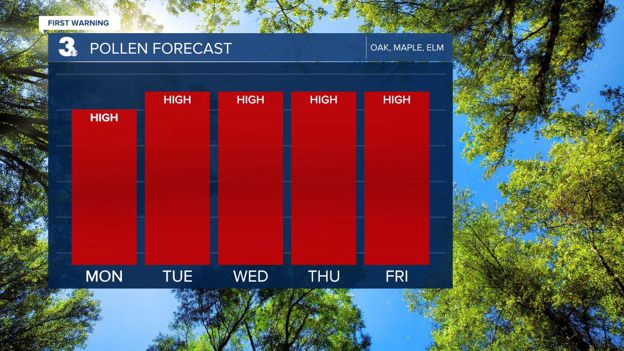
Weather & Health
Pollen: High (Oak, Maple, Elm)
UV Index: 8 (High)
Air Quality: Good (Code Green)
Mosquitoes: Low-Moderate
Weather updates on social media:
Facebook: MylesHendersonWTKR
Instagram: @MylesHendersonWTKR
