


Meteorologist Myles Henderson’s First Warning Forecast
Back to the summer-like heat, humidity, and storms. A risk for severe thunderstorms later today. A decent stretch of weather through the weekend.
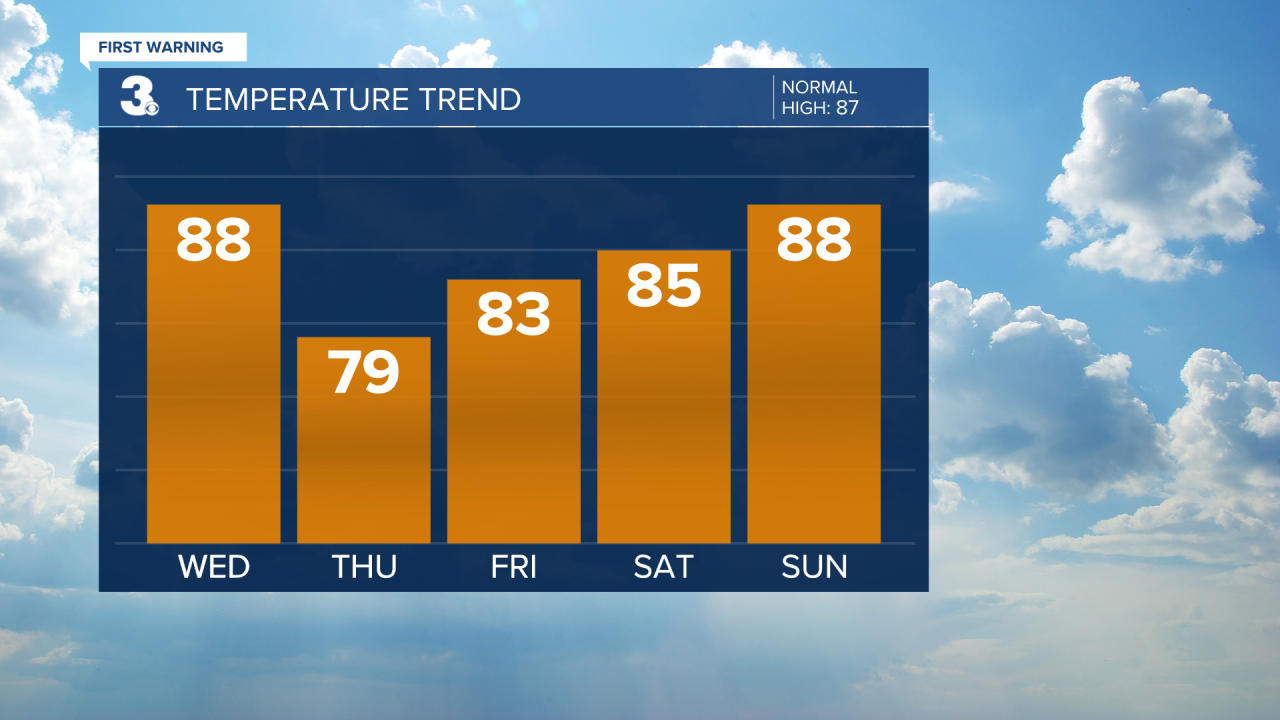
Feeling like summer again. Highs will warm to the upper 80s, but it will feel more like the low 90s with the building humidity. We will start with partly cloudy skies, but scattered showers and storms will move in this afternoon to evening. Strong to severe thunderstorms are possible with a risk for damaging wind gusts and localized flooding. Showers and storms will continue tonight with the storm threat dropping after midnight.

Scattered showers will linger on Thursday as we clear from mostly cloudy to partly cloudy skies. It will still be warm and muggy with highs in the mid 80s.
We will see more sunshine as we approach the weekend. Expect mostly sunny skies on Friday with a mix of sun and clouds Saturday and Sunday. It will still be warm and humid with highs in the mid to upper 80s.
Our next round of rain and storms is set to move in Monday to Tuesday with a cold front.
Today: Clouds building in, PM Storms. Highs in the upper 80s. Winds: S 5-10
Tonight: Mostly Cloudy, Storms. Lows near 70. Winds: S 5-10
Tomorrow: Scattered Showers, Clearing Skies. Highs in the mid 80s. Winds: NE 5-10
Weather & Health
Pollen: Low-Medium (Grasses)
UV Index: 8 (Very High)
Air Quality: Moderate (Code Yellow)
Mosquitoes: Very High
Tropical Update
No tropical activity at this time.
Weather updates on social media:
Facebook: MylesHendersonWTKR
Twitter: @MHendersonWTKR
Instagram: @MylesHendersonWTKR
