


Meteorologist Myles Henderson’s First Warning Forecast
Climbing back to the 60s and 70s to end the week. Tracking a chance for rain and a severe storm threat on Thursday.
The spring-like temperatures return today. We will warm to the mid 60s this afternoon, near normal for this time of year. Expect a mix of partly to mostly cloudy skies with a stray shower possible.

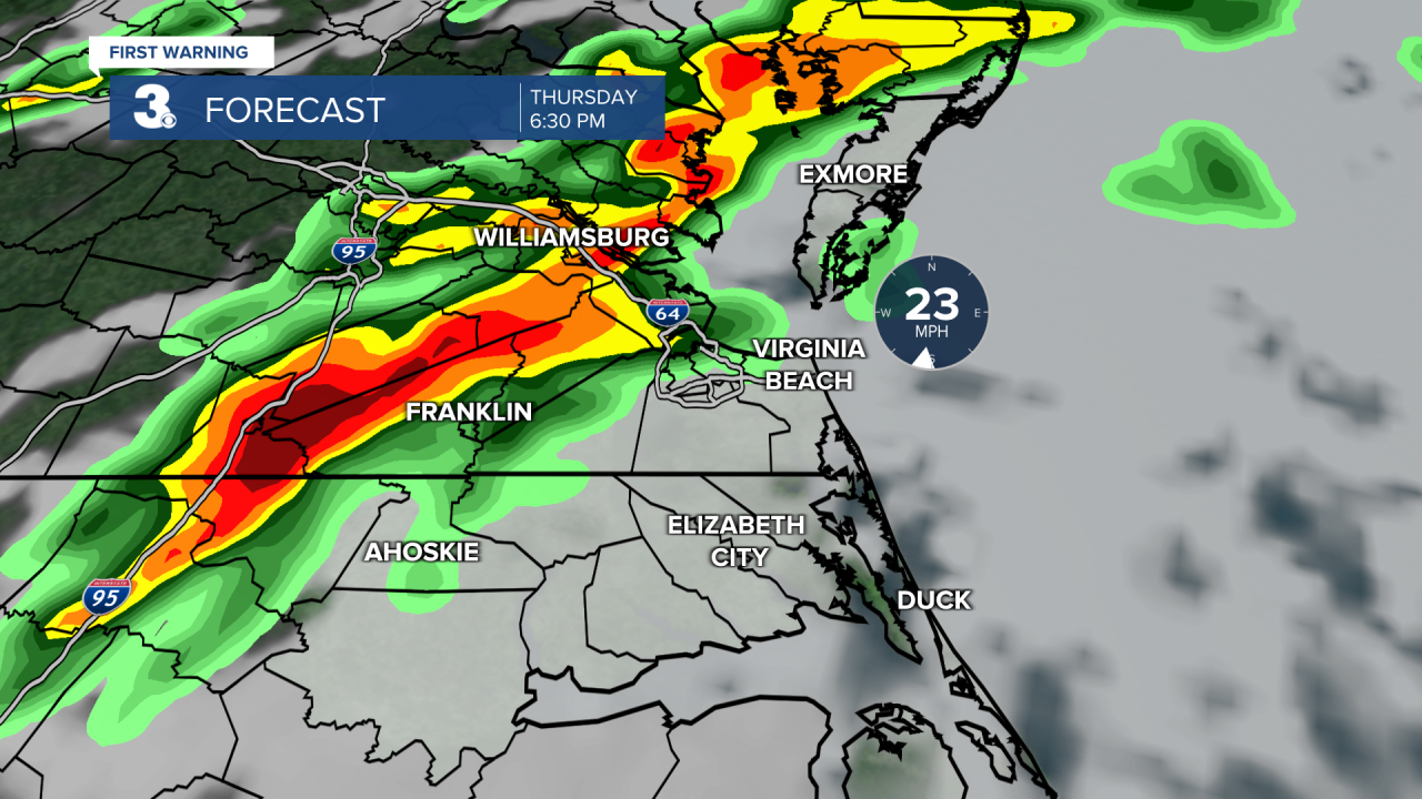
We will climb to the upper 70s on Thursday, the warmest day of the week. A cold front is set to move in late Thursday, bringing us a chance for showers and storms. The highest rain chance for rain will be in the evening. Strong to severe thunderstorms are possible with a risk for localized flooding, damaging wind gusts, and pockets of hail. It will be very windy Thursday with S/SW winds at 15 to 25 and gusts to 35+ mph.
Skies will clear out on Friday with highs in the upper 60s. It will still be windy with a west wind at 10 to 20 and gusts to near 30 mph. Highs will linger in the low to mid 60s this weekend. Expect more sunshine on Saturday and a chance for showers on Sunday.
Today: Mix of Clouds, Warmer. Highs in the mid 60s. Winds: S 5-15
Tonight: Mix of Clouds. Lows in the upper 50s. Winds: S 10-15
Tomorrow: Mostly Cloudy, PM Storms, Windy. Highs in the upper 70s. Winds: SW 15-25G35+
Weather & Health
Pollen: Medium-High (Juniper, Elm, Poplar)
UV Index: 5 (Moderate)
Air Quality: Good (Code Green)
Mosquitoes: Low
Weather updates on social media:
Facebook: MylesHendersonWTKR
Twitter: @MHendersonWTKR
Instagram: @MylesHendersonWTKR
