


Meteorologist Myles Henderson’s First Warning Forecast
Climbing to the 90s to end the week. Tracking our next chance for rain moving in Sunday.
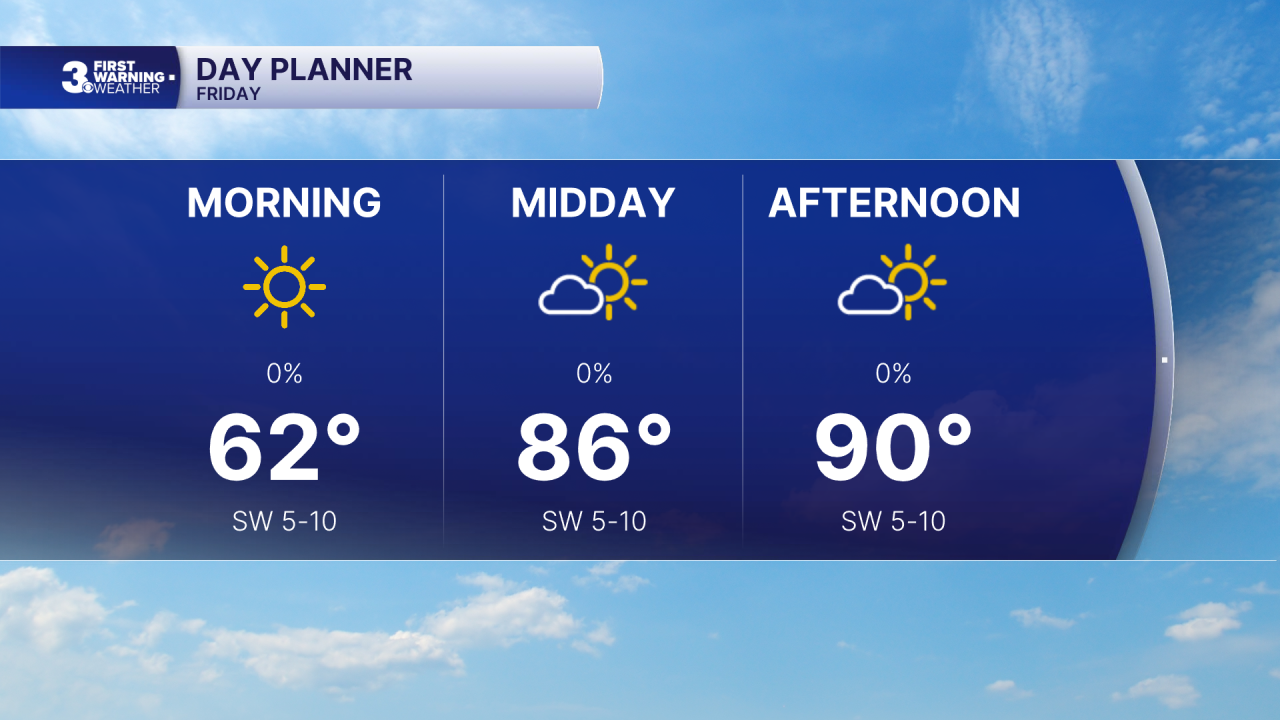
Another step warmer today with highs near 90. Expect mostly sunny skies with a light SW wind.
The hot air sticks around for the weekend with highs in the low to mid 90s. We will see partly cloudy skies through most of the weekend. Our next chance for rain is set to move in Sunday with a cold front. Expect scattered showers with an isolated storm possible Sunday afternoon to evening.

The cold front will bring in a cool down for early next week. Highs will drop to near 80 on Monday and into the 70s on Tuesday. The heat returns for the end of next week.
Today: Mostly Sunny. Highs in the low 80s. Winds: N/E 5-10
Tonight: Mainly Clear. Lows in the low 60s. Winds: E/S 5-10
Tomorrow: Partly Cloudy. Highs near 90. Winds: SW 5-10
Weather & Health
Pollen: Moderate (Trees & Grasses)
UV Index: 9 (Very High)
Air Quality: Moderate (Code Yellow)
Mosquitoes: High
Tropical Update
No tropical activity at this time
Weather updates on social media:
Facebook: MylesHendersonWTKR
Instagram: @MylesHendersonWTKR
