


Meteorologist Myles Henderson’s First Warning Forecast
Warming up… Expect a nice mix of sun and clouds today with highs warming to the low and mid 50s, a few degrees above normal for this time of year. Clouds will continue to build in tonight with lows in the low 40s.
Thursday will be the warmest day of the week with highs in the mid 60s. Expect mostly cloudy skies with a spotty shower possible.
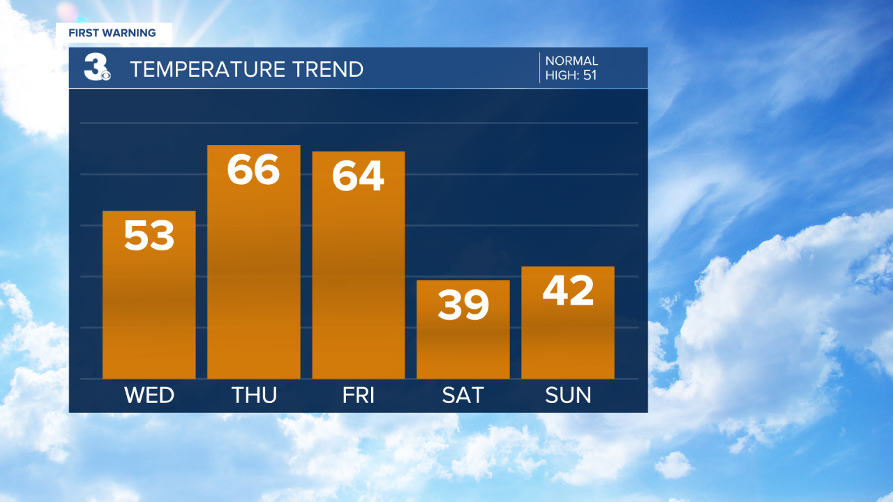
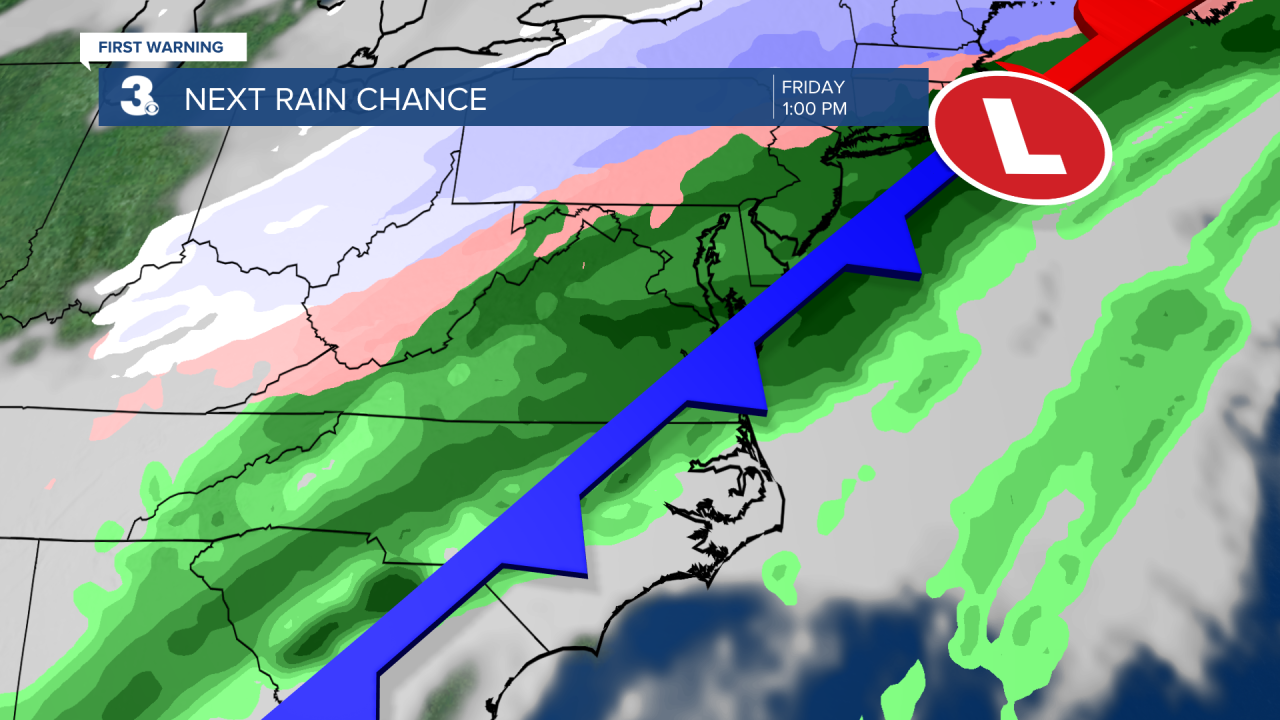
Friday will be our soggy day this week. Expect mostly cloudy skies with rain showers for most of day as a cold front moves through. Winds will ramp up and turn from SW to north as the front moves through. Highs will return to the 60s on Friday.
Rain will move out Friday night to early Saturday morning. Some sleet or snow could mix in, but no accumulation is expected. Clouds will clear out Saturday morning, but it will still be cold and windy. Highs will only reach the upper 30s on Saturday, about 25 degrees cooler.
Today: Partly Cloudy. Highs in the mid 50s. Winds: N/E 5-10
Tonight: Partly Cloudy. Lows in the low 40s. Winds: SE 5-10
Tomorrow: Mostly Cloudy, Spotty Showers. Highs in the mid 60s. Winds: S 5-15
Weather updates on social media:
Facebook: MylesHendersonWTKR
Twitter: @MHendersonWTKR
Instagram: @MylesHendersonWTKR
