


Meteorologist Myles Henderson’s First Warning Forecast
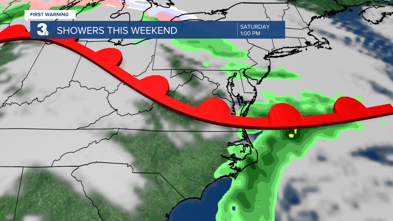
A much warmer midweek. The next few days will be in the 60s before another chilly day on Friday. Watching a few showers for the weekend with even warmer temperatures.
We will warm to the low 60s this afternoon, almost 10 degrees above normal for this time of year. Expect a nice mix of sun and clouds today with more clouds in the morning and more sun in the afternoon. Highs will reach the mid to upper 60s on Wednesday with mostly sunny skies.
A cold front will move through the region Thursday to Friday. Rain chances will be slim, but we will see some extra clouds and a temperature drop. Expect highs in the low 60s on Thursday, dropping to the upper 40s on Friday.
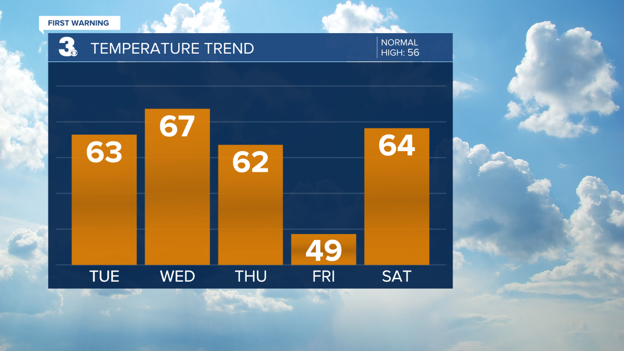
We will warm back to the 60s and 70s this weekend as a warm front lifts through. The front will bring in some extra clouds (partly to mostly cloudy skies) and the chance for a few spotty showers. Highs will climb to near 80 on Monday.
Today: Partly Cloudy, Warmer. Highs in the low 60s. Winds: SE/SW 5-10
Tonight: Mainly Clear. Lows in the low 40s. Winds: SW 5-10
Tomorrow: Mostly Sunny. Highs in the upper 60s. Winds: W/N/E 5-10
Weather & Health
Pollen: Medium-High (Juniper, Elm, Maple)
UV Index: 4 (Moderate)
Air Quality: Good (Code Green
Mosquitoes: Low
Weather updates on social media:
Facebook: MylesHendersonWTKR
Twitter: @MHendersonWTKR
Instagram: @MylesHendersonWTKR
