


Meteorologist Myles Henderson’s First Warning Forecast
Warming trend going into the weekend. Tracking a few rain chances to end the week. Much colder to start next week.
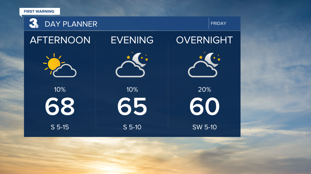
Highs will warm to the upper 60s today. Expect sunshine in the morning with clouds building in through the afternoon. A cold front is set to move through tonight to Saturday morning. Most of the rain will fall apart before it gets here, but a spotty shower is possible.
Highs will warm to the 70s this weekend. Low 70s on Saturday and mid 70s on Sunday. Another cold front will move in on Sunday and will give us a bigger chance for showers and even an isolated storm. Behind this front the temperatures will take a dive.

Cold and windy to start next week. Highs will drop to the 50s on Monday and the upper 40s on Tuesday. Temperatures will fall to the 30s overnight Monday to Tuesday morning with a wind chill in the 20s.

Today: Building Clouds. Highs in the upper 60s. Winds: S/SW 5-15
Tonight: Partly Cloudy. Lows in the mid 50s. Winds: SW 5-10
Tomorrow: Partly Cloudy. Highs in the low 70s. Winds: W/N 5-10
Weather & Health
Pollen: Low (Ragweed)
UV Index: 4 (Moderate)
Air Quality: Good (Code Green)
Mosquitoes: Moderate
Tropical Update
No tropical activity at this time
Weather updates on social media:
Facebook: MylesHendersonWTKR
Instagram: @MylesHendersonWTKR
