




Meteorologist Myles Henderson’s First Warning Forecast
A warming trend through midweek but still comfortable with lower humidity. Rain returns to end the weekend.
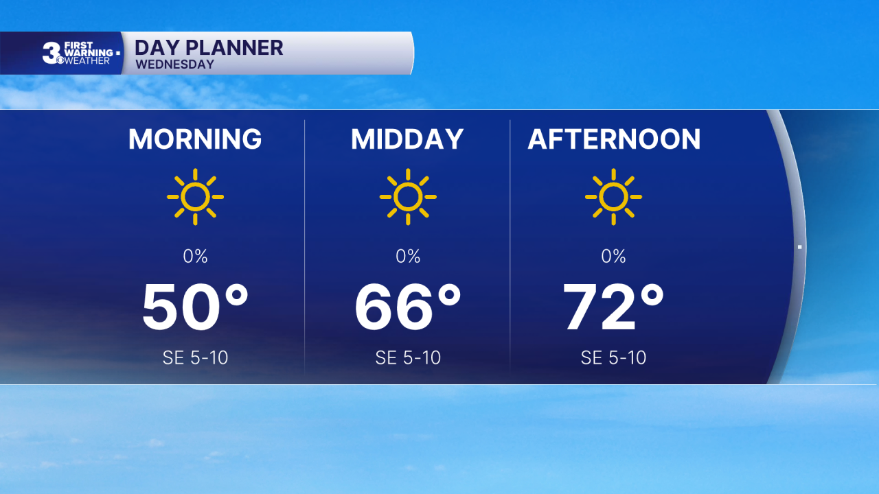
A cooler start this morning with temperatures in the 40s and 50s. Lots of sunshine again today with highs in the low 70s, closer to normal for this time of year.
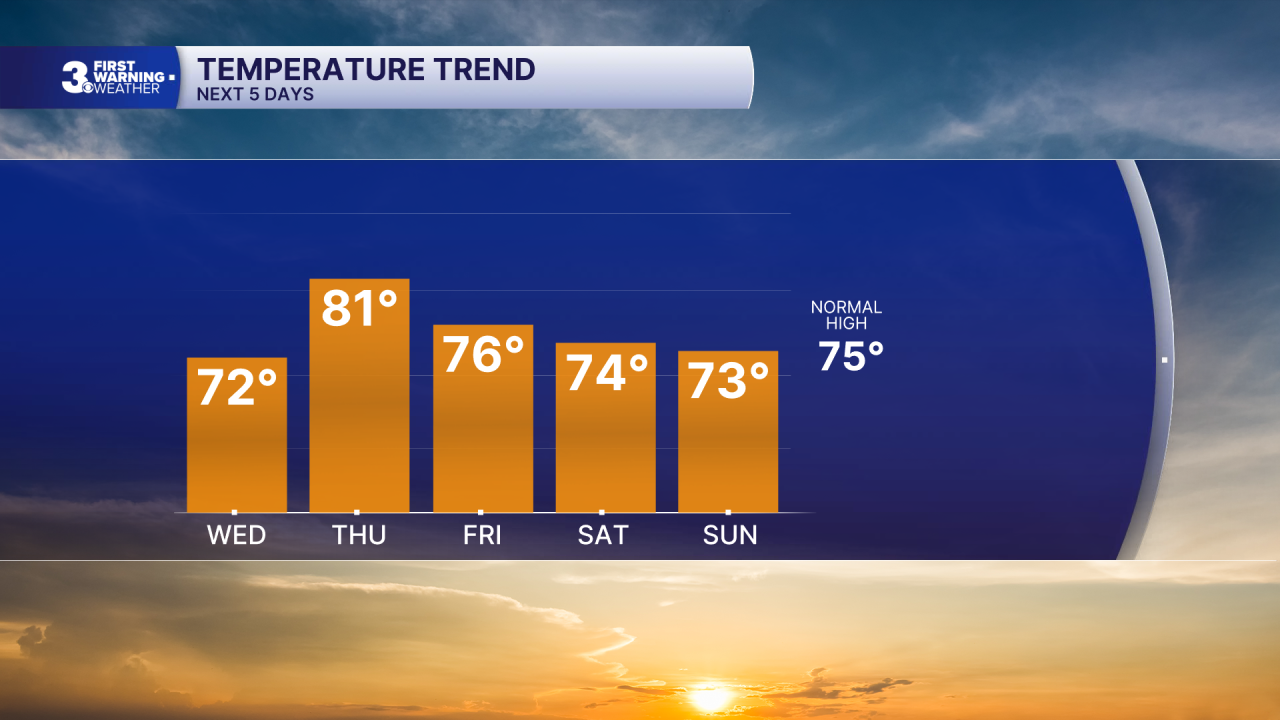
Thursday will be the warmest day of the week with highs near 80. We will drop back to the mid 70s, near normal, for Friday.
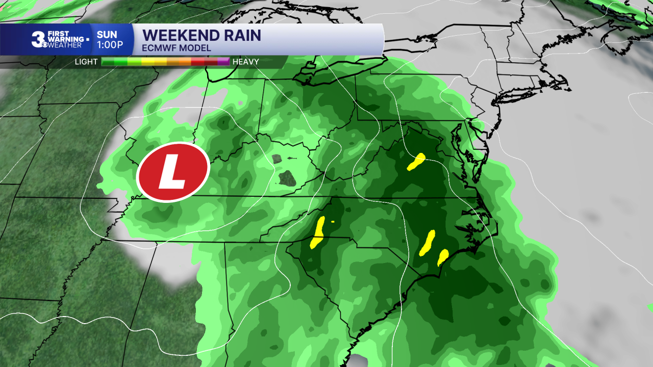
When it comes to our weekend forecast, all eyes are focused to the south. Tropical Depression Nine in the Gulf is expected to develop into a hurricane this week and move toward the U.S. Gulf Coast. That system will spread rainfall across the Southeast to Mid-Atlantic to end the weekend and start next week.
Today: Sunny. Highs in the low 70s. Winds: SE 5-10
Tonight: Clear. Lows in the mid 50s. Winds: S 5-10
Tomorrow: A Few Clouds. Highs in the low 80s. Winds: SW 5-10
Weather & Health
Pollen: Low (Ragweed)
UV Index: 5 (Medium)
Air Quality: Good (Code Green)
Mosquitoes: High
Tropical Update
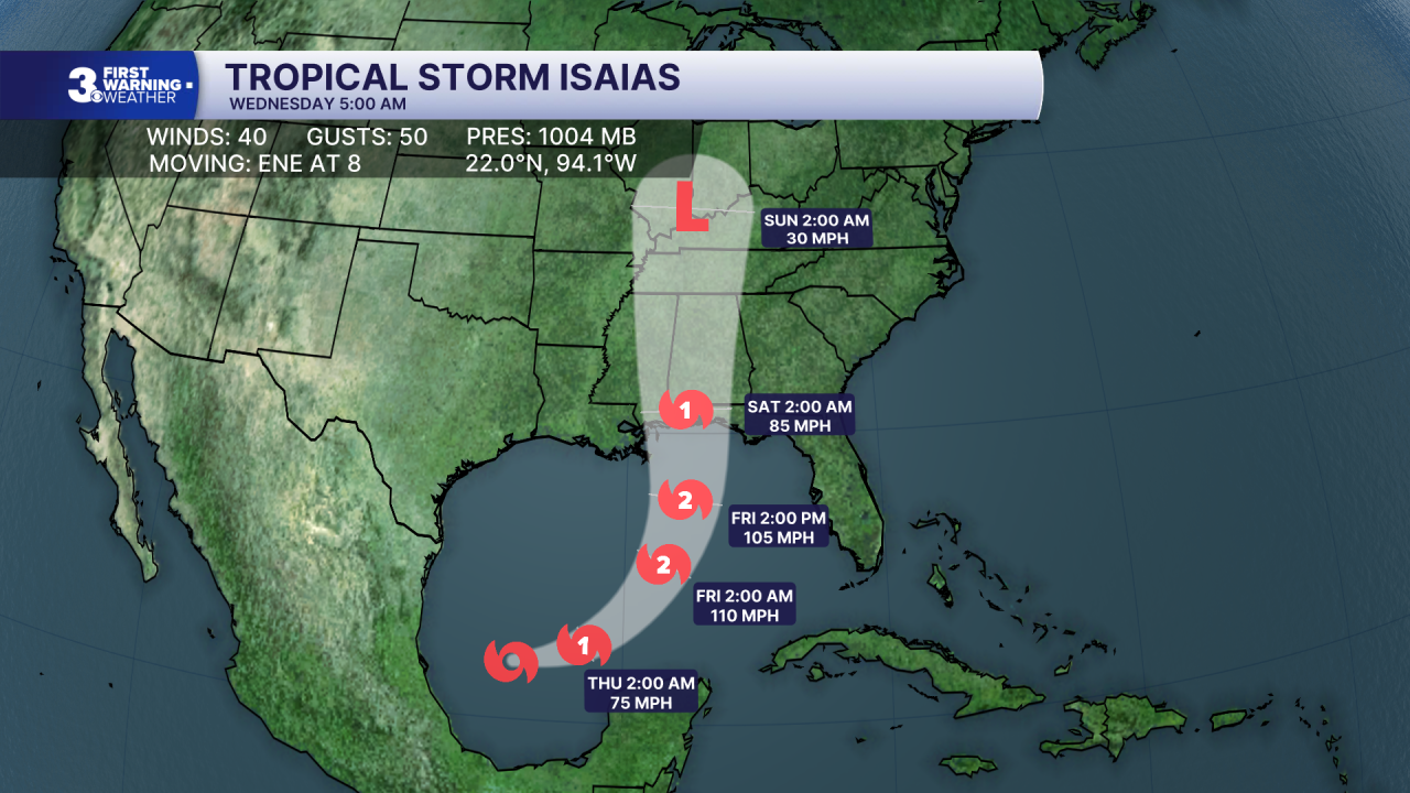
Tropical Depression Nine becomes Tropical Storm Isaias. On the forecast track, Isaias is expected to pass to the north of the Yucatan Peninsula on Thursday and approach the U.S. northern Gulf Coast on Friday. Maximum sustained winds have increased to near 40 mph with higher gusts. Rapid strengthening is forecast over the next day or two, and Isaias is expected to become a hurricane by Thursday.
Weather updates on social media:
Facebook: MylesHendersonWTKR
Instagram: @MylesHendersonWTKR
